Old Maps of Troy Township, Ohio for Genealogy
Trace your family roots with 38 historic maps of Troy Township. These high-res maps reveal old neighborhoods, homesites, landmarks, and streets — helping you uncover where your ancestors lived and how the area evolved over time.
- Explore historic neighborhoods: Identify where your relatives may have lived in the 1800s or 1900s.
- Compare maps over time: Trace the changes in streets, buildings, and landmarks for multi-generational research.
- Perfect for genealogy & ancestry research: Used by family historians and researchers to map out lineage and migration.
These maps are an incredible resource for exploring your personal connection to Troy Township's past.
Troy Township, OH maps
(38)- 1902 Map of Parkersburg
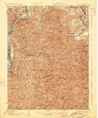
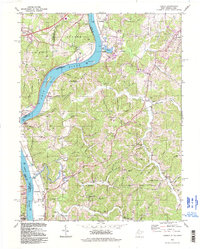
 1902 Parkersburg1902 Print · USGSThe river-and-rail corridor between Ohio and West Virginia comes alive at the dawn of the twentieth century. Researchers can trace the early footprints of Parkersburg and Vienna, the sprawling Blennerhassett Island, and the old rail lines at Belpre.
 - 1904 Map of Parkersburg
 1904 Parkersburg1904 Print · USGSThe riverfront economies of Wood County and Washington County meet at the turn of the century where the Muskingum and Ohio rivers converge. Researchers can trace the early rail networks of the Baltimore and Ohio R.R. and locate family-named settlements like Gravelbank, Center Belpre, and Vincent.5 unique versions available
 - 1904 Map of Chesterhill, 1957 Print
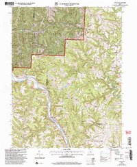
 1904 Chesterhill1957 Print · USGSSoutheast Ohio's rugged hill country is captured here during the peak of its rail-and-river economy in the early twentieth century. Researchers can locate vanished rural post offices and community landmarks like Calvary P O, Bethany Church, and Patten Mills.
 - 1906 Map of Belleville
 1906 Belleville1906 Print · USGSWood County at the turn of the century is defined by its deep river valleys and the expansion of the Baltimore and Ohio RR. Genealogists and historians can trace late-Victorian settlements like Mineral Wells, Belleville, and the riverfront at Walkers Crossing.2 unique versions available
 - 1906 Map of Chesterhill, 1943 Print
 1906 Chesterhill1943 Print · USGSSoutheastern Ohio at the start of the century reveals a landscape of coal-mining hamlets and river valley rail lines. Genealogists and researchers can trace family landmarks like Mills School, Patten Mills, and the scattered post offices of Calvary PO and Federal.
 - 1907 Map of Keno, 1919 Print
 1907 Keno1919 Print · USGSMeigs County and the Ohio River valley appear in high detail just after the turn of the century, showing a landscape defined by river trade and rail. Researchers can trace family sites at Nease Settlement, find the Minersville PO, or locate old schools like Morningstar School and Redbrush School.3 unique versions available
 - 1924 Map of Belleville, 1954 Print
 1924 Belleville1954 Print · USGSWood County’s riverfront settlements and rural school districts are captured here in the mid-twenties during the height of the rail era. Genealogists can locate long-lost family landmarks like Harris Ferry, Meldahl, and dozens of rural schoolhouses including Leafy Glen School.
 - 1926 Map of Belleville
 1926 Belleville1926 Print · USGSThe Ohio River valley and its rugged Wood County hinterlands come into focus in the mid-twenties. Genealogists and historians can locate dozens of rural schools and churches like Leafy Glen School, Torch PO, and Serepta Church along the winding runs.2 unique versions available
 - 1949 Map of Clarksburg
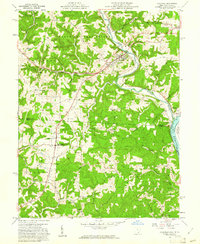
 1949 Clarksburg1949 Print · USGSThe upper Ohio River valley and the industrial heart of West Virginia come into focus during this post-war period. Genealogists and researchers can trace the rail corridors of the Baltimore and Ohio and locate centers like Fairmont, Grafton, and Waynesburg.
 - 1956 Map of Clarksburg, 1966 Print
 1956 Clarksburg1966 Print · USGSThe Ohio River valley and the industrial heart of West Virginia are seen here in the mid-1950s as rail and river commerce thrived. Researchers can trace historic transport lines like the Baltimore and Ohio RR and locate ancestral homes in Clarksburg, Moundsville, or Parkersburg.2 unique versions available
 - 1960 Map of Coolville, 1961 Print
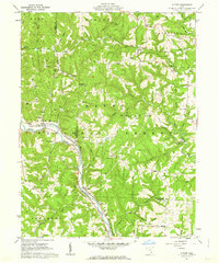
 1960 Coolville1961 Print · USGSThe Hocking River valley and Wayne National Forest are captured here in the early sixties, showing a landscape of ridge-top farms and timber. Genealogists can locate family landmarks such as Stewart Cem, Bethel Ch, and the Olive-Orange Township Sch.4 unique versions available
 - 1961 Map of Clarksburg
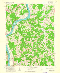
 1961 Clarksburg1961 Print · USGSThe mid-century industrial and river landscapes of West Virginia and Ohio are detailed here, centered on the Ohio River. Researchers can trace the Baltimore and Ohio rail lines connecting towns like Parkersburg, Clarksburg, and Monongah.
 - 1961 Map of Lubeck, 1963 Print
 1961 Lubeck1963 Print · USGSThe West Virginia-Ohio border along the Ohio River is captured here in the early sixties, showing the vital river-and-rail infrastructure of the era. Researchers can trace family history through dozens of rural burial sites like Hickenbottom Cem or explore riverside landmarks such as Mustapha Island.4 unique versions available
 - 1961 Map of Little Hocking, 1963 Print
 1961 Little Hocking1963 Print · USGSThe Ohio River valley south of Parkersburg comes to life in the early sixties, showing the vital river-and-rail corridor at Little Hocking. Family historians can trace rural roots through Quaker Cem and Neal Cem, or locate landmarks like the Covered Bridge.4 unique versions available
 - 1961 Map of Cutler, 1963 Print
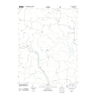
 1961 Cutler1963 Print · USGSSoutheast Ohio in the early sixties reveals a landscape of winding river valleys and ridge-top farms within the Wayne National Forest. Genealogists can trace family names through dozens of sites like Beebe Cem and Crippen Cem, or locate landmarks such as the Cutler Sch and Haga Ch.3 unique versions available
 - 1981 Map of Parkersburg, 1984 Print
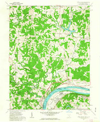
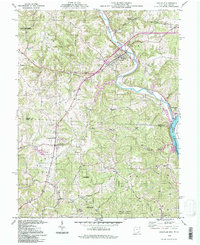
 1981 Parkersburg1984 Print · USGSThe Ohio River valley at the start of the 1980s reveals a landscape shaped by river commerce and the rail networks of the Baltimore and Ohio RR. Genealogists and historians can trace the development of riverfront communities like Parkersburg, Marietta, and Williamstown, alongside rural landmarks like Blennerhassett Island and Elizabeth.
 - 1988 Map of Clarksburg, 1989 Print
 1988 Clarksburg1989 Print · USGSThe central Appalachians are documented in detail during the late eighties, showing the industrial and river-based economies of West Virginia, Ohio, and Pennsylvania. Researchers can trace historic rail routes like the B & O RR and locate river towns from St Marys to Parkersburg.
 - 1994 Map of Coolville, 1998 Print
 1994 Coolville1998 Print · USGSSoutheastern Ohio's river valleys and wooded ridges are surveyed here in the late twentieth century as the Hocking River meets the Ohio River. Genealogists can trace family landmarks like the Pleasant Home Cem, Lawrence Chapel, and the small settlement of Tuppers Plains.
 - 1994 Map of Little Hocking, 1998 Print
 1994 Little Hocking1998 Print · USGSAlong the Ohio River during the late twentieth century, this area shows the historic river-bottom lands of Washington Bottom. Researchers can locate riverside landmarks like Blennerhassett Island and trace rural lineages through the McDougle Cem and Fairfield Cem.
 - 1994 Map of Cutler, 1998 Print
 1994 Cutler1998 Print · USGSSoutheastern Ohio's ridges and river bends appear here in the final decade of the century, showing the enduring rural layout of Washington County. Researchers can trace ancestral sites at Haga Mission, Old Railroad Grade, and Norris Cem.
 - 1994 Map of Lubeck, 1998 Print
 1994 Lubeck1998 Print · USGSThe Ohio River valley near the Wood and Athens county lines appears here during the mid-to-late twentieth century. Researchers can trace riverfront history at Fort Belleville and Harris Ferry, or locate family sites like Munchmeyer Ch and Newberry Cem.
 - 2002 Map of Cutler, 2006 Print
 2002 Cutler2006 Print · USGSSoutheast Ohio's ridge country is captured here at the turn of the twenty-first century, showing the rural communities of Washington and Athens counties. Researchers can locate many family burial sites like Finsterwald Cemetery and old landmarks such as Cutler School.
 - 2010 Map of Little Hocking, 2010 Print
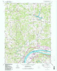
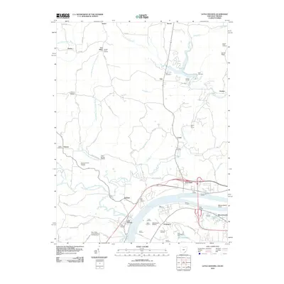 2010 Little Hocking2010 Print · USGSCovers Troy Township, including Belpre, Dunham, and other nearby areas
 - 2011 Map of Coolville, 2011 Print
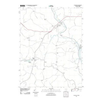 2011 Coolville2011 Print · USGSCovers Troy Township, including Coolville, Success, and other nearby areas
 - 2011 Map of Cutler, 2011 Print
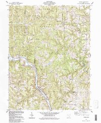
 2011 Cutler2011 Print · USGSCovers Troy Township, including Cutler, Decaturville, and other nearby areas
Showing maps 1-25 of 38
Top cities near Troy Township
- Parkersburg historical maps
- Belpre historical maps
- Blennerhassett historical maps
- Dunham historical maps
- Barlow historical maps
- Chester historical maps
See more
Top neighborhoods of Troy Township
- Hockingport historical maps
- Torch historical maps
- Ireland historical maps
- Youba historical maps
- Coolville historical maps
Frequently asked questions
- What are the different types of historical maps available for Troy Township?
- What is the oldest map of Troy Township?
- Where can I purchase historical maps of Troy Township for my home or office?
- Where can I download high-res historical maps of Troy Township?
- Are there historical topographic maps available for Troy Township?
- Is there historical aerial imagery available for Troy Township?
- Where are historical maps of Troy Township sourced from?