Old Maps of Flag, Ohio
Explore 15 old maps of Flag, spanning from 1903 to today. These high-resolution historic maps reveal how streets, neighborhoods, landmarks, and natural features evolved over time — perfect for genealogy, metal detecting, research, and local history exploration.
What you can do with these maps:
- See how Flag changed over time: Compare historical maps to modern-day views to trace roads, homesites, rail lines & more.
- View detailed metadata: Each map includes creators, publishers, year, scale, and archive source.
- Overlay maps with satellite & LiDAR: Visualize the past alongside modern tools to explore terrain & human change.
- Trusted historical sources: Maps sourced from the USGS, Library of Congress, and other archives.
- Access maps your way: View online, download high-res files, or order prints for personal or research use.
Start exploring old maps of Flag to uncover forgotten places, hidden landmarks, and the deep history beneath your feet.
Flag, OH maps
(15)- 1903 Map of Macksburg, 1958 Print
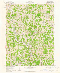
 1903 Macksburg1958 Print · USGSSoutheast Ohio's river valleys and rail corridors were the lifelines of Noble and Washington counties at the turn of the century. Genealogists can trace family roots through rural post offices like Germantown Saltpeter PO and rail hubs such as Macksburg and Dexter City.
 - 1905 Map of Macksburg, 1948 Print
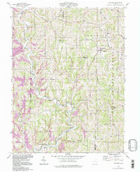
 1905 Macksburg1948 Print · USGSSoutheastern Ohio at the turn of the century was a landscape of deep creek valleys and rising ridges connected by river and rail. Local historians can trace early post offices like Carlisle Berne P.O. and the winding P. R. R. railroad.
 - 1949 Map of Clarksburg
 1949 Clarksburg1949 Print · USGSThe upper Ohio River valley and the industrial heart of West Virginia come into focus during this post-war period. Genealogists and researchers can trace the rail corridors of the Baltimore and Ohio and locate centers like Fairmont, Grafton, and Waynesburg.
 - 1956 Map of Clarksburg, 1966 Print
 1956 Clarksburg1966 Print · USGSThe Ohio River valley and the industrial heart of West Virginia are seen here in the mid-1950s as rail and river commerce thrived. Researchers can trace historic transport lines like the Baltimore and Ohio RR and locate ancestral homes in Clarksburg, Moundsville, or Parkersburg.2 unique versions available
 - 1961 Map of Clarksburg
 1961 Clarksburg1961 Print · USGSThe mid-century industrial and river landscapes of West Virginia and Ohio are detailed here, centered on the Ohio River. Researchers can trace the Baltimore and Ohio rail lines connecting towns like Parkersburg, Clarksburg, and Monongah.
 - 1961 Map of Stafford, 1963 Print
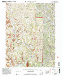
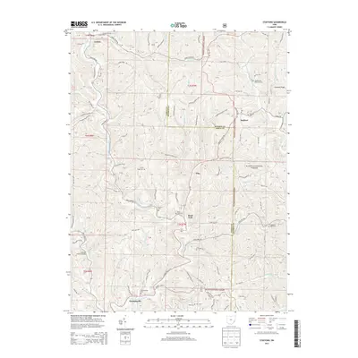
 1961 Stafford1963 Print · USGSSoutheastern Ohio's ridge-and-valley landscape is captured here in the early sixties, showing the rural communities of Stafford and Harriettsville. Researchers can locate several remote churches and cemeteries, such as Zion Ch, Stewart Cem, and Mt Tabor Ch.3 unique versions available
 - 1980 Map of Senecaville, 1983 Print
 1980 Senecaville1983 Print · USGSEastern Ohio at the start of the eighties reveals a complex landscape of coal extraction and river commerce. Genealogists and historians can trace rail lines like the Conrail and Baltimore and Ohio RR connecting towns like Byesville and Woodsfield.2 unique versions available
 - 1988 Map of Clarksburg, 1989 Print
 1988 Clarksburg1989 Print · USGSThe central Appalachians are documented in detail during the late eighties, showing the industrial and river-based economies of West Virginia, Ohio, and Pennsylvania. Researchers can trace historic rail routes like the B & O RR and locate river towns from St Marys to Parkersburg.
 - 1994 Map of Stafford, 1998 Print
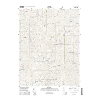
 1994 Stafford1998 Print · USGSThe Noble and Monroe county borderlands appear in the mid-nineties as a landscape of deep valleys and forested ridges. Genealogists and historians can trace old homesteads and landmarks like Mt Tabor Ch, Township Sch, and the Zion Cem.
 - 2002 Map of Stafford, 2006 Print
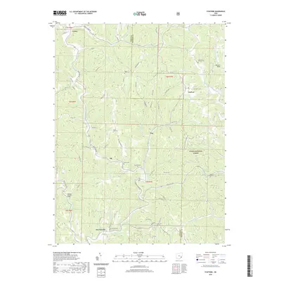
 2002 Stafford2006 Print · USGSSoutheast Ohio's ridge country at the turn of the millennium shows a landscape shaped by rural tradition and natural resource extraction. Genealogists can trace family landmarks like Mt Tabor Ch and Zion Cem or locate the old Township Sch near Harriettsville.
 - 2011 Map of Stafford, 2011 Print
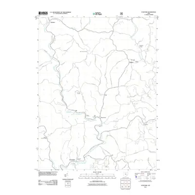 2011 Stafford2011 Print · USGSCovers Flag, including Elk, Stafford, and other nearby areas
 - 2013 Map of Stafford, 2013 Print
 2013 Stafford2013 Print · USGSCovers Flag, including Elk, Stafford, and other nearby areas
 - 2016 Map of Stafford, 2016 Print
 2016 Stafford2016 Print · USGSCovers Flag, including Elk, Stafford, and other nearby areas
 - 2019 Map of Stafford, 2019 Print
 2019 Stafford2019 Print · USGSCovers Flag, including Elk, Stafford, and other nearby areas
 - 2023 Map of Stafford, 2023 Print
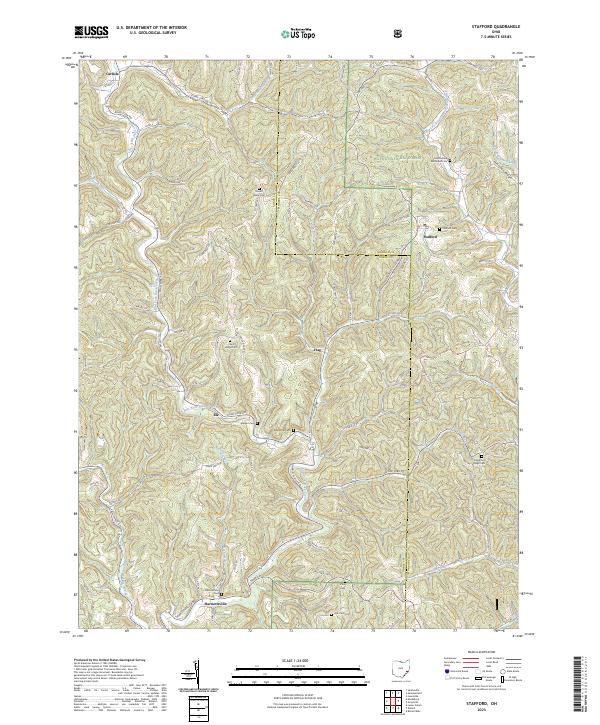 2023 Stafford2023 Print · USGSSoutheast Ohio's ridge-and-valley landscape is documented here in recent years, showing the intersection of Noble and Monroe Counties. Genealogists can locate numerous rural burial sites like Stafford Cem and Harriettsville Cem while tracing historic hamlets such as Elk and Flag.
End of results
Showing maps 1-15 of 15
Top cities near Flag
- Woodsfield historical maps
- Caldwell historical maps
- Grandview historical maps
- Malaga historical maps
- Lowell historical maps
- Elk historical maps
See more
Frequently asked questions
- What are the different types of historical maps available for Flag?
- What is the oldest map of Flag?
- Where can I purchase historical maps of Flag for my home or office?
- Where can I download high-res historical maps of Flag?
- Are there historical topographic maps available for Flag?
- Is there historical aerial imagery available for Flag?
- Where are historical maps of Flag sourced from?