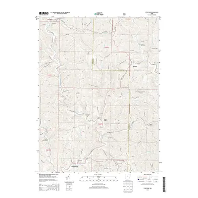
2013 Map of Stafford
USGS Topo · Published 2013About this map
Huffman Covered Bridge stands as a landmark of rural engineering along the banks of East Fork Duck Creek in this 2013 survey. The landscape of Noble and Monroe counties is defined by its ridge-and-hollow topography, where small settlements like Stafford, Harriettsville, and Road Fork are situated at key crossroads. These communities are anchored by local history, evidenced by numerous burial grounds including Harriettsville Cem, Stafford Cem, and Zion Cem.
Find a feature on this map
92 named features on this map. Tap any name to fly to it.
Don’t see what you’re looking for? This feature index may not catch every label — zoom into the map to look around manually.
Map Details
Editions of this 2013 Stafford Map
This is the sole edition of this map. No revisions or reprints were ever made.
Other maps of this area

1903 · Macksburg
USGS Topo · 1:62,500

1905 · New Matamoras
USGS Topo · 1:62,500

1905 · Woodsfield
USGS Topo · 1:62,500

1905 · Macksburg
USGS Topo · 1:62,500

1909 · Summerfield
USGS Topo · 1:62,500

1911 · Summerfield
USGS Topo · 1:62,500

1924 · New Matamoras
USGS Topo · 1:62,500

1926 · New Matamoras
USGS Topo · 1:62,500

1949 · Clarksburg
USGS Topo · 1:250,000

1956 · Clarksburg
USGS Topo · 1:250,000