Old Maps of Tahlequah, Oklahoma for Hiking & Exploration
Hike through history with 32 historic maps of Tahlequah. Explore old trails, ghost towns, and forgotten backroads — perfect for outdoor adventurers and local explorers.
- Rediscover forgotten places: Map out old mining camps, roads, and footpaths that no longer exist on modern maps.
- Layer with modern tools: Combine with LiDAR or satellite views to plan hikes through historical terrain.
- Made for exploration: Popular among hikers, overlanders, and local history lovers.
Use these maps to find adventure and explore the hidden past of Tahlequah.
Tahlequah, OK maps
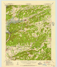
(32)- 1898 Map of Tahlequah, 1954 Print
 1898 Tahlequah1954 Print · USGSThe Cherokee Nation capital and the surrounding Indian Territory come to life in this survey conducted before Oklahoma statehood. Genealogists can trace family-named landmarks and early institutions like the Female Seminary, Salem Springs, and the Cherokee Insane Asylum.
 - 1901 Map of Muscogee
 1901 Muscogee1901 Print · USGSIndian Territory at the turn of the century shows a landscape shaped by river commerce and the coming of the railroads. Genealogists can trace family roots through early settlements like Tullahassee and Webbers Falls, or locate historic river crossings such as Whisky Ford.6 unique versions available
 - 1901 Map of Tahlequah
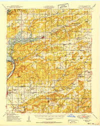
 1901 Tahlequah1901 Print · USGSTahlequah and the Cherokee Nation are captured here during the final years of the Indian Territory era. Genealogists can locate family landmarks such as the Female Seminary, Elm Springs Mission, and the rail-stop settlements of Stilwell and Wauhillau.8 unique versions available
 - 1905 Map of Muscogee
 1905 Muscogee1905 Print · USGSIndian Territory at the turn of the century shows a landscape transitioning from tribal nations to a rail-centered economy. Researchers can trace ancestral river crossings and early settlements like Fort Gibson, Tenkillers Ferry, and Gibson Sta.
 - 1905 Map of Tahlequah
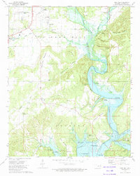
 1905 Tahlequah1905 Print · USGSTahlequah and the surrounding Cherokee Nation are captured here in the years before Oklahoma statehood. Researchers can trace the early rail routes and find historic sites like the Female Seminary, the Cherokee Orphan Asylum, and Elm Springs Mission.
 - 1946 Map of Fort Smith
 1946 Fort Smith1946 Print · USGSThe Arkansas-Oklahoma borderlands appear here in the mid-forties, as new reservoirs began to transform the river valleys. Genealogists and historians can trace rail-served towns from Muskogee to Fort Smith and locate landmarks like Camp Chaffee.
 - 1948 Map of Hulbert, 1957 Print
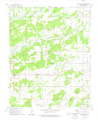
 1948 Hulbert1957 Print · USGSCherokee County at mid-century reveals a landscape of rural schoolhouses and family cemeteries just as the reservoir began to reshape the river valley. Genealogists can trace family roots through sites like Sequoyah Indian Sch, Lost City, and the Fort Gibson National Cem.3 unique versions available
 - 1950 Map of Hulbert
 1950 Hulbert1950 Print · USGSOklahoma's Cherokee County appears here at a pivotal moment just after the war, as the Gibson Reservoir begins to reshape the landscape. Researchers can trace dozens of rural landmarks, including the Sequoyah Indian School, the Fort Gibson National Cemetery, and the Camp Gruber Military Reservation.2 unique versions available
 - 1965 Map of Fort Smith
 1965 Fort Smith1965 Print · USGSEastern Oklahoma and Western Arkansas are captured here during a period of massive post-war change as new reservoirs reshaped the river valleys. Genealogists and historians can trace the rail networks of the Midland Valley RR and find established communities like Stilwell, Sallisaw, and Stigler.
 - 1967 Map of Fort Smith
 1967 Fort Smith1967 Print · USGSThe Arkansas River valley and the foothills of the Ozarks are captured here during a period of significant military and industrial activity. Researchers can trace the sprawling bounds of Camp Chaffee and Camp Gruber or locate vanished rail stops along the Midland Valley RR.
 - 1972 Map of Hulbert NE, 1974 Print
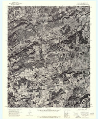 1972 Hulbert NE1974 Print · USGSCherokee County appears in high-resolution detail in the early seventies, showing a landscape defined by cattle ranching and dense woodland. Genealogists and historians can trace property boundaries and land use near Kolpin Mountain and the banks of Fourteenmile Creek.
 - 1972 Map of Tahlequah, 1974 Print
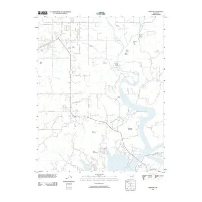
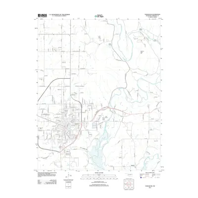
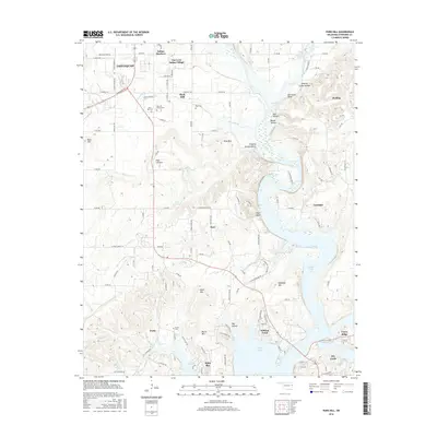
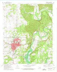 1972 Tahlequah1974 Print · USGSTahlequah and the Illinois River valley are captured in the early 1970s, showcasing a mix of academic growth and riverfront geography. Genealogists and historians can trace the footprint of Northeastern State College, locate the Manus Cem, and follow the OLD RAILROAD GRADE through the hills.3 unique versions available
 - 1973 Map of Park Hill, 1974 Print
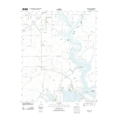
 1973 Park Hill1974 Print · USGSNear the Illinois River in the 1970s, this Cherokee County landscape reveals a deep history of settlement and community life. Researchers can locate family sites at Ross Cem, explore Tsa La Gi Indian Village, or trace the shoreline near Carters Landing.2 unique versions available
 - 1974 Map of Thompson Corner, 1978 Print
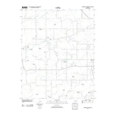
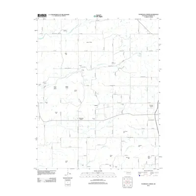
 1974 Thompson Corner1978 Print · USGSCherokee County in the mid-seventies is documented here as a landscape of rural communities and hilltop cemeteries. Genealogists and local historians can trace family roots through landmarks like Thompson Corner, New Hope Ch, and the Houston Cem.
 - 1978 Map of Muskogee, 1979 Print
 1978 Muskogee1979 Print · USGSThe confluence of the Arkansas, Verdigris, and Neosho Rivers defines the Muskogee region in the late seventies. Genealogists and historians can trace the footprints of Camp Gruber (Abandoned), the campus of Bacone College, and early aviation at Hatbox Field.
 - 1978 Map of Fort Smith, 1979 Print
 1978 Fort Smith1979 Print · USGSThe Arkansas-Oklahoma borderlands in the late seventies show a landscape shaped by massive river reservoirs and sprawling military reservations. Trace the historic rail lines of the Missouri Pacific RR and locate regional landmarks like Fort Gibson, Tenkiller Ferry Lake, and Barling.2 unique versions available
 - 1978 Map of Stilwell, 1979 Print
 1978 Stilwell1979 Print · USGSThe Oklahoma-Arkansas borderlands come alive in the late seventies, showing the transition from the Cherokee Nation hills to the Arkansas Ozarks. Researchers can trace the Kansas City Southern rail line through Stilwell, find Wrights Chapel, or locate the Northeastern State College campus in Tahlequah.
 - 2010 Map of Park Hill, 2010 Print
 2010 Park Hill2010 Print · USGSCovers Tahlequah, including Caney Ridge, Pettit, and other nearby areas
 - 2010 Map of Tahlequah, 2010 Print
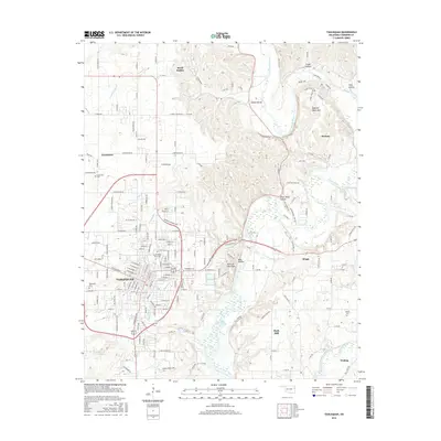
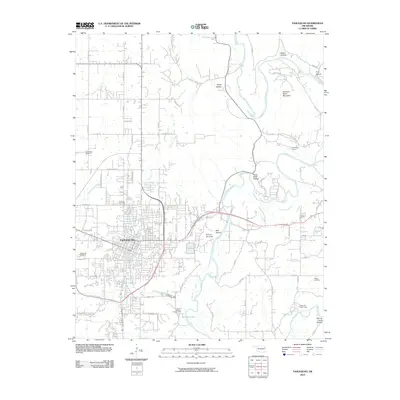 2010 Tahlequah2010 Print · USGSCovers Tahlequah, including Welling, Cherokee County, and other nearby areas
 - 2010 Map of Thompson Corner, 2010 Print
 2010 Thompson Corner2010 Print · USGSCovers Tahlequah, including Hulbert, Shady Grove, and other nearby areas
 - 2012 Map of Park Hill, 2012 Print
 2012 Park Hill2012 Print · USGSCovers Tahlequah, including Caney Ridge, Pettit, and other nearby areas
 - 2012 Map of Tahlequah, 2012 Print
 2012 Tahlequah2012 Print · USGSCovers Tahlequah, including Welling, Cherokee County, and other nearby areas
 - 2012 Map of Thompson Corner, 2012 Print
 2012 Thompson Corner2012 Print · USGSCovers Tahlequah, including Hulbert, Shady Grove, and other nearby areas
 - 2016 Map of Park Hill, 2016 Print
 2016 Park Hill2016 Print · USGSCovers Tahlequah, including Caney Ridge, Pettit, and other nearby areas
 - 2016 Map of Tahlequah, 2016 Print
 2016 Tahlequah2016 Print · USGSCovers Tahlequah, including Welling, Cherokee County, and other nearby areas
Showing maps 1-25 of 32
Top cities near Tahlequah
Top neighborhoods of Tahlequah
Frequently asked questions
- What are the different types of historical maps available for Tahlequah?
- What is the oldest map of Tahlequah?
- Where can I purchase historical maps of Tahlequah for my home or office?
- Where can I download high-res historical maps of Tahlequah?
- Are there historical topographic maps available for Tahlequah?
- Is there historical aerial imagery available for Tahlequah?
- Where are historical maps of Tahlequah sourced from?