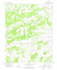
1974 Map of Thompson Corner
USGS Topo · Published 1978About this map
Thompson Corner serves as a central hub in this Cherokee County landscape, where small community centers and rural infrastructure are dispersed across high ridges and deep hollows. The presence of several landmarks like Shady Grove Sch, Swimmer Ch, and Mt Zion Ch alongside family-named plots such as Parris Cem and Houston Cem highlights the genealogical value of this rural area.
Find a feature on this map
54 named features on this map. Tap any name to fly to it.
Don’t see what you’re looking for? This feature index may not catch every label — zoom into the map to look around manually.
Map Details
Editions of this 1974 Thompson Corner Map
This is the sole edition of this map. No revisions or reprints were ever made.
Other maps of this area

1896 · Pryor
USGS Topo · 1:125,000

1898 · Tahlequah
USGS Topo · 1:125,000

1899 · Siloam Springs
USGS Topo · 1:125,000

1901 · Muscogee
USGS Topo · 1:125,000

1901 · Pryor
USGS Topo · 1:125,000

1901 · Tahlequah
USGS Topo · 1:125,000

1903 · Siloam Springs
USGS Topo · 1:125,000

1904 · Siloam Springs
USGS Topo · 1:125,000

1905 · Muscogee
USGS Topo · 1:125,000

1905 · Tahlequah
USGS Topo · 1:125,000