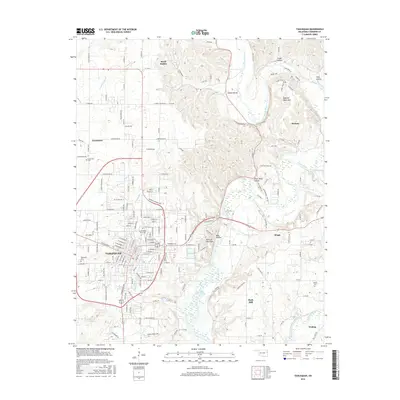
2016 Map of Tahlequah
USGS Topo · Published 2016About this map
Tahlequah serves as the focal point of this Cherokee County study, highlighting the significant footprint of Northeastern State Univ and the surrounding residential growth. The landscape is defined by the winding course of the Illinois River, which cuts through the high ground of Sparrow Hawk Mtn and provides the drainage for numerous hollows like Steely Hollow and River Bend Hollow. To the south, the waters of Tenkiller Ferry Lake reach toward Park Hill, while the Baron Fork flows near the settlement of Welling. Genealogists will find three distinct burial grounds marked: Tahlequah Cem, Grandview Cem, and the more remote Manus Cem near the eastern edge. The map captures a moment of modern connectivity where older routes like Bus 62 meet new developments, all while the terrain remains punctuated by natural landmarks such as McSpadden Falls and the Point of the Pines.
Find a feature on this map
175 named features on this map. Tap any name to fly to it.
Don’t see what you’re looking for? This feature index may not catch every label — zoom into the map to look around manually.
Map Details
Editions of this 2016 Tahlequah Map
This is the sole edition of this map. No revisions or reprints were ever made.
Other maps of this area

1896 · Pryor
USGS Topo · 1:125,000

1898 · Tahlequah
USGS Topo · 1:125,000

1899 · Siloam Springs
USGS Topo · 1:125,000

1901 · Muscogee
USGS Topo · 1:125,000

1901 · Pryor
USGS Topo · 1:125,000

1901 · Tahlequah
USGS Topo · 1:125,000

1903 · Siloam Springs
USGS Topo · 1:125,000

1904 · Siloam Springs
USGS Topo · 1:125,000

1905 · Muscogee
USGS Topo · 1:125,000

1905 · Tahlequah
USGS Topo · 1:125,000