Old Maps of Coal County, Oklahoma for Academic Research
Study the evolution of Coal County with 119 high-resolution historic maps. Whether you're teaching, researching, or modeling changes in land use, these maps provide essential visual documentation of urban, environmental, and geographic change.
- Analyze long-term change: Track patterns in development, transportation, and natural features.
- Ideal for environmental or urban studies: Support academic projects with primary historical map data.
- Use in the classroom or lab: Educators and researchers rely on these maps to bring historical context to life.
These maps are a powerful tool for teaching, research, and visualizing how Coal County has changed over the decades.
Coal County, OK maps
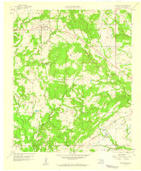
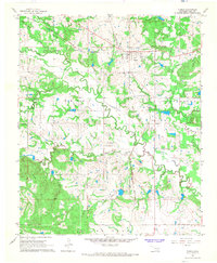
(119)- 1896 Map of Coalgate, 1957 Print
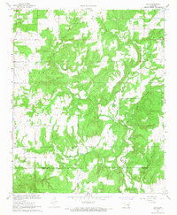
 1896 Coalgate1957 Print · USGSIndian Territory in the mid-1890s shows a landscape of tribal boundaries and nascent rail towns just before the turn of the century. Genealogists and historians can trace the early foundations of Coalgate and Calvin or locate family-named features along Muddy Boggy Creek.
 - 1899 Map of Coalgate
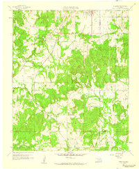
 1899 Coalgate1899 Print · USGSIndian Territory at the close of the nineteenth century is captured here as the coal industry transformed the landscape. Genealogists can trace family roots in the Seminole Nation or search for early mining-era homesites in Coalgate and Phillips.
 - 1899 Map of Atoka
 1899 Atoka1899 Print · USGSIn the final years of the Indian Territory, this map details the complex border between the Chickasaw and Choctaw Nations. Genealogists can trace early homesteads near Old Boggy Depot, the Buffalo Creek Church, and the Chickasaw Rock Academy.
 - 1900 Map of Atoka
 1900 Atoka1900 Print · USGSIndian Territory at the turn of the century shows the developing rail-and-river network before Oklahoma statehood. Genealogists and historians can trace original settlements like Old Boggy Depot, find the Chickasaw Rock Academy, and follow the Missouri Kansas and Texas R.R. through Atoka.4 unique versions available
 - 1900 Map of Coalgate
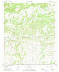
 1900 Coalgate1900 Print · USGSIndian Territory at the turn of the century shows a land of tribal boundaries and emerging coal towns. Researchers can trace the early rail corridors of the M. K. and T. R. R. and locate vanished communities like Guertie, Citra, and Legal.3 unique versions available
 - 1901 Map of Stonewall
 1901 Stonewall1901 Print · USGSBefore Oklahoma statehood, this late-century survey captures the Chickasaw Nation and Seminole Nation borderlands in high detail. Researchers can locate early schools like Collins Institute and trace the paths between settlements such as Stonewall, Ada, and Fitzhugh.4 unique versions available
 - 1901 Map of Tishomingo
 1901 Tishomingo1901 Print · USGSThe Chickasaw Nation comes to life in this late-frontier survey of Johnston County and the surrounding Indian Territory. Genealogists and historians can locate early industrial sites like the Asphalt Mines, the landmark Harley Institute, and the site of Fort Washita.4 unique versions available
 - 1957 Map of Coalgate, 1958 Print
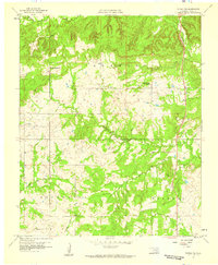
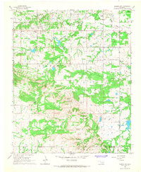
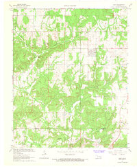
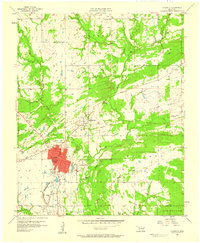 1957 Coalgate1958 Print · USGSCoalgate and the surrounding Coal County coalfields are captured here in the late fifties, showing the area's transition into a modern civic hub. Genealogists can trace family footprints at Calvary Cem, Sandmann Mine No 2, and the rural Lone Star Sch.3 unique versions available
 - 1957 Map of Lehigh, 1958 Print
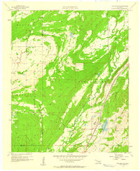
 1957 Lehigh1958 Print · USGSOklahoma's coal mining heartland comes alive in this mid-century survey of the Lehigh and Atoka area. Researchers can trace family history through the Lehigh Cem, locate old Strip Mine works, and find rural landmarks like Macedonia Sch.4 unique versions available
 - 1957 Map of Coalgate SE, 1958 Print
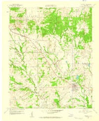
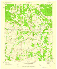
 1957 Coalgate SE1958 Print · USGSSoutheastern Oklahoma in the late fifties was a landscape of state-managed lands and busy rail corridors. Researchers can trace the lineage of rural communities through Cairo Cem and Flora or follow the heavy tracks of the Kansas City Southern.3 unique versions available
 - 1957 Map of Stonewall, 1959 Print
 1957 Stonewall1959 Print · USGSThe town of Stonewall and the surrounding Pontotoc County landscape are documented here in the late fifties during a period of steady growth. Researchers can trace family sites at Highland Cem or locate rural landmarks like Ahloso Sch and the Fish Hatchery.2 unique versions available
 - 1957 Map of Centrahoma, 1959 Print
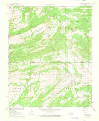
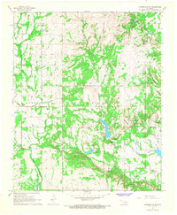
 1957 Centrahoma1959 Print · USGSOklahoma's coal and oil country is captured here in the late fifties, centered on the community of Centrahoma. Genealogists and historians can trace the locations of the Round Lake Cem, the Hazelton Mine, and the Oak Grove Sch (Abandoned).3 unique versions available
 - 1957 Map of Tupelo NE, 1959 Print
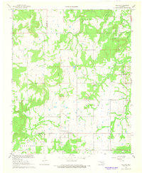
 1957 Tupelo NE1959 Print · USGSCoal County ranching and rural life are documented here in the late fifties, centered on the Muddy Boggy Creek drainage. Genealogists and historians can locate the Boiling Springs Ch, Glass Cem, and the old ranch at Diamond Bar Ranch.
 - 1957 Map of Ardmore, 1968 Print
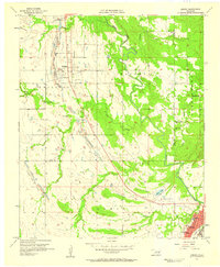
 1957 Ardmore1968 Print · USGSSouth-central Oklahoma in the late fifties was a landscape of rising reservoir waters and expanding rail lines. Genealogists and historians can trace the foundations of Ardmore and Duncan or locate early recreation sites at Platt National Park and Lake Murray State Park.3 unique versions available
 - 1958 Map of Lula, 1959 Print
 1958 Lula1959 Print · USGSCoal County prairie life in the late fifties centered on small rail-side settlements and rural parishes. Family historians can trace church communities at Rocky Point Ch and locate burial sites like Lula Cem along the Kansas Oklahoma and Gulf line.3 unique versions available
 - 1958 Map of Steedman, 1959 Print
 1958 Steedman1959 Print · USGSPontotoc and Hughes counties appear here in the late fifties as a landscape of oil production and quiet rural communities. Researchers can trace the Old Indian Boundary and locate family landmarks like Black Rock Cem and Dawson Chapel.2 unique versions available
 - 1963 Map of Ardmore
 1963 Ardmore1963 Print · USGSSouthern Oklahoma during the early sixties shows a landscape defined by the Arbuckle Mountains and a booming energy economy. Genealogists and historians can trace family-named sites across the Ardmore Oil Field, find old schools like Southeastern State College, or locate historic markers such as Boggy Depot State Park.2 unique versions available
 - 1966 Map of Tupelo, 1968 Print
 1966 Tupelo1968 Print · USGSTupelo and central Coal County are captured in the mid-1960s as a vital railroad junction. Researchers can trace the Old Indian Treaty Boundary and locate family burial sites at Byrds Prairie Cem and Wilson Cem.3 unique versions available
 - 1966 Map of Harden City, 1968 Print
 1966 Harden City1968 Print · USGSOklahoma's oil and cattle country comes to life in the late sixties at the junction of Pontotoc and Coal Counties. Trace the rural landscape through family landmarks like Atkins Cem, the McLish Sch, and industrial sites including a local Refinery.
 - 1967 Map of Wardville, 1968 Print
 1967 Wardville1968 Print · USGSWardville and the surrounding prairie lands of Atoka and Coal Counties are captured here in the late sixties, showing a landscape of scattered family farms and energy exploration. Genealogists and local historians can locate King Cem, Lone Star Ch, and the rural community of Wardville near Rabbit Creek.2 unique versions available
 - 1967 Map of Ashland, 1968 Print
 1967 Ashland1968 Print · USGSThe rural landscape of Pittsburg County comes into focus in the late sixties, showing the intersection of local life and military operations. Researchers can trace the Reservation Boundary of the U S Naval Ammunition Depot alongside local landmarks like Friendship Ch and Ward Springs Cem.2 unique versions available
 - 1967 Map of Non, 1968 Print
 1967 Non1968 Print · USGSThe rural landscape of Hughes and Coal counties is captured in the late sixties, centered on the settlement of Non. Genealogists and researchers can locate the Non Cemetery, Rock Creek Cemetery, and numerous active sandpits along Boggy Creek.3 unique versions available
 - 1967 Map of Connerville NE, 1968 Print
 1967 Connerville NE1968 Print · USGSJohnston and Coal County show a landscape of remote springs and rural settlements during the late 1960s. Genealogists can trace family sites at Seely Cem and Pilgrim Cem or locate the community hubs of Pontotoc and Bromide.
 - 1967 Map of Parker, 1968 Print
 1967 Parker1968 Print · USGSCentral Oklahoma's rural landscape is captured here in the late 1960s, defined by the winding paths of Muddy Boggy Creek and Salt Creek. Genealogists can locate family landmarks like McCarty Cem or the community hub at Parker and Pine Sch.2 unique versions available
 - 1967 Map of Gerty, 1968 Print
 1967 Gerty1968 Print · USGSThe rural landscape of Hughes and Coal counties is captured here in the late sixties, centered on the town of Gerty. Researchers can locate family landmarks like Gerty Cem and Salt Creek Ch or trace the NE Citra Oil and Gas Field.3 unique versions available
Showing maps 1-25 of 119
Top cities of Coal County
- Coalgate historical maps
- Tupelo historical maps
- Lehigh historical maps
- Phillips historical maps
- Centrahoma historical maps
Frequently asked questions
- What are the different types of historical maps available for Coal County?
- What is the oldest map of Coal County?
- Where can I purchase historical maps of Coal County for my home or office?
- Where can I download high-res historical maps of Coal County?
- Are there historical topographic maps available for Coal County?
- Is there historical aerial imagery available for Coal County?
- Where are historical maps of Coal County sourced from?