Old Maps of McIntosh County, Oklahoma for Metal Detecting
Plan your next treasure hunt with 144 historic maps of McIntosh County. Find old homesites, ghost towns, trails, and gathering spots that may be lost to time — perfect for identifying promising metal detecting locations.
- Locate forgotten sites: Uncover places like long-lost settlements, abandoned rail lines, or gathering spots.
- Plan better hunts: Use map overlays combined with LiDAR or satellite views to narrow in on historically rich areas.
- Made for detectorists: Thousands of hobbyists use these maps to discover relics, coins, and hidden history.
Use these historic maps to boost your research and find new opportunities beneath the surface of McIntosh County.
McIntosh County, OK maps
(144)- 1896 Map of Okmulgee, 1954 Print
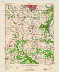
 1896 Okmulgee1954 Print · USGSThe Creek Nation of the Indian Territory is captured here in the late nineteenth century, just before the turn of the century. Genealogists and researchers can trace early mission sites like Wealaka Mission and established frontier settlements including Council Hill and Wellington.
 - 1900 Map of Sansbois
 1900 Sansbois1900 Print · USGSIndian Territory in the late nineteenth century is documented here through its tribal boundaries and early river settlements. Genealogists can trace family roots near Stigler, Porum, and Whitefield, or locate the isolated station at Sandtown along the St L & S F R R.2 unique versions available
 - 1900 Map of Canadian
 1900 Canadian1900 Print · USGSIndian Territory at the turn of the century shows a landscape of tribal nations and developing rail towns along the CANADIAN RIVER. Genealogists and historians can trace early settlements like Fishertown and Indianola or the original Creek Nation Choctaw Nation Boundary Line.6 unique versions available
 - 1900 Map of Okmulgee
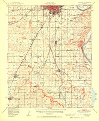
 1900 Okmulgee1900 Print · USGSThe Indian Territory of the Creek Nation is captured here during the late 1890s, just before statehood changed the region forever. Researchers can trace the early foundations of Okmulgee or locate vanished sites like Wealaka Mission and Wellington (Lee P.O.).6 unique versions available
 - 1901 Map of Muscogee
 1901 Muscogee1901 Print · USGSIndian Territory at the turn of the century shows a landscape shaped by river commerce and the coming of the railroads. Genealogists can trace family roots through early settlements like Tullahassee and Webbers Falls, or locate historic river crossings such as Whisky Ford.6 unique versions available
 - 1905 Map of Muscogee
 1905 Muscogee1905 Print · USGSIndian Territory at the turn of the century shows a landscape transitioning from tribal nations to a rail-centered economy. Researchers can trace ancestral river crossings and early settlements like Fort Gibson, Tenkillers Ferry, and Gibson Sta.
 - 1909 Map of Sans Bois, 1954 Print
 1909 Sans Bois1954 Print · USGSHaskell and Muskogee counties are seen here in the decade following statehood, when rail lines and river crossings dictated the pulse of rural life. Genealogists can trace family roots through numerous local landmarks like Kanima P O, Belle Starr School, and the Sansbois Sta.
 - 1911 Map of Sansbois
 1911 Sansbois1911 Print · USGSEastern Oklahoma's river valleys and rugged hills come alive in this early twentieth-century survey of the Choctaw Nation's western reaches. Researchers can locate rural landmarks like Sansbois Station, the Belle Starr School, and early river crossings such as the Thornton Ferry.3 unique versions available
 - 1946 Map of Fort Smith
 1946 Fort Smith1946 Print · USGSThe Arkansas-Oklahoma borderlands appear here in the mid-forties, as new reservoirs began to transform the river valleys. Genealogists and historians can trace rail-served towns from Muskogee to Fort Smith and locate landmarks like Camp Chaffee.
 - 1948 Map of Keefeton, 1963 Print
 1948 Keefeton1963 Print · USGSMuskogee County in the late 1940s is a hub of overlapping rail lines and small rural communities just before the major shifts of the postwar era. Researchers can trace the heritage of local settlements like Rentiesville and Summit or locate family burial sites at Brushy Mtn Cem and McLain Cem.2 unique versions available
 - 1950 Map of Keefeton
 1950 Keefeton1950 Print · USGSMuskogee County in the late nineteen-forties shows a landscape of busy rail corridors and established rural townships just after the war. Researchers can trace historic homesteads and community hubs through landmarks like Rentiesville, the Plainview Cem, and Hatbox Field.2 unique versions available
 - 1962 Map of Henryetta, 1963 Print
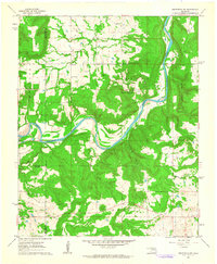
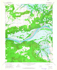
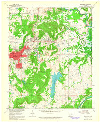 1962 Henryetta1963 Print · USGSHenryetta and its surrounding rail junctions are captured here in the early sixties as the landscape prepared for the creation of Eufaula Reservoir. Researchers can trace historic industrial sites like the Smelter and small communities such as Spelter City, Dewar, and Kusa.4 unique versions available
 - 1962 Map of Raiford, 1963 Print
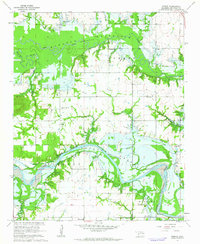
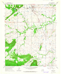
 1962 Raiford1963 Print · USGSMcIntosh County during the early 1960s shows a rural landscape on the cusp of change as the reservoir began to fill. Researchers can trace local heritage at Lenna Sch Cem, find the rural center of Raiford, and map the original course of Flat Rock Creek.
 - 1962 Map of Henryetta SW, 1963 Print
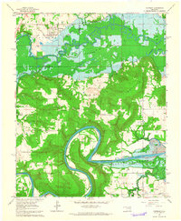
 1962 Henryetta SW1963 Print · USGSThe North Canadian River valley near the McIntosh and Okfuskee county lines comes alive in this early sixties survey. Local historians can trace family-named landmarks and tribal community centers like Yardeka Ch, Ryals Sch, and the Hickory Ground No 1 Ch.2 unique versions available
 - 1962 Map of Pierce, 1963 Print
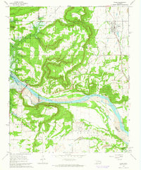
 1962 Pierce1963 Print · USGSMcIntosh County sits at a geographic crossroads in the early sixties as the rising waters of the new reservoir began to reshape the river valleys. Genealogists can locate family landmarks like Pierce Cem, Lerblance Cem, and rural schools including Warrior Sch.4 unique versions available
 - 1962 Map of Hoffman, 1964 Print
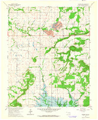
 1962 Hoffman1964 Print · USGSThe Okmulgee and McIntosh county line is captured here in the early sixties as the reservoir began to transform the river valley. Genealogists can trace family landmarks like Morrison Cemetery, Tiger Mountain School, and the settlement of Lenna.2 unique versions available
 - 1963 Map of Porum, 1964 Print
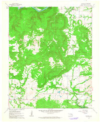
 1963 Porum1964 Print · USGSThe Oklahoma hill country comes into focus in the early sixties as the Eufaula Reservoir begins to shape the landscape. Genealogists and local historians can trace the foundations of Porum and Hoyt, alongside rural landmarks like Sandy Ridge Sch and Starr Cem.2 unique versions available
 - 1963 Map of Warner NW, 1964 Print
 1963 Warner NW1964 Print · USGSMcIntosh County in the early sixties shows the rising waters of the Eufaula Reservoir and the scars of local industry. Genealogists and historians can trace the Old Indian Treaty Boundary and locate landmarks like Paradise Cem and the Strip Mine.3 unique versions available
 - 1963 Map of Stidham, 1964 Print
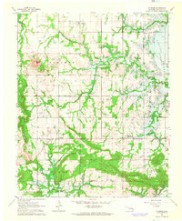 1963 Stidham1964 Print · USGSMcIntosh County communities like Stidham and Fame are shown in the early sixties as the rising Eufaula Reservoir reshaped the local creeks. Researchers can locate numerous local landmarks including Artussee Indian Ch, Ramsey Cem, and Carters Corner.3 unique versions available
 - 1963 Map of Eufaula, 1964 Print
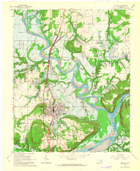 1963 Eufaula1964 Print · USGSThe McIntosh County seat is shown here in the early sixties during the creation of its namesake reservoir. Researchers can trace the original riverbanks before the flooding of the Eufaula Reservoir and locate local landmarks like West Eufaula Ch and McIntosh Cem.3 unique versions available
 - 1963 Map of Checotah, 1964 Print
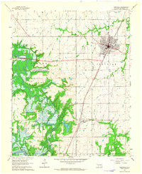 1963 Checotah1964 Print · USGSMcIntosh County during the early sixties shows the landscape changing as the Eufaula Reservoir began to take shape. Genealogists and historians can locate Richard Cem, Deep Fork Ch, and the original rail-side layout of Onapa before the valley was inundated.3 unique versions available
 - 1963 Map of Texanna, 1964 Print
 1963 Texanna1964 Print · USGSOklahoma's river valleys were undergoing a massive transformation in the early sixties as the reservoir began to fill. Researchers can trace land tracts near the Old Indian Treaty Boundary or find family sites like Lindsey Chapel and Triplett Cem.3 unique versions available
 - 1963 Map of Warner, 1964 Print
 1963 Warner1964 Print · USGSWarner and the nearby agricultural college are captured in the early sixties as the regional hub for this part of Muskogee County. Genealogists can trace family landmarks and burial sites like Popejoy Chapel, Woodall Cem, and the Conley Sch.3 unique versions available
 - 1965 Map of Fort Smith
 1965 Fort Smith1965 Print · USGSEastern Oklahoma and Western Arkansas are captured here during a period of massive post-war change as new reservoirs reshaped the river valleys. Genealogists and historians can trace the rail networks of the Midland Valley RR and find established communities like Stilwell, Sallisaw, and Stigler.
 - 1967 Map of Fort Smith
 1967 Fort Smith1967 Print · USGSThe Arkansas River valley and the foothills of the Ozarks are captured here during a period of significant military and industrial activity. Researchers can trace the sprawling bounds of Camp Chaffee and Camp Gruber or locate vanished rail stops along the Midland Valley RR.
Showing maps 1-25 of 144
Top cities of McIntosh County
- Checotah historical maps
- Eufaula historical maps
- Hanna historical maps
- Hitchita historical maps
- Rentiesville historical maps
- Stidham historical maps
Frequently asked questions
- What are the different types of historical maps available for McIntosh County?
- What is the oldest map of McIntosh County?
- Where can I purchase historical maps of McIntosh County for my home or office?
- Where can I download high-res historical maps of McIntosh County?
- Are there historical topographic maps available for McIntosh County?
- Is there historical aerial imagery available for McIntosh County?
- Where are historical maps of McIntosh County sourced from?