1900s (20th Century) Maps of Okmulgee County, Oklahoma
Explore 34 historic maps of Okmulgee County from the 1900s (20th Century). These maps offer a rare glimpse into what life looked like during the 1900s — showing old roads, neighborhoods, homes, and landmarks that have changed or disappeared over time.
Whether you're researching your family's past, planning a metal detecting trip, or studying how Okmulgee County's landscape evolved across the 1900s, these high-resolution maps are a powerful tool for exploring the history of this region.
- Focus on a specific era: All maps on this page are from the 1900s, giving you a focused view of this time period.
- See what’s changed: Compare century-old streets, trails, and buildings to today's modern landscape using overlays and satellite layers.
- Research with precision: Use these maps for genealogy, historical research, land use analysis, or educational projects.
- View, download, or print: Maps are fully viewable online in high resolution, and can be downloaded or printed for your own records.
Start exploring Okmulgee County's history through authentic maps from the 1900s. This is your window into the past.
Okmulgee County, OK maps
(34)- 1900 Map of Canadian
 1900 Canadian1900 Print · USGSIndian Territory at the turn of the century shows a landscape of tribal nations and developing rail towns along the CANADIAN RIVER. Genealogists and historians can trace early settlements like Fishertown and Indianola or the original Creek Nation Choctaw Nation Boundary Line.6 unique versions available
 - 1900 Map of Wewoka
 1900 Wewoka1900 Print · USGSIndian Territory at the turn of the century shows a landscape defined by tribal nations and the early expansion of the railway. Genealogists can trace family homesteads near Wewoka and Holdenville, or locate remote landmarks like Marks Store and the Baptist Mission.4 unique versions available
 - 1900 Map of Okmulgee
 1900 Okmulgee1900 Print · USGSThe Indian Territory of the Creek Nation is captured here during the late 1890s, just before statehood changed the region forever. Researchers can trace the early foundations of Okmulgee or locate vanished sites like Wealaka Mission and Wellington (Lee P.O.).6 unique versions available
 - 1901 Map of Nuyaka
 1901 Nuyaka1901 Print · USGSIndian Territory within the Creek Nation was undergoing rapid change in the late 19th century as railroads connected once-remote outposts. Researchers can trace early settlements and schools like Nuyaka Mission, Bristow, and the crossroads at Smiths Store before Oklahoma reached statehood.4 unique versions available
 - 1914 Map of Kiefer
 1914 Kiefer1914 Print · USGSCreek and Tulsa Counties are seen here during the height of the early oil boom, centered on the rail junctions and tank farms. Researchers can trace the development of petroleum infrastructure near Glenpool or locate vanished country schools like Blackout Forest School and Locust Hill School.2 unique versions available
 - 1916 Map of Kiefer
 1916 Kiefer1916 Print · USGSCreek County at the height of the early oil boom years is captured here in fine detail. Genealogists can trace the rural landscape through family-named schools like Crowson School, Bluebell School, and the Louisiana Baptist Church.3 unique versions available
 - 1946 Map of Fort Smith
 1946 Fort Smith1946 Print · USGSThe Arkansas-Oklahoma borderlands appear here in the mid-forties, as new reservoirs began to transform the river valleys. Genealogists and historians can trace rail-served towns from Muskogee to Fort Smith and locate landmarks like Camp Chaffee.
 - 1954 Map of Oklahoma City
 1954 Oklahoma City1954 Print · USGSOklahoma City and its surrounding counties are captured here in the early fifties during a period of significant postwar growth. Researchers can trace the development of the Turner Turnpike and locate aviation hubs like Tinker Field or Will Rogers Field.
 - 1957 Map of Oklahoma City, 1969 Print
 1957 Oklahoma City1969 Print · USGSCentral Oklahoma is captured here in a period of significant mid-century growth and industrialization. Researchers can trace family roots through numerous rural markers like Memory Lane Cem, New Hope School, and the sprawling grounds of Tinker Air Force Base.3 unique versions available
 - 1962 Map of Henryetta, 1963 Print
 1962 Henryetta1963 Print · USGSHenryetta and its surrounding rail junctions are captured here in the early sixties as the landscape prepared for the creation of Eufaula Reservoir. Researchers can trace historic industrial sites like the Smelter and small communities such as Spelter City, Dewar, and Kusa.4 unique versions available
 - 1962 Map of Hoffman, 1964 Print
 1962 Hoffman1964 Print · USGSThe Okmulgee and McIntosh county line is captured here in the early sixties as the reservoir began to transform the river valley. Genealogists can trace family landmarks like Morrison Cemetery, Tiger Mountain School, and the settlement of Lenna.2 unique versions available
 - 1963 Map of Oklahoma City
 1963 Oklahoma City1963 Print · USGSCentral Oklahoma in the early sixties showcases a landscape of rapid suburban growth and established oil production. Researchers can trace historic rail lines like the Chicago Rock Island and Pacific RR or locate rural landmarks such as Mayflower School and Bethel Church.
 - 1965 Map of Fort Smith
 1965 Fort Smith1965 Print · USGSEastern Oklahoma and Western Arkansas are captured here during a period of massive post-war change as new reservoirs reshaped the river valleys. Genealogists and historians can trace the rail networks of the Midland Valley RR and find established communities like Stilwell, Sallisaw, and Stigler.
 - 1967 Map of Fort Smith
 1967 Fort Smith1967 Print · USGSThe Arkansas River valley and the foothills of the Ozarks are captured here during a period of significant military and industrial activity. Researchers can trace the sprawling bounds of Camp Chaffee and Camp Gruber or locate vanished rail stops along the Midland Valley RR.
 - 1967 Map of Pharoah, 1968 Print
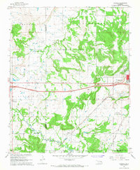 1967 Pharoah1968 Print · USGSThe Oklahoma oil fields west of Henryetta are captured here during the late sixties, showcasing a landscape defined by petroleum extraction and rail transport. Genealogists can trace family locations through numerous sites like West Lawn Cemetery, Arbeka Ch, and the settlement at Pharoah.2 unique versions available
 - 1970 Map of Council Hill, 1972 Print
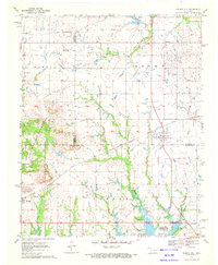 1970 Council Hill1972 Print · USGSCouncil Hill and Hitchita appear at the convergence of three Oklahoma counties in the early seventies, just as the regional landscape was being reshaped. Genealogists and researchers can trace family sites at the Council Hill Cem, Ridley Cem, and New Hope Ch while exploring the developing shoreline of the Eufaula Reservoir.2 unique versions available
 - 1970 Map of Morris, 1972 Print
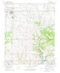 1970 Morris1972 Print · USGSEastern Oklahoma at the start of the 1970s reveals a landscape shaped by petroleum and rail. Genealogists and historians can trace family locations near Morris and Grayson, or locate historic sites like Indian Cem and the Grave Creek Ch.
 - 1971 Map of Okmulgee South, 1972 Print
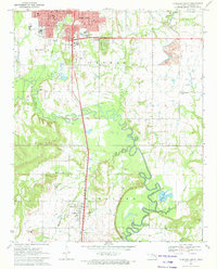 1971 Okmulgee South1972 Print · USGSOklahoma's Okmulgee County is captured here in the early seventies, showing a landscape defined by the Deep Fork bottomlands and active oil fields. Genealogists can trace the rural communities around Schulter, noting landmarks like Big Cussetah Ch and Pawhuska Cem.
 - 1971 Map of Spanish Peak, 1972 Print
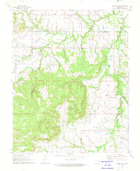 1971 Spanish Peak1972 Print · USGSThe Oklahoma borderlands of Tulsa and Okmulgee counties come alive in the early seventies, showing a landscape shaped by petroleum and ranching. Genealogists and local historians can trace the foundations of Hectorville, locate the Liberty Sch, and find family sites like the Bruner Cem.2 unique versions available
 - 1971 Map of Okmulgee NE, 1972 Print
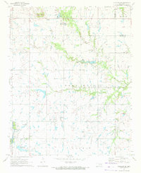 1971 Okmulgee NE1972 Print · USGSOkmulgee and Muskogee counties are captured here in the early seventies, showcasing a rural landscape shaped by petroleum and agriculture. Researchers can locate local landmarks like Pumpkin Center, Antioch Cem, and the Ashley Landing Strip.2 unique versions available
 - 1971 Map of Boynton, 1972 Print
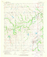 1971 Boynton1972 Print · USGSBoynton and the surrounding plains of Muskogee County appear here during the early 1970s, showing a landscape defined by ranching and petroleum. Trace family history through the locations of Boynton Cem, Charles Cem, and the tracks of the St Louis - San Francisco railroad.2 unique versions available
 - 1971 Map of Okmulgee North, 1973 Print
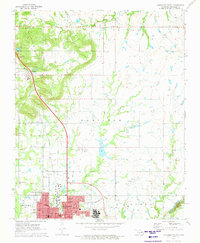 1971 Okmulgee North1973 Print · USGSOklahoma's petroleum and rail landscapes are on full display in the early seventies, centered on the growing hub of Okmulgee. Genealogists and historians can trace rural congregations at Natura Mission and Groveania Ch, or locate family sites near Jerusalem Cem.
 - 1971 Map of Concharty Mountain, 1973 Print
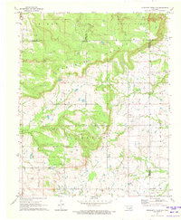 1971 Concharty Mountain1973 Print · USGSOklahoma's rugged coal and oil country comes into sharp focus during the early 1970s at the junction of four counties. Researchers can trace rural life and industry through landmarks like Bald Hill Cem, Twin Hills Sch, and the local Coal Mines.2 unique versions available
 - 1973 Map of Nuyaka, 1975 Print
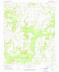 1973 Nuyaka1975 Print · USGSThe Creek County and Okmulgee County line in the early 1970s reveals a landscape of active oil production and small rural settlements. Researchers can locate Tuskegee Cem, the Old Railroad Grade, and the quiet crossroads of Nuyaka.
 - 1973 Map of Okfuskee, 1975 Print
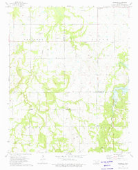 1973 Okfuskee1975 Print · USGSOklahoma's petroleum and mission history intersect in the 1970s at the boundary of Okfuskee and Okmulgee counties. Genealogists and historians can locate family landmarks like Nuyaka Mission Ch, the Okfuskee Cem, and early settlements such as Oriental.
Showing maps 1-25 of 34
Top cities of Okmulgee County
- Okmulgee historical maps
- Henryetta historical maps
- Beggs historical maps
- Morris historical maps
- Dewar historical maps
- Schulter historical maps
See more
Frequently asked questions
- What are the different types of historical maps available for Okmulgee County?
- What is the oldest map of Okmulgee County?
- Where can I purchase historical maps of Okmulgee County for my home or office?
- Where can I download high-res historical maps of Okmulgee County?
- Are there historical topographic maps available for Okmulgee County?
- Is there historical aerial imagery available for Okmulgee County?
- Where are historical maps of Okmulgee County sourced from?