1960s Maps of Osage County, Oklahoma
Explore 23 historic maps of Osage County from the 1960s. These maps offer a rare glimpse into what life looked like during the 1960s — showing old roads, neighborhoods, homes, and landmarks that have changed or disappeared over time.
Whether you're researching your family's past, planning a metal detecting trip, or studying how Osage County's landscape evolved across the 1960s, these high-resolution maps are a powerful tool for exploring the history of this region.
- Focus on a specific era: All maps on this page are from the 1960s, giving you a focused view of this time period.
- See what’s changed: Compare century-old streets, trails, and buildings to today's modern landscape using overlays and satellite layers.
- Research with precision: Use these maps for genealogy, historical research, land use analysis, or educational projects.
- View, download, or print: Maps are fully viewable online in high resolution, and can be downloaded or printed for your own records.
Start exploring Osage County's history through authentic maps from the 1960s. This is your window into the past.
Osage County, OK maps
(23)- 1960 Map of Nanos, 1961 Print
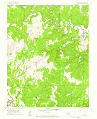
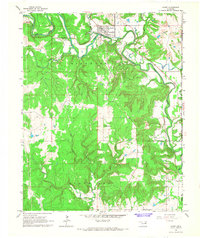
 1960 Nanos1961 Print · USGSOsage County in the early sixties is shown here as a landscape of rural industry and rail transport. Genealogists and historians can locate the Pappin Cem and trace the paths of Wild Hog Creek or the Atchison Topeka and Santa Fe line.2 unique versions available
 - 1960 Map of Nelagoney, 1961 Print
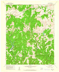
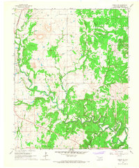
 1960 Nelagoney1961 Print · USGSThe Osage Hills at the start of the sixties were a landscape defined by petroleum production and quiet creek valleys. Local historians can trace the paths of the Missouri Kansas Texas railroad through Okesa and identify oil wells across Strike Axe.2 unique versions available
 - 1960 Map of Herd, 1961 Print
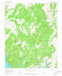
 1960 Herd1961 Print · USGSOsage County's industrial and recreational landscape is captured here in the early sixties as petroleum extraction and state park development shaped the hills. Genealogists and historians can trace the Atchison Topeka and Santa Fe rail line through Herd and Bigheart, and locate rural landmarks like Twin Mounds or the old Cem.4 unique versions available
 - 1960 Map of Pawhuska, 1961 Print
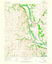
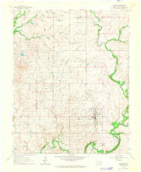
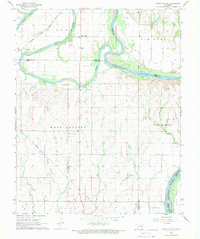
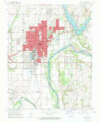
 1960 Pawhuska1961 Print · USGSThe Osage County seat comes alive in the early sixties, showing a community built on a foundation of oil and ranching. Genealogists and historians can trace rail lines like the Midland Valley or locate local landmarks including Indian Camp Sch and Lookout Cem.3 unique versions available
 - 1963 Map of Charley Creek, 1964 Print
 1963 Charley Creek1964 Print · USGSThe Arkansas River defines the border of Kay and Osage counties in the early 1960s, a landscape shaped by petroleum and rural community life. Researchers can trace family roots at Longwood Ch, Braden Sch, and the Big Bend Oil Field.4 unique versions available
 - 1963 Map of Avant SE, 1964 Print
 1963 Avant SE1964 Print · USGSOsage and Tulsa counties meet here in the early sixties, as the oil industry and railroads shaped the local landscape. Genealogists can trace family footprints at Captain Cem, Delaware Ch, and the outlying Osage Gardens development.4 unique versions available
 - 1963 Map of Uncas, 1965 Print
 1963 Uncas1965 Print · USGSThe Arkansas River valley in Kay County shows a landscape of rail-served settlements and early energy production in the early sixties. Trace the path of the Atchison Topeka and Santa Fe through Uncas and locate historical Oil Wells and the Oak Grove Cem.2 unique versions available
 - 1964 Map of Charley Creek NE
 1964 Charley Creek NE1964 Print · USGSOsage County's landscape in the 1960s was defined by the oil industry and the winding Arkansas River. Researchers can trace the rail-and-river economy through the settlement of Apperson and the many Oil Wells dotting the Big Hill region.2 unique versions available
 - 1964 Map of Kaw City, 1965 Print
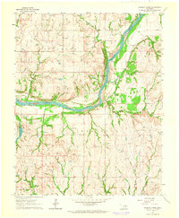
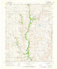
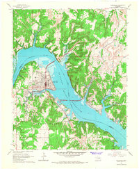
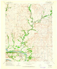 1964 Kaw City1965 Print · USGSKaw City and the Arkansas River valley are shown here in the mid-sixties, just before the landscape was transformed by reservoir construction. Genealogists and local historians can trace the original townsite of Kaw City, the community of Washunga, and the Washunga Cem before their relocation.4 unique versions available
 - 1964 Map of Barnsdall, 1965 Print
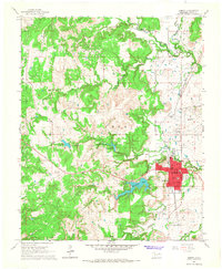
 1964 Barnsdall1965 Print · USGSOsage County's petroleum landscape is captured here in the mid-1960s, centered on the oil-producing hub of Barnsdall. Researchers can trace the legacy of the regional oil boom through the Pershing Oil Field, Tallant tank farm, and local family sites like Javine Cem.2 unique versions available
 - 1964 Map of Shidler, 1965 Print
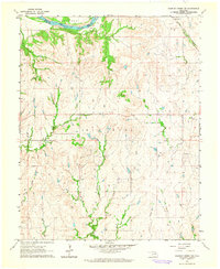
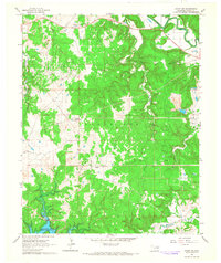
 1964 Shidler1965 Print · USGSOsage County's ranching and oil landscapes are captured here in the mid-sixties, centered on the town of Shidler. Researchers can trace the layout of Webb City, identify an early Landing Field, and locate the winding paths of Salt Creek and Beaver Creek.2 unique versions available
 - 1964 Map of Hardy, 1965 Print
 1964 Hardy1965 Print · USGSNorthern Oklahoma and the Kansas borderlands appear in the mid-sixties as a landscape of rural creek valleys and reservation boundaries. Researchers can trace the Midland Valley terrain and locate local landmarks like the Hardy settlement and the Radio Tower.2 unique versions available
 - 1964 Map of Wynona, 1965 Print
 1964 Wynona1965 Print · USGSOsage County's petroleum landscape is captured here in the mid-1960s, centered on the rail-aligned town of Wynona. Trace the extensive Wynona Oil Field and find historic sites like Pershing and St Josephs Cem along the railroad.2 unique versions available
 - 1964 Map of Grainola, 1966 Print
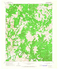
 1964 Grainola1966 Print · USGSOsage County territory during the mid-sixties reveals a landscape defined by ranching and early petroleum development within the Foraker Indian Reservation. Trace the legacy of small settlements like Grainola and Frankfort alongside the Frankfort Oil Field.2 unique versions available
 - 1966 Map of Cleveland, 1967 Print
 1966 Cleveland1967 Print · USGSCleveland and the Arkansas River valley are seen here in the mid-sixties as the newly formed reservoir reshaped the Pawnee County landscape. Researchers can locate family sites at Woodland Cemetery and Dixie Cem, or trace the rail corridor of the Missouri Kansas Texas.2 unique versions available
 - 1966 Map of Avant NW, 1967 Print
 1966 Avant NW1967 Print · USGSOsage County in the mid-1960s was defined by its oil heritage and the winding creek valleys of the Oklahoma interior. Researchers can trace the dense network of Oil Wells across the West Avant Oil Field and the path of the Midland Valley rail line.2 unique versions available
 - 1966 Map of Hominy, 1967 Print
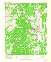
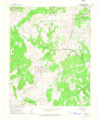
 1966 Hominy1967 Print · USGSIn mid-century Osage County, the town of Hominy and the nearby Indian Village sit at the intersection of a rail-driven economy and burgeoning oil production. Genealogists and historians can trace the locations of the Hominy Cemetery, Mound Valley Sch, and the extensive Hominy Oil Field.2 unique versions available
 - 1966 Map of Avant SW, 1967 Print
 1966 Avant SW1967 Print · USGSOsage County's oil economy and changing shoreline are visible in this mid-sixties survey of the Oklahoma hill country. Researchers can trace the extent of the Wildhorse Oil Field or locate rural landmarks like Morgans Corner and Arrowhead Ranch.3 unique versions available
 - 1966 Map of Avant, 1967 Print
 1966 Avant1967 Print · USGSOsage County is captured in the mid-1960s as a landscape of river-valley settlements and active industrial fields. Researchers can trace the Midland Valley rail route through Avant and locate family sites at Avant Cem or Lombard Cem.4 unique versions available
 - 1966 Map of Hominy NE, 1967 Print
 1966 Hominy NE1967 Print · USGSOsage County's petroleum landscape is captured here in the mid-1960s, showing a territory defined by oil production and winding waterways. Researchers can trace the Missouri - Kansas - Texas RR and locate sites like the Cem near the Sunset Oil Field.2 unique versions available
 - 1966 Map of New Prue, 1967 Print
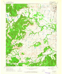
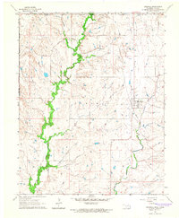
 1966 New Prue1967 Print · USGSOsage County was undergoing a major geographic shift in the mid-sixties as the newly formed Keystone Reservoir altered the valley floor. Genealogists and historians can trace the early layout of New Prue and find industrial footprints in the Osage City Oil Field or near Wildhorse.3 unique versions available
 - 1968 Map of Ponca City SE, 1969 Print
 1968 Ponca City SE1969 Print · USGSThe confluence of the Salt Fork and Arkansas rivers defines this part of Noble County in the late sixties. Researchers can trace the Atchison Topeka and Santa Fe rail line and locate old community hubs like White Eagle and West Bressie.
 - 1968 Map of Ponca City, 1970 Print
 1968 Ponca City1970 Print · USGSPonca City and the surrounding Kay County prairies are captured here in the late sixties, highlighting a landscape shaped by petroleum and the Arkansas River. Researchers can locate family sites at St Marys Cem, trace the Atchison Topeka and Santa Fe rail lines, or find the White Eagle Station.2 unique versions available
End of results
Showing maps 1-23 of 23
Top cities of Osage County
- Pawhuska historical maps
- Hominy historical maps
- Fairfax historical maps
- Barnsdall historical maps
- Wynona historical maps
- Shidler historical maps
See more
Frequently asked questions
- What are the different types of historical maps available for Osage County?
- What is the oldest map of Osage County?
- Where can I purchase historical maps of Osage County for my home or office?
- Where can I download high-res historical maps of Osage County?
- Are there historical topographic maps available for Osage County?
- Is there historical aerial imagery available for Osage County?
- Where are historical maps of Osage County sourced from?