2020s Maps of Pushmataha County, Oklahoma
Explore 35 historic maps of Pushmataha County from the 2020s. These maps offer a rare glimpse into what life looked like during the 2020s — showing old roads, neighborhoods, homes, and landmarks that have changed or disappeared over time.
Whether you're researching your family's past, planning a metal detecting trip, or studying how Pushmataha County's landscape evolved across the 2020s, these high-resolution maps are a powerful tool for exploring the history of this region.
- Focus on a specific era: All maps on this page are from the 2020s, giving you a focused view of this time period.
- See what’s changed: Compare century-old streets, trails, and buildings to today's modern landscape using overlays and satellite layers.
- Research with precision: Use these maps for genealogy, historical research, land use analysis, or educational projects.
- View, download, or print: Maps are fully viewable online in high resolution, and can be downloaded or printed for your own records.
Start exploring Pushmataha County's history through authentic maps from the 2020s. This is your window into the past.
Pushmataha County, OK maps
(35)- 2022 Map of Whitesboro, 2022 Print
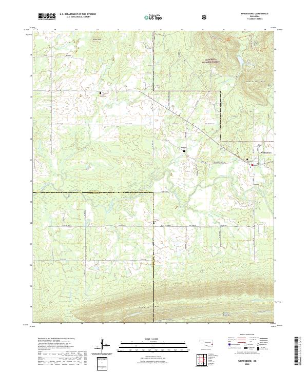 2022 Whitesboro2022 Print · USGSLe Flore and Pushmataha Counties are shown here at the edge of the Kiamichi Mountains in the early 2020s. Genealogists and hikers can trace the Choctaw Nation Trl and locate several burial grounds including Whitesboro Cem and Bohannon Cem.
 - 2022 Map of Lane NE, 2022 Print
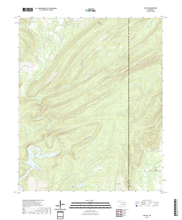 2022 Lane NE2022 Print · USGSThe Atoka and Pushmataha county line in southeastern Oklahoma is captured here in the early twenty-first century. Researchers can trace the rugged drainage of McGee Creek through Bugaboo Canyon and locate family-named landmarks like Leyba Ranch Rd.
 - 2022 Map of Daisy, 2022 Print
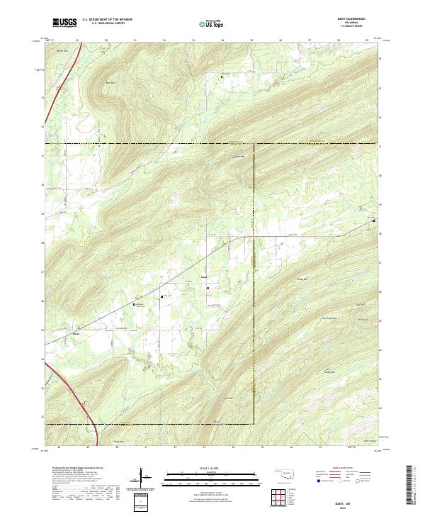 2022 Daisy2022 Print · USGSSoutheastern Oklahoma’s ridge-and-valley landscape is documented here in the early twenty-first century as the Kiamichi foothills remained sparsely settled. Genealogists and hikers can trace remote landmarks like Mountain Home Cem, Rock Town, and the rural community of Daisy.
 - 2022 Map of Signal Mountain, 2022 Print
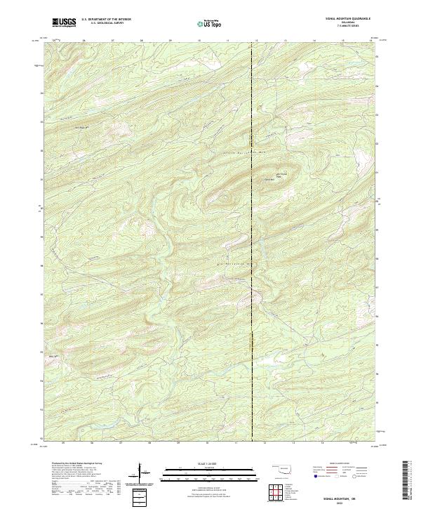 2022 Signal Mountain2022 Print · USGSThe high ridges of Pushmataha County are captured here in the early twenty-first century, showing a remote landscape of summits and creek drainages. Trace old backcountry routes like Billy Bell Trl and family-named landmarks such as John Noah Mtn.
 - 2022 Map of Adel, 2022 Print
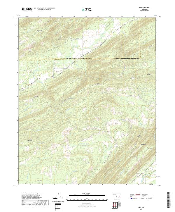 2022 Adel2022 Print · USGSThe mountains of Pushmataha County are captured here in the early 2020s, showing the high ridges and watercourses around Adel. Researchers can trace old routes like Rock Town Rd and landmarks such as Johns Valley and Wild Horse Gap.
 - 2022 Map of Caney Mountain, 2022 Print
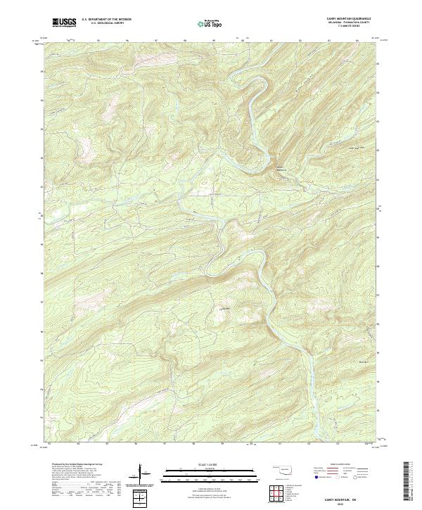 2022 Caney Mountain2022 Print · USGSPushmataha County in the early twenty-first century is defined by its mountains and river valleys. Outdoor enthusiasts and local historians can trace the paths of Harry Rowe Trl and Bear Canyon Rd near Caney Mtn and Iron Springs.
 - 2022 Map of Albion SW, 2022 Print
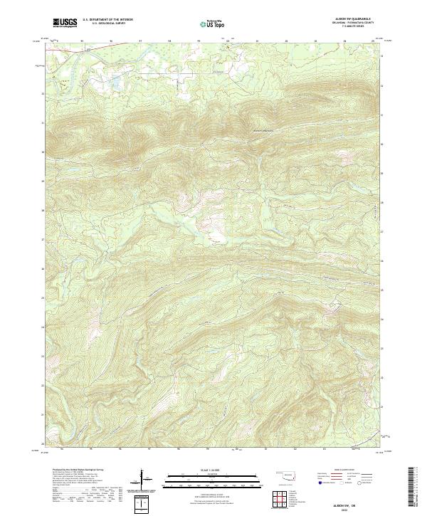 2022 Albion SW2022 Print · USGSPushmataha County is shown here in the early twenty-first century, centered on the high ridges and deep drainages of the Kiamichi Mountains. Researchers can trace the path of the Kiamichi River and follow the remote Black Fork Trl across the rugged interior.
 - 2022 Map of Albion SE, 2022 Print
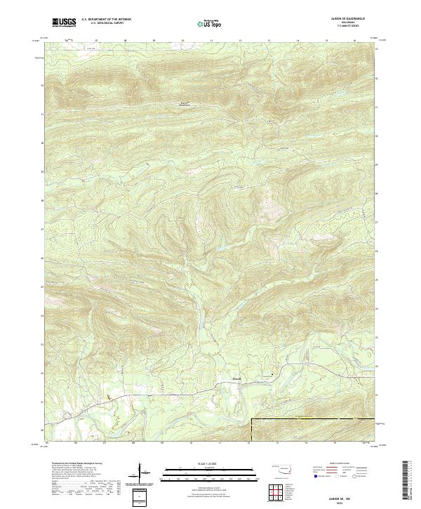 2022 Albion SE2022 Print · USGSPushmataha County is shown in the early 2020s as a landscape of steep mountain ridges and remote valley trails. Researchers can trace family sites near Fewell, the Fewell Cem, and historic mountain routes like the K Trl and Ferguson Trl.
 - 2022 Map of Finley, 2022 Print
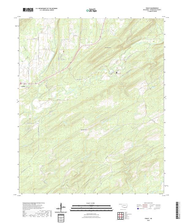 2022 Finley2022 Print · USGSFinley and the surrounding Pushmataha County hills are captured here in the early twenty-first century. Genealogists and local historians can trace family sites near One Creek Cem, Medicine Springs, and along the old Rattan Trl.
 - 2022 Map of Redden, 2022 Print
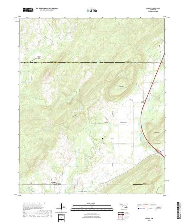 2022 Redden2022 Print · USGSAtoka County's northern hills are documented here in the early twenty-first century, showing the rural settlement of Redden and the surrounding mountain ridges. Local history researchers can locate several family-named landmarks and burial sites, including Redden Cem, Baker Cem, and Hewitt Mtn.
 - 2022 Map of Spencerville, 2022 Print
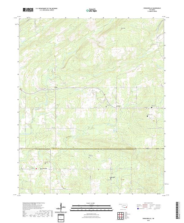 2022 Spencerville2022 Print · USGSPushmataha County is documented here in the early twenty-first century, showing the rural homesteads and creek-cut valleys south of the Kiamichi Mountains. Genealogists can locate several remote burial grounds, including Black Jack Indian Cem, Goodwater Cem, and Corinne Cem.
 - 2022 Map of Wildhorse Mountain, 2022 Print
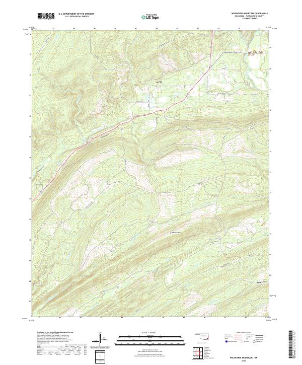 2022 Wildhorse Mountain2022 Print · USGSPushmataha County's rugged ridge-and-valley landscape is mapped here in the early twenty-first century, showing a complex network of creeks and high-altitude trails. You can trace the path of the Rattan Trl as it skirts the base of Wildhorse Mtn and identify local water sources like Sulphur Spring.
 - 2022 Map of Darwin, 2022 Print
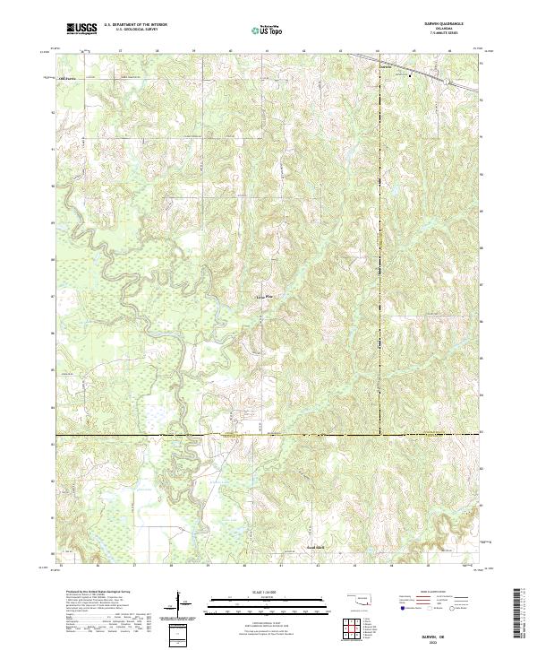 2022 Darwin2022 Print · USGSSoutheastern Oklahoma’s creek-bottom lands are captured here in the early twenty-first century, centered on the intersection of Atoka and Pushmataha counties. Genealogists can locate the Darwin Cem and trace the winding course of Muddy Boggy Creek through local settlements like Old Farris and Lone Pine.
 - 2022 Map of Albion, 2022 Print
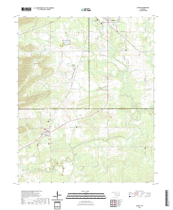 2022 Albion2022 Print · USGSThe Kiamichi River valley and the distinctive Potato Hills region come alive in this recent survey of eastern Oklahoma. Genealogists and historians can trace local family lineages through numerous sites like Armstrong Cem, Albion Cem, and the historic Old Talihina Cem.
 - 2022 Map of Counts, 2022 Print
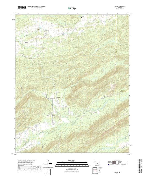 2022 Counts2022 Print · USGSSoutheast Oklahoma’s rugged ridge-and-valley landscape is documented here in the early twenty-first century. Genealogists can trace family histories through numerous remote sites like Sardis Indian Baptist Church Cem, Counts, and Smith Cem.
 - 2022 Map of Snow, 2022 Print
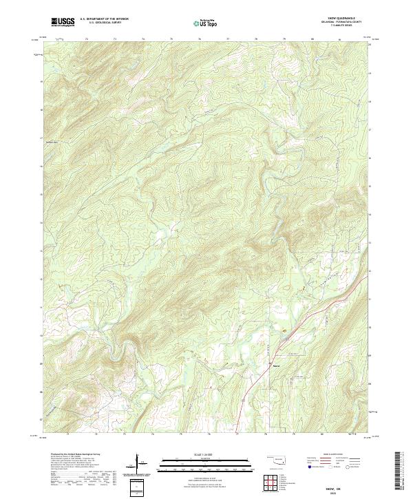 2022 Snow2022 Print · USGSThe rural settlement of Snow and its surrounding mountain valleys are captured here in the early 2020s. Genealogists and local historians can trace the paths of Joslin Valley Rd and family-named landmarks like Dunbar Mtn and Tucker Hollow.
 - 2022 Map of Antlers West, 2022 Print
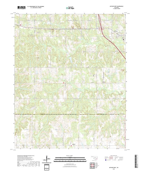 2022 Antlers West2022 Print · USGSPushmataha County's timber and ranch lands are mapped here in the modern era, centered on the western expansion of the county seat. Genealogists and local historians can trace family sites near Antlers City Cem, Hall Cem, and the southern settlement of Nelson.
 - 2022 Map of Kiamichi, 2022 Print
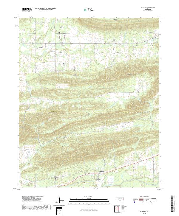 2022 Kiamichi2022 Print · USGSThe Kiamichi River valley and Potato Hills are shown in this recent survey of Pushmataha County. Genealogists can trace local roots at Kiamichi Pioneer Cem, Laura Cem, and the settlement of Kiamichi along the river banks.
 - 2022 Map of Clebit, 2022 Print
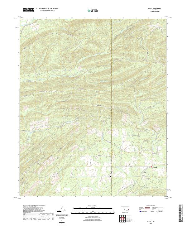 2022 Clebit2022 Print · USGSPushmataha and McCurtain counties are shown here in the early 2020s, dominated by dense timberlands and winding creek valleys. Researchers can trace rural routes like Watson Creek Rd and locate local landmarks such as Pickens, Clebit, and the Countyline Cem.
 - 2022 Map of Cloudy, 2022 Print
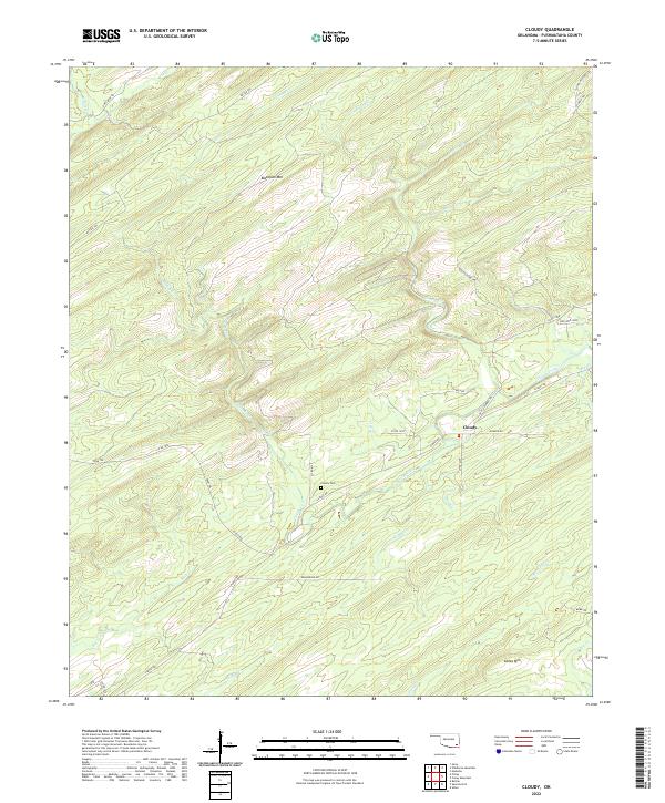 2022 Cloudy2022 Print · USGSThe rural settlement of Cloudy is documented here in its contemporary landscape of timbered ridges and creek valleys. Researchers can locate the Cloudy Cem and trace historic routes like the Tram Trl and Cloudy-Nashora Trl.
 - 2022 Map of Stanley, 2022 Print
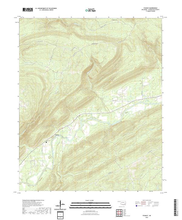 2022 Stanley2022 Print · USGSPushmataha County in the modern era maintains its quiet, valley-centered character along the winding Kiamichi River. Genealogists and hikers can trace the geography around Stanley, locating the Stanley Cem and landmarks like Umbrella Rock.
 - 2022 Map of Rattan, 2022 Print
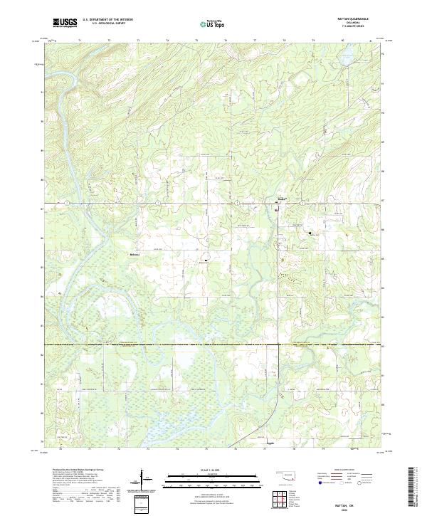 2022 Rattan2022 Print · USGSThe Kiamichi River valley in Pushmataha County remains a landscape of quiet rural settlements and winding timber trails. Genealogists can trace family names at the Belzoni Cem and Rattan Cem or locate the site of Apple near the Choctaw County line.
 - 2022 Map of Farris, 2022 Print
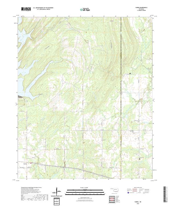 2022 Farris2022 Print · USGSThe community of Farris and the hills along the Atoka-Pushmataha county line are mapped here in the early twenty-first century. Researchers can trace rural lineages at Zoraya Cem and Sugarloaf Cem or follow the paths of Cold Springs Cr and Simpson Valley.
 - 2022 Map of Sobol, 2022 Print
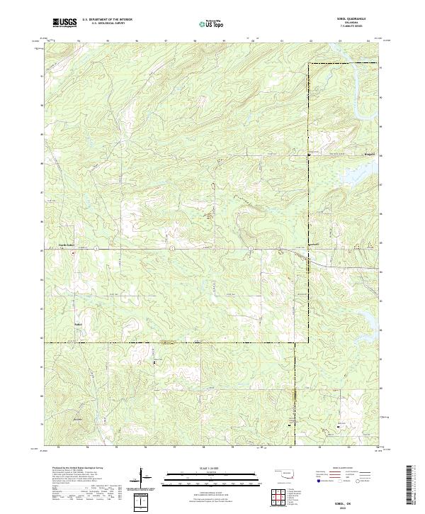 2022 Sobol2022 Print · USGSSoutheast Oklahoma's rural landscape is captured here in the early twenty-first century at the intersection of three counties. Genealogists and local historians can locate several family burial grounds including Sobol Cem and Ringold Cem, along with the small settlement of Burwell.
 - 2022 Map of Kosoma, 2022 Print
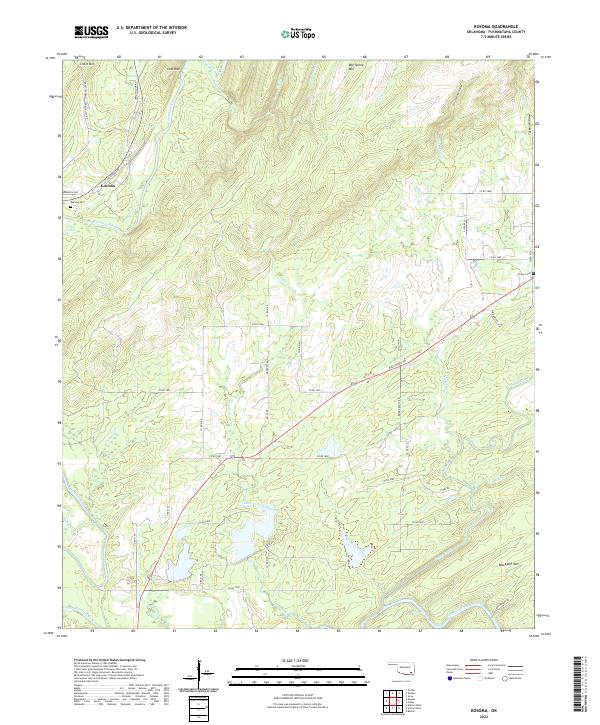 2022 Kosoma2022 Print · USGSPushmataha County is documented here in the early twenty-first century, showing the rural homesteads and mountain terrain of the Ouachita foothills. Genealogists and local historians can trace family sites near Kosoma, Kosoma Cem, and Finley Cem.
Showing maps 1-25 of 35
Top cities of Pushmataha County
Frequently asked questions
- What are the different types of historical maps available for Pushmataha County?
- What is the oldest map of Pushmataha County?
- Where can I purchase historical maps of Pushmataha County for my home or office?
- Where can I download high-res historical maps of Pushmataha County?
- Are there historical topographic maps available for Pushmataha County?
- Is there historical aerial imagery available for Pushmataha County?
- Where are historical maps of Pushmataha County sourced from?