2022 Map of Whitesboro
USGS Topo · Published 2022About this map
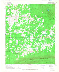
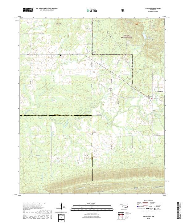
Whitesboro and the smaller settlement of Bohannon anchor this modern survey of the Oklahoma highlands near the Le Flore and Pushmataha county line. The landscape is defined by the high elevations of the Kiamichi Mountains, specifically the prominent Kiamichi Mountain Ridge and Tombstone Mtn which dominate the southern half of the quadrangle. This area serves as a significant intersection of recreational and natural resources, featuring a section of the Ouachita National Forest and the historical Choctaw Nation Trl. Waterways such as the Kiamichi River and Bohannon Cr carve through the terrain, while local genealogy is preserved at sites like Whitesboro Cem, Prairie Grove Cem, and County Line Cem. The road network, including White Wood Rd and Horse Heaven Ranch Rd, reflects the rural, ranch-oriented character of the region.
Find a feature on this map
59 named features on this map. Tap any name to fly to it.
Don’t see what you’re looking for? This feature index may not catch every label — zoom into the map to look around manually.
Map Details
Editions of this 2022 Whitesboro Map
This is the sole edition of this map. No revisions or reprints were ever made.
Historical Maps of Whitesboro Through Time
6 maps found