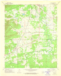
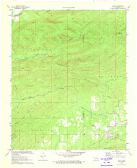
1970s Maps of Pushmataha County, Oklahoma
Explore 22 historic maps of Pushmataha County from the 1970s. These maps offer a rare glimpse into what life looked like during the 1970s — showing old roads, neighborhoods, homes, and landmarks that have changed or disappeared over time.
Whether you're researching your family's past, planning a metal detecting trip, or studying how Pushmataha County's landscape evolved across the 1970s, these high-resolution maps are a powerful tool for exploring the history of this region.
- Focus on a specific era: All maps on this page are from the 1970s, giving you a focused view of this time period.
- See what’s changed: Compare century-old streets, trails, and buildings to today's modern landscape using overlays and satellite layers.
- Research with precision: Use these maps for genealogy, historical research, land use analysis, or educational projects.
- View, download, or print: Maps are fully viewable online in high resolution, and can be downloaded or printed for your own records.
Start exploring Pushmataha County's history through authentic maps from the 1970s. This is your window into the past.
Pushmataha County, OK maps
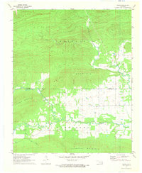
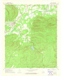
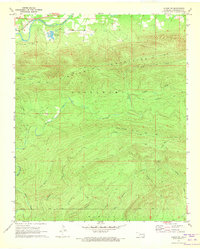
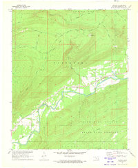
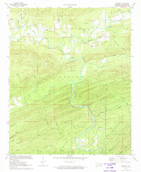
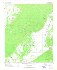
(22)- 1971 Map of Yanush, 1973 Print
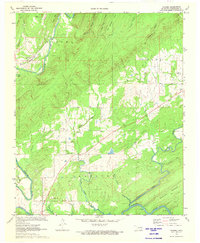
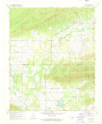 1971 Yanush1973 Print · USGSSoutheastern Oklahoma’s Choctaw country is documented here in the early 1970s, focused on the rural community of Yanush and the surrounding creek valleys. Genealogists and historians can locate the Old Choctaw Indian Council House and several family-named burial sites like Hokit Cem and King Cem.2 unique versions available
 - 1971 Map of Albion SE, 1973 Print
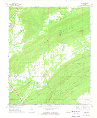
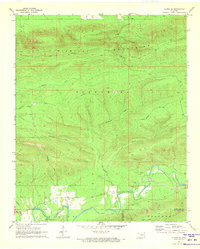 1971 Albion SE1973 Print · USGSPushmataha County was a landscape of remote mountain trails and river bottomlands in the early 1970s. Researchers can trace family sites near Fewell, locate the Fewell Cem, and follow the old Wildhorse Trail through the Kiamichi Mountains.
 - 1971 Map of Kiamichi, 1973 Print
 1971 Kiamichi1973 Print · USGSThe Kiamichi River valley and Potato Hills are documented here in the early 1970s, showing a landscape shaped by rail and river. Researchers can locate family landmarks like Cole Spur Cem, Buffalo Valley Sch, and the St Louis-San Francisco railroad line.
 - 1971 Map of Spencerville, 1973 Print
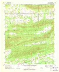
 1971 Spencerville1973 Print · USGSSoutheast Oklahoma in the early seventies shows a landscape of timbered ridges and quiet creek valleys along the Choctaw and Pushmataha county line. Genealogists and local historians can locate rural landmarks like Spencerville Ch, Oleta, and Blackjack Ch.
 - 1971 Map of Sardis, 1973 Print
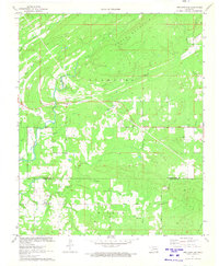
 1971 Sardis1973 Print · USGSThe rugged terrain of Pushmataha and Latimer counties comes into focus in the early seventies, showing a land of ridge-top summits and winding valleys. Trace family landmarks like Borden Cem and Mission Ch near the banks of Jackfork Creek.2 unique versions available
 - 1971 Map of Clayton, 1973 Print
 1971 Clayton1973 Print · USGSPushmataha County in the early seventies is a landscape of mountain ridges and river valleys centered on the St Louis - San Francisco rail line. Genealogists and hikers can trace the Alexander Trail, locate the local Cem, or explore the grounds of Minnetonka Camp.
 - 1971 Map of Albion SW, 1973 Print
 1971 Albion SW1973 Print · USGSPushmataha County is captured here in the early seventies, showing the concentrated activity of the Kiamichi River valley. Genealogists and historians can trace the St Louis-San Francisco rail line and locate high-elevation landmarks like Cripple Mountain and the Clayton Trail.
 - 1971 Map of Rattan, 1973 Print
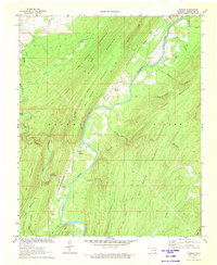
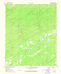
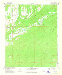
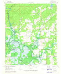 1971 Rattan1973 Print · USGSThe Kiamichi River valley was undergoing a major transformation in the early seventies as the waters of Hugo Lake began to rise. Genealogists and local historians can trace family locations near Belzoni, Apple, and the Rattan Cem before the reservoir altered the terrain.2 unique versions available
 - 1971 Map of Stanley, 1973 Print
 1971 Stanley1973 Print · USGSPushmataha County in the early seventies centers on the riverside settlement of Stanley, where the St Louis San Francisco railroad tracks trace the water. Genealogists and hikers can locate the Stanley Cem, the Flagpole Lookout Tower, and old routes like Walters Mule Road.
 - 1971 Map of Albion, 1973 Print
 1971 Albion1973 Print · USGSSoutheast Oklahoma in the early 1970s reveals a landscape of deep valleys and winding waterways where the railroad still shaped local life. Genealogists can trace family names through rural landmarks like Armstrong Cem, Myers Cem, and the Evangelistic Tabernacle.2 unique versions available
 - 1972 Map of Clebit, 1973 Print
 1972 Clebit1973 Print · USGSIn the Ouachita foothills during the early 1970s, this area shows the intersection of timber-country trails and industrial expansion. Genealogists and researchers can locate the Countyline Cem, trace the Industrial Railroad, and follow the Nolia Trail.
 - 1972 Map of Dunbar, 1973 Print
 1972 Dunbar1973 Print · USGSPushmataha County in the early seventies reveals a landscape dominated by the winding Kiamichi River and the high ridges of the Ouachitas. Genealogists and historians can locate old rail stops like Wadena and Dunbar, or find the secluded Reynolds Cem.
 - 1972 Map of Kosoma, 1973 Print
 1972 Kosoma1973 Print · USGSPushmataha County in the early seventies shows a landscape shaped by the winding Kiamichi River and the timber-rich ridges of the Ouachitas. Researchers can trace the rail corridor of the St Louis San Francisco and locate local landmarks like Old Cedar Ch and Finley Cem.2 unique versions available
 - 1972 Map of Cloudy, 1973 Print
 1972 Cloudy1973 Print · USGSPushmataha County is captured here in the early 1970s, showing a rugged timber landscape shaped by mountain ridges and winding creek beds. Genealogists and historians can trace the Mc Farland Tram, the Cloudy Cem, and the old Harris Trail.
 - 1972 Map of Snow, 1973 Print
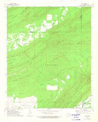
 1972 Snow1973 Print · USGSSoutheastern Oklahoma in the early seventies remained a landscape of deep timber and quiet valley settlements. Genealogists and hunters can trace the geography of the Pushmataha County State Game Refuge and old family-named sites like Tucker Hollow or Snow.
 - 1972 Map of Wildhorse Mountain, 1973 Print
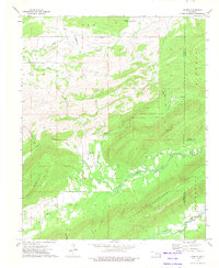
 1972 Wildhorse Mountain1973 Print · USGSPushmataha County in the early seventies is a landscape of high ridges and isolated mountain hollows. Researchers can locate the Divide Ch, the heights of Wildhorse Mountain, and the remote Pushmataha County State Game Refuge.
 - 1972 Map of Nashoba, 1973 Print
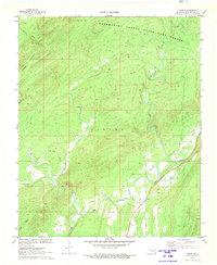
 1972 Nashoba1973 Print · USGSThe rural Kiamichi Mountains are captured here in the early seventies, centered on the settlements of Nashoba and Nolia. Researchers can locate family sites at Black Fork Cem or trace the early industrial landscape through several Shale Pits and the local Fish Farm.2 unique versions available
 - 1972 Map of Finley, 1973 Print
 1972 Finley1973 Print · USGSPushmataha County is documented here in the early seventies, centered on the small community of Finley. Researchers can trace old routes like the Gunsmoke Trail or locate the One Creek Cem and Medicine Springs.
 - 1973 Map of Adel, 1975 Print
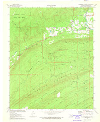
 1973 Adel1975 Print · USGSSoutheast Oklahoma in the early 1970s is shown here as a landscape of heavy ridges and timbered valleys. Researchers can trace the St Louis San Francisco rail line through Finley or locate small settlements like Adel and Peveyhouse.
 - 1973 Map of Counts, 1975 Print
 1973 Counts1975 Print · USGSSoutheast Oklahoma at the start of the 1970s shows a landscape of tucked-away valleys and family-named cemeteries. Genealogists can trace local lineages through Burris Cem, Nace Cem, and the settlement at Counts.2 unique versions available
 - 1973 Map of Redden, 1975 Print
 1973 Redden1975 Print · USGSThe Oklahoma hill country comes into focus in the early seventies as the toll road begins to modernize the landscape. Genealogists and local historians can trace family sites at Hewitt Cem and Baker Cem, or locate the rural crossroads of Redden.2 unique versions available
 - 1973 Map of Daisy, 1975 Print
 1973 Daisy1975 Print · USGSSoutheastern Oklahoma’s ridgelines and valleys are captured here in the early 1970s, showing the intersection of three counties. Researchers can locate remote burial sites like Mountain Home Cem and Bond Cem or trace the early path of the Indian Nation Toll Road.2 unique versions available
End of results
Showing maps 1-22 of 22
Top cities of Pushmataha County
Frequently asked questions
- What are the different types of historical maps available for Pushmataha County?
- What is the oldest map of Pushmataha County?
- Where can I purchase historical maps of Pushmataha County for my home or office?
- Where can I download high-res historical maps of Pushmataha County?
- Are there historical topographic maps available for Pushmataha County?
- Is there historical aerial imagery available for Pushmataha County?
- Where are historical maps of Pushmataha County sourced from?