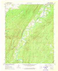
1972 Map of Dunbar
USGS Topo · Published 1973About this map
The Kiamichi River carves a deep path through the Ouachita Mountains in this early 1970s survey of Pushmataha County. The corridor of the St Louis-San Francisco railroad dictates the settlement pattern, connecting the small communities of Dunbar and Wadena along the riverbanks. The landscape is defined by massive ridges, including Wildcat Mountain and Box Mountain, which rise sharply above the river valley.
Find a feature on this map
42 named features on this map. Tap any name to fly to it.
Don’t see what you’re looking for? This feature index may not catch every label — zoom into the map to look around manually.
Map Details
Editions of this 1972 Dunbar Map
This is the sole edition of this map. No revisions or reprints were ever made.
Other maps of this area

1898 · McAlester
USGS Topo · 1:125,000

1901 · Antlers
USGS Topo · 1:125,000

1901 · Tuskahoma
USGS Topo · 1:125,000

1901 · Alikchi
USGS Topo · 1:125,000

1908 · Tuskahoma
USGS Topo · 1:125,000

1909 · Mc Alester
USGS Topo · 1:125,000

1909 · Tuskahoma
USGS Topo · 1:125,000

1912 · Antlers
USGS Topo · 1:125,000

1925 · Antlers
USGS Topo · 1:125,000

1950 · Mcalester
USGS Topo · 1:250,000