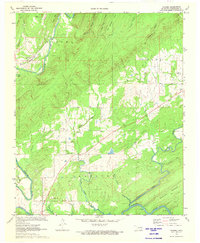
1972 Map of Kosoma
USGS Topo · Published 1973About this map
The Kiamichi River winds through this section of Pushmataha County, carving a valley between the high ridges of Kosoma and Blackjack Mountain. In the early 1970s, the landscape here was defined by the intersection of the St Louis San Francisco railroad and rural settlements like Kosoma and Finley. The area shows a transition toward more managed water resources, as notes from the margin indicate certain low-lying areas were subject to inundation by the Hugo Dam project during this era.
Find a feature on this map
32 named features on this map. Tap any name to fly to it.
Don’t see what you’re looking for? This feature index may not catch every label — zoom into the map to look around manually.
Map Details
Editions of this 1972 Kosoma Map
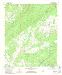
2 editions found
Other maps of this area

1901 · Antlers
USGS Topo · 1:125,000

1901 · Alikchi
USGS Topo · 1:125,000

1912 · Antlers
USGS Topo · 1:125,000

1925 · Antlers
USGS Topo · 1:125,000

1950 · Mcalester
USGS Topo · 1:250,000

1957 · Moyers
USGS Topo · 1:24,000

1957 · Jumbo
USGS Topo · 1:24,000

1961 · Antlers East
USGS Topo · 1:24,000

1961 · Antlers West
USGS Topo · 1:24,000

1962 · McAlester
USGS Topo · 1:250,000