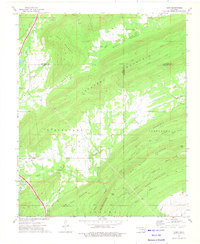
1973 Map of Daisy
USGS Topo · Published 1975About this map
Jackfork Mountain and Bald Mountain dominate this landscape at the junction of Pittsburg, Atoka, and Pushmataha counties. The settlement of Daisy serves as a focal point in the southwestern quadrant, connected by the Indian Nation Toll Road which cuts through Mc Gee Valley and Stringtown. The geography is defined by a series of high ridges and narrow valleys, such as Burris Valley, which are drained by numerous waterways including Buck Creek, Mud Creek, and Fobb Creek. Genealogists will find several burial sites recorded here, including Mountain Home Cem, Vivian Cem, Billy Cem, and Bond Cem. Local industry and land use are indicated by the presence of a Landing Strip, pipelines, and Drill Holes scattered among the peaks of Turkey Mountain and Tuskahoma Mountain.
Find a feature on this map
45 named features on this map. Tap any name to fly to it.
Don’t see what you’re looking for? This feature index may not catch every label — zoom into the map to look around manually.
Map Details
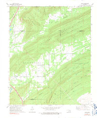
Editions of this 1973 Daisy Map
2 editions found
Other maps of this area

1898 · McAlester
USGS Topo · 1:125,000

1901 · Antlers
USGS Topo · 1:125,000

1909 · Mc Alester
USGS Topo · 1:125,000

1912 · Antlers
USGS Topo · 1:125,000

1925 · Antlers
USGS Topo · 1:125,000

1950 · Mcalester
USGS Topo · 1:250,000

1957 · Jumbo
USGS Topo · 1:24,000

1957 · Lane NE
USGS Topo · 1:24,000

1962 · McAlester
USGS Topo · 1:250,000

1965 · McAlester
USGS Topo · 1:250,000