Old Maps of Sherman County, Oregon
Explore 174 old maps of Sherman County, spanning from 1916 to today. These high-resolution historic maps reveal how streets, neighborhoods, landmarks, and natural features evolved over time — perfect for genealogy, metal detecting, research, and local history exploration.
What you can do with these maps:
- See how Sherman County changed over time: Compare historical maps to modern-day views to trace roads, homesites, rail lines & more.
- View detailed metadata: Each map includes creators, publishers, year, scale, and archive source.
- Overlay maps with satellite & LiDAR: Visualize the past alongside modern tools to explore terrain & human change.
- Trusted historical sources: Maps sourced from the USGS, Library of Congress, and other archives.
- Access maps your way: View online, download high-res files, or order prints for personal or research use.
Start exploring old maps of Sherman County to uncover forgotten places, hidden landmarks, and the deep history beneath your feet.
Sherman County, OR maps
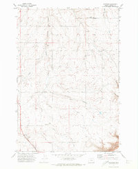
(174)- 1916 Map of Arlington
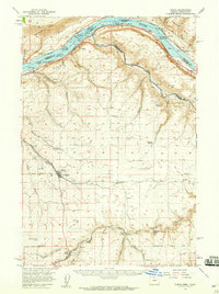
 1916 Arlington1916 Print · USGSThe Columbia River frontier of the mid-1910s reveals a world where the Oregon Trail and early railroads met the water. Genealogists can trace family roots through rural landmarks like Stegeman Ranch, Shutler, and the Locust Grove School.4 unique versions available
 - 1916 Map of Condon
 1916 Condon1916 Print · USGSNorth-central Oregon at the start of the twentieth century was a land of high plateaus and deep canyons centered on the Condon wheat country. Genealogists can trace a vast network of rural schoolhouses like Linville School and Buckhorn School, alongside early rail stops at Mikkalo and Gwendolen.3 unique versions available
 - 1930 Map of Dufur, 1945 Print
 1930 Dufur1945 Print · USGSWasco County at the start of the 1930s shows a transition from pioneer wagon routes to a rail-and-ranch economy. Genealogists can locate dozens of country schools like Ireland Sch and early infrastructure including the Barlow Road and the Great Southern Railroad.2 unique versions available
 - 1934 Map of Dufur
 1934 Dufur1934 Print · USGSWasco County during the mid-1930s reveals a landscape of high plateaus and river canyons shaped by pioneering roads and rail. Genealogists can trace family roots through a dense network of rural schoolhouses like Kelly Sch and Wolf Run Sch, or follow the path of the historic Barlow Road.2 unique versions available
 - 1953 Map of The Dalles, 1965 Print
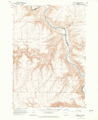
 1953 The Dalles1965 Print · USGSThe Columbia River Gorge at mid-century shows a region being transformed by massive hydroelectric dams and a growing highway network. Researchers can trace the development of The Dalles Dam, locate the Maryhill Museum, and find old rail stops in Rufus, Wishram, and Arlington.3 unique versions available
 - 1956 Map of The Dalles
 1956 The Dalles1956 Print · USGSThe Columbia River Gorge and the high Cascades are captured in the mid-1950s, showing a vital corridor of rail and road. Researchers can trace the original path of The Old Oregon Trail or locate historical landmarks like the Maryhill Museum and Mount Hood.
 - 1957 Map of The Dalles
 1957 The Dalles1957 Print · USGSThe Columbia River Gorge and the high plateaus of the mid-1950s come alive on this detailed survey of northern Oregon and southern Washington. Researchers can trace the path of the Oregon Trail and The Old Barlow Road alongside river towns like The Dalles and Wishram.
 - 1957 Map of Wasco, 1959 Print
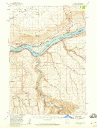
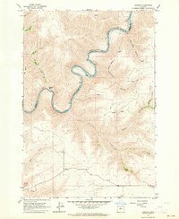
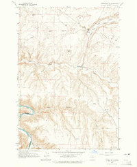
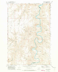
 1957 Wasco1959 Print · USGSSherman County and the Columbia River frontier are captured in the late fifties, showing the vital rail and water routes of the Inland Empire. Researchers can trace historic settlements from Wasco to Klondike and locate family landmarks like Sunrise Cemetery.2 unique versions available
 - 1957 Map of Wishram, 1959 Print
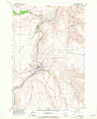
 1957 Wishram1959 Print · USGSThe Columbia Gorge in the late fifties was a powerhouse of rail transport and river management. Trace the junction of the S P & S and Union Pacific railroads near Wishram, and find rural landmarks like the Stonehenge Memorial and Douglas Hollow School.2 unique versions available
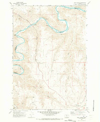
 - 1962 Map of Sherars Bridge
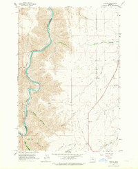
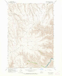
 1962 Sherars Bridge1962 Print · USGSThe Deschutes River canyon serves as a vital transit and recreation corridor during the early sixties. Follow the historic rail lines of the Northern Pacific and trace local landmarks like Sherars Bridge, Warner Cemetery, and Sherar.3 unique versions available
 - 1962 Map of Erskine, 1964 Print
 1962 Erskine1964 Print · USGSThe Deschutes River canyon in Sherman County remained a vital transportation artery in the early sixties as competing rail lines navigated its steep walls. Researchers can trace the junction of the Oregon Trunk Railroad and Spokane Portland and Seattle, or locate rural sites like Erskine and the IOOF Cem.2 unique versions available
 - 1962 Map of Summit Ridge, 1964 Print
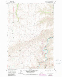
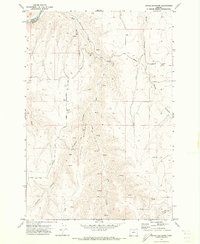
 1962 Summit Ridge1964 Print · USGSThe high plateau of Wasco and Sherman counties comes into focus in the early sixties, centered on the dramatic rise of Summit Ridge. Researchers can trace the riverfront rail operations of the Oregon Trunk and Spokane Portland and Seattle Ry and locate remote landmarks like Ferry Canyon and Center Ridge Road.
 - 1962 Map of Sinamox, 1964 Print
 1962 Sinamox1964 Print · USGSThe Deschutes River canyon serves as a vital rail corridor in the early 1960s, carrying heavy transit through the high desert. Genealogists and rail historians can trace the remote outposts of Sinamox and Oakbrook alongside the Oregon Trunk railroad.2 unique versions available
 - 1962 Map of Grass Valley, 1964 Print
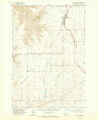 1962 Grass Valley1964 Print · USGSGrass Valley and the surrounding Sherman County plateau are shown here during the early 1960s as a vital railroad and ranching corridor. Researchers can locate the Michigan Cem, trace the Union Pacific line, and find the small community of Eakin.
 - 1962 Map of Maupin, 1964 Print
 1962 Maupin1964 Print · USGSMaupin and the Deschutes River canyon come to life in the early sixties as the railroad and river define the local landscape. Researchers can trace the Oregon Trunk rail line past the Fish Hatchery at Oak Springs and through the riverside settlement of Cambrai.3 unique versions available
 - 1964 Map of Turner Butte, 1965 Print
 1964 Turner Butte1965 Print · USGSMid-century Gilliam County comes into focus in this survey of the high desert along the Sherman Co Gilliam Co border. Trace the historical Oregon Trail (Approximate Route), the Union Pacific tracks, and the remote settlement of Barnett near the John Day River.2 unique versions available
 - 1964 Map of Mc Donald, 1965 Print
 1964 Mc Donald1965 Print · USGSThe high plateau of Sherman County meets the John Day River in the mid-1960s, preserving the intersecting paths of early pioneers. You can trace the historic Oregon Trail and Barlow Cutoff as they descend toward the river crossing at McDonald Ford.2 unique versions available
 - 1970 Map of Devils Backbone, 1973 Print
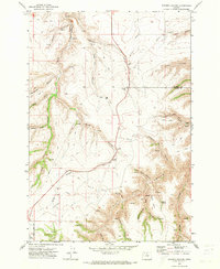
 1970 Devils Backbone1973 Print · USGSThe high canyon country of Gilliam County is captured here in the early 1970s, where the John Day River carves the county line. Genealogists and historians can trace old routes like Mikkalo Road to remote landmarks such as Potters Cem and the former site of Lewis.
 - 1970 Map of Chimney Springs, 1973 Print
 1970 Chimney Springs1973 Print · USGSThe high plateaus and canyons of the John Day country are captured here during the early seventies, when ranching life centered on remote outposts and spring-fed canyons. Researchers can trace land use at Buckhorn Ranch, locate the passage at Bills Pass, or find water sources like Duncan Spring.
 - 1970 Map of Indian Cove, 1973 Print
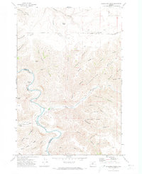
 1970 Indian Cove1973 Print · USGSThe John Day River canyonlands along the Sherman and Gilliam county line are captured here in the early seventies. Researchers can trace the sinuous river curves through Indian Cove or locate remote water sources like Penny Spring and Hawkins Spring.
 - 1970 Map of Kent, 1973 Print
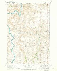
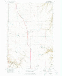 1970 Kent1973 Print · USGSSherman County agriculture and transportation are captured here in the early 1970s, as the community centered around wheat storage and ranching. Genealogists and historians can trace the Old Railroad Grade past Kent and locate the IOOF Cem or the Decker Airstrip.
 - 1970 Map of Macken Canyon, 1973 Print
 1970 Macken Canyon1973 Print · USGSThe high desert plateaus along the Wasco and Sherman County line appear here in the early seventies, defined by deep canyons and seasonal springs. Researchers can trace the path of an Old Railroad Grade and locate agricultural landmarks like the lone Grain Elevator and Macken Springs.
 - 1970 Map of Shoestring Ridge, 1973 Print
 1970 Shoestring Ridge1973 Print · USGSThe high canyons and river breaks of north-central Oregon are documented here just as the 1970s began. Genealogists and local historians can trace the remote ranching landscape across Shoestring Ridge, identifying isolated landmarks like Schilling Spring and the Richmond Road.
 - 1970 Map of Rosebush, 1973 Print
 1970 Rosebush1973 Print · USGSSherman County wheat country is captured here during the early seventies, showing the small settlements and transport links of the plateau. Researchers can trace the Old Railroad Grade and locate local landmarks like the Bourbon Grain Elevator and Rutledge.
 - 1970 Map of Esau Canyon, 1973 Print
 1970 Esau Canyon1973 Print · USGSThe high desert canyons along the Sherman and Gilliam county lines were characterized by remote ranching and river access in the 1970s. Researchers can trace historic transport routes like Ruggles (Pack) Grade and locate local landmarks such as Rietmann Ranch or the Ajax Landing Strip.
Showing maps 1-25 of 174
Top cities of Sherman County
Frequently asked questions
- What are the different types of historical maps available for Sherman County?
- What is the oldest map of Sherman County?
- Where can I purchase historical maps of Sherman County for my home or office?
- Where can I download high-res historical maps of Sherman County?
- Are there historical topographic maps available for Sherman County?
- Is there historical aerial imagery available for Sherman County?
- Where are historical maps of Sherman County sourced from?