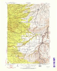
1930 Map of Dufur
USGS Topo · Published 1956About this map
Dufur and the surrounding agricultural uplands of Wasco County are captured here in the years following the 1930 survey, showing a landscape defined by wheat farming, timber, and the transition from rail to highway travel. The Great Southern Railroad and the Oregon Trunk Railway provide the industrial backbone of the region, while the historic Barlow Road and the Wapinitia Highway carve paths through the diverse terrain. Local industry is evident in the multiple lumber operations such as the Dufur Mill, Underhill Mill, and Linn Mill, which served the timbered slopes near the Hood River Co Wasco Co border.
Find a feature on this map
92 named features on this map. Tap any name to fly to it.
Don’t see what you’re looking for? This feature index may not catch every label — zoom into the map to look around manually.
Map Details
Editions of this 1930 Dufur Map
2 editions found
Other maps of this area

1924 · Mount Hood
USGS Topo · 1:125,000

1926 · Hood River
USGS Topo · 1:125,000

1927 · Mount Hood
USGS Topo · 1:125,000

1927 · Mt. Jefferson
USGS Topo · 1:125,000

1928 · Madras
USGS Topo · 1:125,000

1929 · Hood River
USGS Topo · 1:125,000

1930 · Mt. Jefferson
USGS Topo · 1:125,000

1930 · Dufur
USGS Topo · 1:125,000

1931 · Madras
USGS Topo · 1:125,000

1934 · Dufur
USGS Topo · 1:125,000