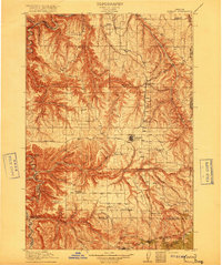
1916 Map of Condon
USGS Topo · Published 1916About this map
Condon serves as the primary hub in this 1916 survey, where the regional rail line terminates amidst an extensive network of homestead schools and rural post offices. The landscape is defined by the deep, winding incision of the John Day River along the western boundary and the complex drainage of Thirtymile Creek. The map documents a period of dense rural settlement evidenced by the sheer number of local educational buildings, such as Linville School, Matney School, and Badger School, many of which were situated to serve remote ranching communities like the Buckhorn Ranch. Small grain-shipping points and settlements like Mikkalo, Clem, and Gwendolen are clearly marked along the high plateau, illustrating the early 20th-century agricultural development before modern road networks consolidated these isolated localities.
Find a feature on this map
50 named features on this map. Tap any name to fly to it.
Don’t see what you’re looking for? This feature index may not catch every label — zoom into the map to look around manually.
Map Details
Editions of this 1916 Condon Map
3 editions found
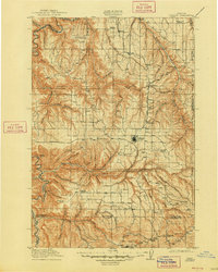
Other maps of this area

1906 · Blalock Island
USGS Topo · 1:125,000

1908 · Blalock Island
USGS Topo · 1:125,000

1916 · Arlington
USGS Topo · 1:125,000

1916 · Condon
USGS Topo · 1:125,000

1926 · Mitchell
USGS Topo · 1:125,000

1953 · Spray
USGS Topo · 1:62,500

1953 · Pendleton
USGS Topo · 1:250,000

1953 · The Dalles
USGS Topo · 1:250,000

1955 · Bend
USGS Topo · 1:250,000

1955 · Canyon City
USGS Topo · 1:250,000