1950s Maps of Clackamas County, Oregon
Explore 35 historic maps of Clackamas County from the 1950s. These maps offer a rare glimpse into what life looked like during the 1950s — showing old roads, neighborhoods, homes, and landmarks that have changed or disappeared over time.
Whether you're researching your family's past, planning a metal detecting trip, or studying how Clackamas County's landscape evolved across the 1950s, these high-resolution maps are a powerful tool for exploring the history of this region.
- Focus on a specific era: All maps on this page are from the 1950s, giving you a focused view of this time period.
- See what’s changed: Compare century-old streets, trails, and buildings to today's modern landscape using overlays and satellite layers.
- Research with precision: Use these maps for genealogy, historical research, land use analysis, or educational projects.
- View, download, or print: Maps are fully viewable online in high resolution, and can be downloaded or printed for your own records.
Start exploring Clackamas County's history through authentic maps from the 1950s. This is your window into the past.
Clackamas County, OR maps
(35)- 1950 Map of Vancouver
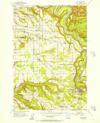
 1950 Vancouver1950 Print · USGSCoastal Oregon and the lower Columbia River valley are captured in detail just after the war. Researchers can trace historic rail routes like the Southern Pacific or locate early settlements such as Vernonia, Gaston, and the Grand Ronde Indian Reservation.
 - 1950 Map of Vancouver, 1951 Print
 1950 Vancouver1951 Print · USGSThe Pacific Northwest urban corridor meets the rugged coast in the years following the war, showing the expansion of Portland and Vancouver. Genealogists and historians can trace the reach of the Southern Pacific RR and locate coastal communities like Tillamook, Seaside, and Tolovana Park.
 - 1951 Map of Lyons, 1953 Print
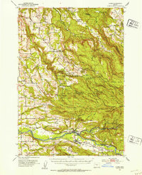 1951 Lyons1953 Print · USGSThe North Santiam River valley and the cataracts of the Silver Creek watershed are captured here in the early 1950s. Genealogists and hikers can trace the original sites of Silver Falls City, the Fox Valley Cem, and the historic Couch Mansion.4 unique versions available
 - 1953 Map of Salem
 1953 Salem1953 Print · USGSMid-century Oregon comes to life through this detailed survey of the Willamette Valley and the adjacent Pacific coastline. Researchers can trace the rail lines of the Southern Pacific RR, visit rural hubs like Fairview School, or locate coastal landmarks like the Yaquina Head Lighthouse.
 - 1953 Map of The Dalles, 1965 Print
 1953 The Dalles1965 Print · USGSThe Columbia River Gorge at mid-century shows a region being transformed by massive hydroelectric dams and a growing highway network. Researchers can trace the development of The Dalles Dam, locate the Maryhill Museum, and find old rail stops in Rufus, Wishram, and Arlington.3 unique versions available
 - 1954 Map of Salem
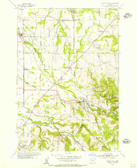
 1954 Salem1954 Print · USGSMid-century Western Oregon is centered on the productive Willamette River valley as its cities and infrastructure expand toward the mountains. Genealogists and historians can trace the rail lines of the Southern Pacific RR and Oregon Electric Ry through towns like Dallas, Independence, and Brownsville.
 - 1954 Map of Damascus, 1956 Print
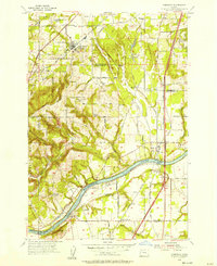
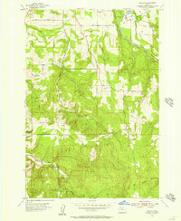
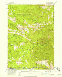
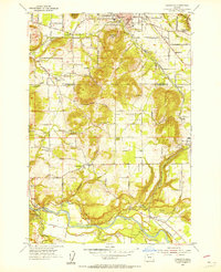 1954 Damascus1956 Print · USGSClackamas and Multnomah counties appear in the mid-1950s as a landscape of rural schools and river-valley settlements. Researchers can trace the Portland Traction Co line through Boring or locate family landmarks like the Baker Cabin and Union School.
 - 1954 Map of Oregon City, 1956 Print
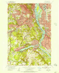
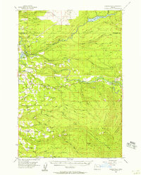
 1954 Oregon City1956 Print · USGSOregon City and the Willamette River banks are captured in the mid-1950s, showing the area's transition from industrial river hub to expanding suburban plateau. Historians can trace established neighborhoods like Canemah or find rural landmarks like Maple Lane Grange and Ten O'Clock Church.
 - 1954 Map of Molalla, 1956 Print
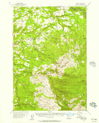
 1954 Molalla1956 Print · USGSClackamas County agriculture and timber industries are in full view during the mid-fifties as Molalla and its surrounding communities thrive. Researchers can trace family roots at Adams Cem or locate defunct landmarks like the Covered Bridge and several abandoned schools.4 unique versions available
 - 1954 Map of Sandy, 1956 Print
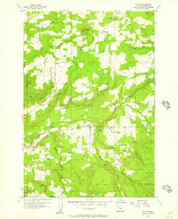
 1954 Sandy1956 Print · USGSThe foothills of the Cascades meet the Clackamas County farm country in the mid-fifties, showing a landscape defined by deep creeks and the Sandy River. Researchers can trace old family lands near Pleasant Home, Cottrell, and the State Fish Hatchery.
 - 1954 Map of Scotts Mills, 1956 Print
 1954 Scotts Mills1956 Print · USGSThe Oregon countryside near the Clackamas and Marion county line is documented here in the mid-fifties as rural life centered on timber and farming. Genealogists can locate family landmarks like Jacks Bridge, rural schoolhouses such as Evans Valley School, and the Maplewood Cem.3 unique versions available
 - 1954 Map of Redland, 1956 Print
 1954 Redland1956 Print · USGSClackamas County is documented here in the mid-1950s, showing a rural landscape in transition as many local schoolhouses were being consolidated. Genealogists and historians can trace family roots through the Feldheimer Ferry site and former schools like Alberta Sch and Viola School.
 - 1954 Map of Gladstone, 1956 Print
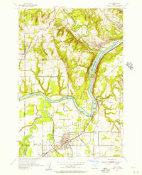
 1954 Gladstone1956 Print · USGSSoutheast Portland and its Clackamas County suburbs are captured here during a period of rapid post-war growth in the mid-fifties. Researchers can trace family roots through numerous local schools and cemeteries or locate defunct aviation sites like Dwyer Landing Field and Wells Airport.
 - 1954 Map of Estacada, 1956 Print
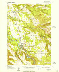 1954 Estacada1956 Print · USGSClackamas County is captured here in the mid-1950s as the river-driven power industry and timber trade defined local life. Researchers can trace the Abandoned Railroad, locate the Barlow Cutoff Historical Mon, or find family names near the IOOF Cemetery and Grange Hall.
 - 1954 Map of Sherwood, 1957 Print
 1954 Sherwood1957 Print · USGSThe northern Willamette Valley comes to life in the mid-1950s as the rail-and-river economy transitions toward highway development. Genealogists and local historians can trace family roots through the Pleasant Hill Cemetery, St Paul School, and the early riverfront layout of Butteville.
 - 1954 Map of Oswego, 1957 Print
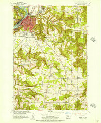
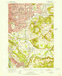
 1954 Oswego1957 Print · USGSSouthwest Portland and the Willamette valley were undergoing rapid suburban growth during the mid-fifties. Researchers can trace the development of neighborhoods like Hillsdale and Multnomah, or locate family sites near Reed College and Riverview Cemetery.
 - 1954 Map of Canby, 1957 Print
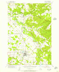
 1954 Canby1957 Print · USGSThe north Willamette Valley is captured here in the mid-fifties, showing a landscape defined by its river forks and developing towns. Genealogists can locate family sites at Robert Bird Cemetery, Zoar Cemetery, or the rural crossroads of Advance.
 - 1955 Map of Yoder
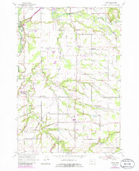 1955 Yoder1955 Print · USGSThe rural prairies south of Canby are captured here in the mid-1950s, showing a landscape of small farming communities and country schools. Genealogists can locate family landmarks like the Norwegian Cem, Whiskey Hill, and the settlement of Rural Dell.3 unique versions available
 - 1955 Map of Colton, 1957 Print
 1955 Colton1957 Print · USGSClackamas County saw a blend of timber management and small-town life in the mid-1950s. Researchers can trace the layout of Colton, find family-named routes like Dhooghe Rd, and locate remote sites like Windy City or the Hillockburn Guard Sta.3 unique versions available
 - 1955 Map of Colton, 1957 Print
 1955 Colton1957 Print · USGSThe rural communities of Clackamas County are captured in the mid-1950s as the timber and farming economies shaped the landscape. Researchers can trace old settlement patterns through Old Colton, the camps at Camp Adams, and family landmarks like Jackson Creek.3 unique versions available
 - 1955 Map of Wilhoit, 1957 Print
 1955 Wilhoit1957 Print · USGSClackamas and Marion counties are captured here in the mid-fifties, showing a landscape of timber ponds and rural schoolhouses. Genealogists can locate family landmarks like Dart Cemetery and historical school sites including Beaver Lake School and Koke Corner.4 unique versions available
 - 1955 Map of Cherryville, 1957 Print
 1955 Cherryville1957 Print · USGSClackamas County in the mid-fifties is defined by its transition from the agricultural valleys near Cherryville to the timbered heights of the Mount Hood National Forest. Genealogists can locate family landmarks like Porter School and Camp Namanu or trace the early path of Highway 26 through Brightwood.3 unique versions available
 - 1955 Map of Mill City, 1958 Print
 1955 Mill City1958 Print · USGSThe Santiam River canyon and its timber towns come alive in the mid-fifties, just as the valley's industrial landscape was shifting. Local historians can trace early settlements like Minto and Niagara, or locate the numerous high-country workings of the Black Eagle Mine and Crown Mine.3 unique versions available
 - 1955 Map of Bend, 1964 Print
 1955 Bend1964 Print · USGSCentral Oregon was undergoing significant growth in the mid-1960s as irrigation and infrastructure transformed the high desert. Researchers can trace the path of the Oregon Trunk Line, locate old stops like Gateway, and find landmarks like Lava Butte or the Grange.3 unique versions available
 - 1956 Map of The Dalles
 1956 The Dalles1956 Print · USGSThe Columbia River Gorge and the high Cascades are captured in the mid-1950s, showing a vital corridor of rail and road. Researchers can trace the original path of The Old Oregon Trail or locate historical landmarks like the Maryhill Museum and Mount Hood.
Showing maps 1-25 of 35
Top cities of Clackamas County
- Lake Oswego historical maps
- Oregon City historical maps
- West Linn historical maps
- Wilsonville historical maps
- Happy Valley historical maps
- Milwaukie historical maps
See more
Frequently asked questions
- What are the different types of historical maps available for Clackamas County?
- What is the oldest map of Clackamas County?
- Where can I purchase historical maps of Clackamas County for my home or office?
- Where can I download high-res historical maps of Clackamas County?
- Are there historical topographic maps available for Clackamas County?
- Is there historical aerial imagery available for Clackamas County?
- Where are historical maps of Clackamas County sourced from?