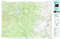
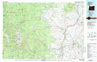
1980s Maps of Clackamas County, Oregon
Explore 30 historic maps of Clackamas County from the 1980s. These maps offer a rare glimpse into what life looked like during the 1980s — showing old roads, neighborhoods, homes, and landmarks that have changed or disappeared over time.
Whether you're researching your family's past, planning a metal detecting trip, or studying how Clackamas County's landscape evolved across the 1980s, these high-resolution maps are a powerful tool for exploring the history of this region.
- Focus on a specific era: All maps on this page are from the 1980s, giving you a focused view of this time period.
- See what’s changed: Compare century-old streets, trails, and buildings to today's modern landscape using overlays and satellite layers.
- Research with precision: Use these maps for genealogy, historical research, land use analysis, or educational projects.
- View, download, or print: Maps are fully viewable online in high resolution, and can be downloaded or printed for your own records.
Start exploring Clackamas County's history through authentic maps from the 1980s. This is your window into the past.
Clackamas County, OR maps
(30)- 1980 Map of Government Camp
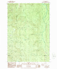
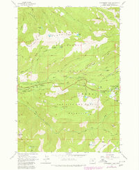 1980 Government Camp1980 Print · USGSGovernment Camp and the surrounding Mount Hood wilderness are captured in the early 1980s as the region's recreation economy flourished. Researchers can trace historic routes like the Pioneer Bridle Trail and locate sites such as Zigzag East Lookout and Barlow Campground.
 - 1982 Map of Oregon City, 1983 Print
 1982 Oregon City1983 Print · USGSGreater Portland and the Willamette Valley are shown in the early eighties as the region's urban and rural landscapes converged. Genealogists and historians can trace family-named sites across French Prairie, visit St Paul Ch, or locate the grounds of Dammasch State Hospital.
 - 1983 Map of Mount Hood
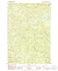
 1983 Mount Hood1983 Print · USGSMount Hood and its surrounding national forest are captured here in the early eighties, spanning from alpine glaciers to the high desert plains. Genealogists and historians can trace old routes like the Barlow Road and locate remote landmarks like Bear Springs Ranger Sta or the settlement of Tygh Valley.
 - 1983 Map of Madras
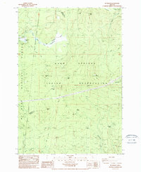
 1983 Madras1983 Print · USGSJefferson County and the Warm Springs Indian Reservation are shown in detail during the early 1980s, from the Cascade peaks to the high desert. Researchers can trace the legacy of tribal lands at Simnasho, find the Abbot Cemetery, or follow the rail lines through Madras Sta.
 - 1983 Map of North Santiam River, 1984 Print
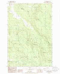
 1983 North Santiam River1984 Print · USGSThe western Cascades and Willamette Valley transition in the early eighties, from the state capital to the high timberlands. Genealogists and historians can trace rail lines like the Southern Pacific and explore communities from Mill City to Silver Falls City.
 - 1985 Map of Fish Creek Mountain
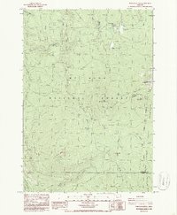
 1985 Fish Creek Mountain1985 Print · USGSThe Clackamas River valley in the mid-1980s was a hub of forest management and outdoor recreation. Researchers can locate the Ripplebrook Ranger Station, the Timber Lake Job Corps Center, and the geothermal Austin Hot Springs.
 - 1985 Map of High Rock
 1985 High Rock1985 Print · USGSIn the mid-1980s, the Clackamas back-country remained a landscape of remote forest camps and steep peaks. Trace old timber access routes and recreation sites like Hambone Spring Campground, Indian Ridge, and the waterfalls along the Salmon River.
 - 1985 Map of Wolf Peak
 1985 Wolf Peak1985 Print · USGSMt Hood National Forest in the mid-1980s reveals a high-country landscape of recent burns and alpine lakes. Hikers and historians can trace the Pacific Crest National Scenic Trail past Timothy Lake and the summits of Wolf Peak and Wolf Camp Butte.
 - 1985 Map of Wapinitia Pass
 1985 Wapinitia Pass1985 Print · USGSHigh mountain passes and the boundary of the Warm Springs Indian Reservation define this mid-1980s Oregon landscape. Trace the Pacific Crest National Scenic Trail past Clear Lake Butte and locate the historic Mc Quinn Line of 1887.
 - 1985 Map of Timothy Lake
 1985 Timothy Lake1985 Print · USGSTimothy Lake and the surrounding Cascades are captured in the mid-1980s as a developed recreational landscape within the Mt Hood National Forest. Hikers and historians can trace the Pacific Crest National Scenic Trail past Summit Lake and explore old resource sites like the Quarries near Buck Creek.
 - 1985 Map of Mt. Mitchell
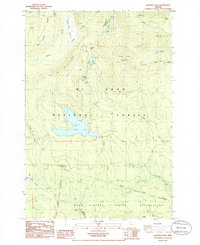
 1985 Mt. Mitchell1985 Print · USGSClackamas County in the mid-1980s reveals a managed wilderness of forest recreation and utility corridors. Researchers can locate remote sites like Oak Grove Campground, trace the path of two steel tower trans lines, and find hidden water bodies like Hideaway Lake.
 - 1985 Map of Rooster Rock
 1985 Rooster Rock1985 Print · USGSThe Clackamas and Marion county borderlands are shown here in the mid-eighties as a hub of forestry and high-elevation mining. Researchers can locate the Ogle Mtn Mine and trace drainage patterns along the Molalla River and Paopanelly Creek.
 - 1985 Map of Wildcat Mountain, 1986 Print
 1985 Wildcat Mountain1986 Print · USGSClackamas County is shown as a high-elevation timber and recreation landscape in the mid-eighties. Researchers can trace forest access routes to Coffman Camp, follow the Salmon River, or locate specific peaks like Old Baldy and Wildcat Mtn.
 - 1985 Map of Cherryville, 1986 Print
 1985 Cherryville1986 Print · USGSClackamas County settlement and timber country are captured here in the mid-1980s as rural communities continued to grow along the creek drainages. Genealogists and local historians can locate rural markers like the Cem near George and the settlements of Firwood and Bissell.
 - 1985 Map of Bagby Hot Springs, 1986 Print
 1985 Bagby Hot Springs1986 Print · USGSThe Oregon Cascades come into focus in the mid-1980s, documenting the dense river systems and forests along the Clackamas and Marion county line. Researchers can trace the layout of Bagby Hot Springs and locate landmarks like Pegleg Falls or Baty Butte.2 unique versions available
 - 1985 Map of Three Lynx, 1986 Print
 1985 Three Lynx1986 Print · USGSThe Clackamas River corridor and the steep timberlands of Mt Hood National Forest are captured here in the mid-1980s. Researchers can trace the remote settlement of Three Lynx, follow the Indian Ridge Tr, and locate high-country landmarks like Squaw Mtn.2 unique versions available
 - 1985 Map of Bull of The Woods, 1986 Print
 1985 Bull of The Woods1986 Print · USGSMount Hood National Forest and the headwaters of the Collawash River are captured here in the mid-1980s. Outdoor historians and researchers can trace the high-altitude trails to the Bull of the Woods Lookout or locate the Sugar Pine Botanical Area.
 - 1985 Map of Elk Prairie, 1986 Print
 1985 Elk Prairie1986 Print · USGSThe timberlands and waterfalls of the Oregon Cascades come into focus during the mid-eighties as state forestry and parks expand. Trace the rugged drainage of the Abiqua Basin, locate the heights of Meyers Butte, and find remote landmarks like Abiqua Falls and Moss Lake.
 - 1985 Map of Wanderers Peak, 1986 Print
 1985 Wanderers Peak1986 Print · USGSThe Mt Hood National Forest back-country comes to life in this mid-eighties survey of Clackamas County timberlands. Researchers can locate remote landmarks like Memaloose Campground and trace the fabric-themed streams from Silk Creek to Flannel Creek.
 - 1985 Map of Bull Run, 1986 Print
 1985 Bull Run1986 Print · USGSClackamas County was a hub of water management and rural settlement in the mid-1980s, centered on the protected forest watersheds. Researchers can trace the layout of historic sites like Bull Run, the local Cem, and recreational landmarks such as Camp Namanu.2 unique versions available
 - 1985 Map of Mt. Wilson, 1988 Print
 1985 Mt. Wilson1988 Print · USGSThe high Cascade country of Wasco County is shown here in the mid-eighties, where tribal lands and national forest boundaries intersect. Researchers can trace historic survey markers like the McQuinn Line or locate remote water sources like Deadman Spring and Willow Springs.
 - 1986 Map of Elwood
 1986 Elwood1986 Print · USGSClackamas County in the mid-1980s shows a landscape of timber-managed forests and small rural settlements. Genealogists and researchers can locate the Dorn Cem, trace the winding Clackamas River, and find the remote outposts of Elwood and Dodge.
 - 1986 Map of Pinhead Buttes
 1986 Pinhead Buttes1986 Print · USGSThe Oregon Cascades meet the western boundary of the Warm Springs Reservation in the mid-eighties. Researchers can trace the high-altitude Pacific Crest National Scenic Trail and locate the historic Sisi Lookout Tower near Lemiti Butte.4 unique versions available
 - 1986 Map of Bedford Point
 1986 Bedford Point1986 Print · USGSIn the mid-1980s, this area of Clackamas County served as a vital hub for river management and forest recreation. Trace the distribution of timber-era infrastructure and riverside sites like the Bedford Point Lookout, Big Cliff, and Fish Creek Landing Strip.
 - 1986 Map of Mt. Lowe
 1986 Mt. Lowe1986 Print · USGSHigh Cascades wilderness within the Clackamas and Marion county lines comes into focus in this mid-eighties survey. Researchers can trace forest drainage systems from Mt Lowe down to the Clackamas River and landmarks like Big Bottom and Round Lake.2 unique versions available
Showing maps 1-25 of 30
Top cities of Clackamas County
- Lake Oswego historical maps
- Oregon City historical maps
- West Linn historical maps
- Wilsonville historical maps
- Happy Valley historical maps
- Milwaukie historical maps
See more
Frequently asked questions
- What are the different types of historical maps available for Clackamas County?
- What is the oldest map of Clackamas County?
- Where can I purchase historical maps of Clackamas County for my home or office?
- Where can I download high-res historical maps of Clackamas County?
- Are there historical topographic maps available for Clackamas County?
- Is there historical aerial imagery available for Clackamas County?
- Where are historical maps of Clackamas County sourced from?