1990s Maps of Clackamas County, Oregon
Explore 29 historic maps of Clackamas County from the 1990s. These maps offer a rare glimpse into what life looked like during the 1990s — showing old roads, neighborhoods, homes, and landmarks that have changed or disappeared over time.
Whether you're researching your family's past, planning a metal detecting trip, or studying how Clackamas County's landscape evolved across the 1990s, these high-resolution maps are a powerful tool for exploring the history of this region.
- Focus on a specific era: All maps on this page are from the 1990s, giving you a focused view of this time period.
- See what’s changed: Compare century-old streets, trails, and buildings to today's modern landscape using overlays and satellite layers.
- Research with precision: Use these maps for genealogy, historical research, land use analysis, or educational projects.
- View, download, or print: Maps are fully viewable online in high resolution, and can be downloaded or printed for your own records.
Start exploring Clackamas County's history through authentic maps from the 1990s. This is your window into the past.
Clackamas County, OR maps
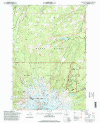
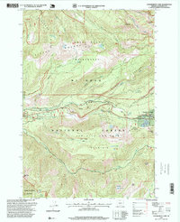
(29)- 1991 Map of North Santiam River, 1993 Print
 1991 North Santiam River1993 Print · USGSMarion and Linn counties come into focus in the early 1990s as the Santiam River valley transitions from the Willamette Valley floor to the Cascade peaks. Researchers can trace timber and rail history through Mill City, locate family landmarks near Stayton, or explore the boundaries of Silver Falls State Park.
 - 1996 Map of Mount Hood North, 1998 Print
 1996 Mount Hood North1998 Print · USGSMount Hood’s north face in the late nineties reveals a high-alpine landscape of glacial basins and early forest management. Researchers can trace historic sites like the Cloud Cap Inn, explore the water systems of Laurance Lake, and locate remote points such as McNeil Point.2 unique versions available
 - 1996 Map of Fort Butte, 1998 Print
 1996 Fort Butte1998 Print · USGSHigh in the Cascade Range during the late nineties, this landscape spans the border of the Warm Springs Indian Reservation. Hikers and historians can trace the Pacific Crest National Scenic Trail past Fort Butte and the springs of Camas Prairie.
 - 1996 Map of Mount Wilson, 1998 Print
 1996 Mount Wilson1998 Print · USGSThe Oregon Cascades in the late 1990s are defined here by the intersection of the Mount Hood National Forest and the Warm Springs Indian Reservation. Hikers and historians can trace the Pacific Crest National Scenic Trail and locate landmarks like the Joe Graham Horse Camp and Red Wolf Pass.
 - 1996 Map of Wapinitia Pass, 1998 Print
 1996 Wapinitia Pass1998 Print · USGSThe northern Cascades meet the Warm Springs Reservation in the late nineties, documenting a landscape defined by pioneer history and geology. Trace the historic Barlow Road and Mc Quinn Line 1887 or locate landmarks like Little Crater Lake and the Kingers Camp Historical Marker.
 - 1996 Map of Mount Hood South, 1998 Print
 1996 Mount Hood South1998 Print · USGSThe south face of Oregon's iconic peak comes into focus in the mid-nineties, showing the intersection of pioneer history and modern recreation. Trace the historic Barlow Road, find the Pioneer Womans Grave, and locate the iconic Timberline Lodge along with numerous backcountry shelters.
 - 1997 Map of Rooster Rock, 1999 Print
 1997 Rooster Rock1999 Print · USGSThe northern Cascades come into focus in the late nineties, where the high ridges of the Clackamas and Marion county line meet. Researchers can trace the drainage of the Molalla River and locate historic sites like the Ogle Mtn Mine and Peshuck Lookout.
 - 1997 Map of Soosap Peak, 1999 Print
 1997 Soosap Peak1999 Print · USGSHigh in the Cascades during the late nineties, this Forest Service revision shows the timber and watershed lands of Clackamas County. Trace mountain lookouts and remote lakes like High Camp Lookout, Cougar Lake, and Emerald Lake.
 - 1997 Map of Wolf Peak, 1999 Print
 1997 Wolf Peak1999 Print · USGSThe Mt Hood National Forest at the close of the twentieth century shows a landscape shaped by wilderness preservation and active timber management. Trace the historic Pacific Crest National Scenic Trail as it skirts Timothy Lake and passes landmarks like Wolf Peak.
 - 1997 Map of Pinhead Buttes, 1999 Print
 1997 Pinhead Buttes1999 Print · USGSThe high Cascade ridgelines between Clackamas and Wasco counties are captured here in the late nineties. Modern researchers can trace the Pacific Crest Nat Scenic Trail as it passes landmarks like the Sisi Lookout and Warm Springs Cabin.
 - 1997 Map of Mount Mitchell, 1999 Print
 1997 Mount Mitchell1999 Print · USGSThe Oregon Cascades within the Mt Hood National Forest are shown here during the late nineties. Trace forest roads and river terrain around Lake Harriet, Oak Grove Butte, and numerous sites like Thunder Quarry.
 - 1997 Map of Bagby Hot Springs, 1999 Print
 1997 Bagby Hot Springs1999 Print · USGSClackamas and Marion counties are captured here in the late nineties, documenting the remote mountain landscape of the Cascades. Researchers can trace the trails around Bagby Hot Springs and locate landmarks like Baty Butte or the Hugh Creek Quarry.
 - 1997 Map of Government Camp, 1999 Print
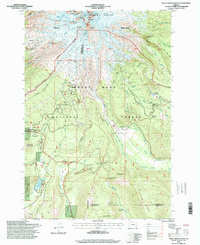
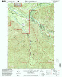
 1997 Government Camp1999 Print · USGSGovernment Camp served as a bustling mountain outpost in the late nineties, positioned between two major wilderness areas. Researchers can trace the layout of the Ski Bowl and locate landmarks like the Zigzag East Lookout and Laurel Hill Quarry.
 - 1997 Map of Brightwood, 1999 Print
 1997 Brightwood1999 Print · USGSThe convergence of the Sandy and Salmon rivers highlights this late-twentieth-century look at the Clackamas County backcountry. Researchers can trace the restricted boundaries of the Bull Run Watershed Management Unit and locate regional hubs like Brightwood or Marmot.
 - 1997 Map of Timothy Lake, 1999 Print
 1997 Timothy Lake1999 Print · USGSMount Hood National Forest was a hub of recreation and resource extraction in the late nineties. Trace the high-country paths of the Pacific Crest National Scenic Trail or locate industrial sites like Alligator Quarry and Devils Ridge Quarry.
 - 1997 Map of Bull Run Lake, 1999 Print
 1997 Bull Run Lake1999 Print · USGSThe northern slopes of Mount Hood are captured here in the late nineties, showcasing a landscape of high alpine lakes and protected watersheds. Hikers and historians can trace the Pacific Crest National Scenic Trail past Lolo Pass or locate the historic Lost Lake Resort.
 - 1997 Map of Wanderers Peak, 1999 Print
 1997 Wanderers Peak1999 Print · USGSThe Oregon Cascades within Mt Hood National Forest are captured here in the late nineties, showing a landscape defined by forestry and high ridges. Researchers can trace the drainage of the South Fork Clackamas River or locate historic extraction sites like Miners Butte and Dunmarow Quarry.
 - 1997 Map of Hickman Butte, 1999 Print
 1997 Hickman Butte1999 Print · USGSThe Clackamas County backcountry near the turn of the millennium was a landscape of protected watersheds and resource extraction. Researchers can trace the drainages of Bull Run River and locate remote landmarks like Old Maid Flat, Hickman Butte, and Goodfellow Lakes.
 - 1997 Map of Fish Creek Mountain, 1999 Print
 1997 Fish Creek Mountain1999 Print · USGSThe Clackamas River corridor comes to life in this late 1990s survey of the Mount Hood National Forest. Researchers can trace the layout of Ripplebrook, locate the Indian Henry site, and identify numerous resource sites like Umpqua Quarry.
 - 1997 Map of Bull of the Woods, 1999 Print
 1997 Bull of the Woods1999 Print · USGSHigh in the Cascades during the late 1990s, this area shows a landscape defined by industrial forestry and protected wilderness. Researchers can trace forest resource sites like the Happy Quarry and remote landmarks such as the Bull of the Woods Lookout.
 - 1997 Map of High Rock, 1999 Print
 1997 High Rock1999 Print · USGSClackamas County’s high country is captured here in the late nineties, showing the managed landscape of the northern Cascades. Local historians and hikers can trace the paths between High Rock, the extractive history at High Rock Quarry, and the remote Rock Lakes Basin.
 - 1997 Map of Three Lynx, 1999 Print
 1997 Three Lynx1999 Print · USGSThe Clackamas River corridor in the late nineties featured a mix of forest management and remote settlements. Researchers can trace the development of Three Lynx and locate mountain features like Shining Lake, Squaw Mtn, and the North Fork Quarry.
 - 1997 Map of Rhododendron, 1999 Print
 1997 Rhododendron1999 Print · USGSClackamas County mountaineering and recreation hubs are documented here in the late nineties, centered on the Rhododendron community. Researchers can trace the path of the Pioneer Bridle Trail and locate local landmarks like Camp Arrah Wanna and the historical Tollgate.
 - 1997 Map of Wildcat Mountain, 1999 Print
 1997 Wildcat Mountain1999 Print · USGSThe northern Cascades near Clackamas County are shown in the late nineties as a landscape of protected wilderness and forest management. Researchers can trace the rugged topography of Mc Intyre Ridge and locate sites like Coffman Camp or the Wildcat Gravel Pit.
 - 1997 Map of Mount Lowe, 1999 Print
 1997 Mount Lowe1999 Print · USGSThe northern Cascades in the late nineties are defined here by high ridgelines and forest management. Researchers can trace the drainages of the Clackamas River, locate high-country clearings like Jim Meadow, and identify resource sites such as Squirrel Quarry.
Showing maps 1-25 of 29
Top cities of Clackamas County
- Lake Oswego historical maps
- Oregon City historical maps
- West Linn historical maps
- Wilsonville historical maps
- Happy Valley historical maps
- Milwaukie historical maps
See more
Frequently asked questions
- What are the different types of historical maps available for Clackamas County?
- What is the oldest map of Clackamas County?
- Where can I purchase historical maps of Clackamas County for my home or office?
- Where can I download high-res historical maps of Clackamas County?
- Are there historical topographic maps available for Clackamas County?
- Is there historical aerial imagery available for Clackamas County?
- Where are historical maps of Clackamas County sourced from?