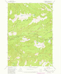
1980 Map of Government Camp
USGS Topo · Published 1980About this map
Government Camp serves as the central hub for this high-altitude landscape within the Mt Hood National Forest and Mt Hood Wilderness during the early 1980s. The map illustrates a dense network of recreational and historical infrastructure, notably the Pioneer Bridle Trail following the Zigzag River, a path deeply connected to early migration through the Cascades. Higher elevations are marked by the Zigzag East Lookout and the Multorpor Mtn Ski Lift, highlighting the area's transition into a premier winter sports destination. Numerous mountain lakes, including Mirror Lake and Lost Lake, are connected by an extensive trail system featuring the Skyline Trail and Burnt Lake Trail. Small-scale developments such as the Sewage Disposal facility and a Gravel Pit appear alongside established sites like Barlow Campground, reflecting the managed growth required to support the region's seasonal tourism and forest service operations.
Find a feature on this map
57 named features on this map. Tap any name to fly to it.
Don’t see what you’re looking for? This feature index may not catch every label — zoom into the map to look around manually.
Map Details
Editions of this 1980 Government Camp Map
This is the sole edition of this map. No revisions or reprints were ever made.
Other maps of this area

1924 · Mount Hood
USGS Topo · 1:125,000

1927 · Mount Hood
USGS Topo · 1:125,000

1953 · The Dalles
USGS Topo · 1:250,000

1956 · The Dalles
USGS Topo · 1:250,000

1956 · High Rock
USGS Topo · 1:62,500

1956 · Mt. Wilson
USGS Topo · 1:62,500

1957 · The Dalles
USGS Topo · 1:250,000
1962 · Hickman Butte
USGS Topo · 1:24,000

1962 · Cathedral Ridge
USGS Topo · 1:24,000
1962 · Government Camp
USGS Topo · 1:24,000