1900s (20th Century) Maps of Crook County, Oregon
Explore 147 historic maps of Crook County from the 1900s (20th Century). These maps offer a rare glimpse into what life looked like during the 1900s — showing old roads, neighborhoods, homes, and landmarks that have changed or disappeared over time.
Whether you're researching your family's past, planning a metal detecting trip, or studying how Crook County's landscape evolved across the 1900s, these high-resolution maps are a powerful tool for exploring the history of this region.
- Focus on a specific era: All maps on this page are from the 1900s, giving you a focused view of this time period.
- See what’s changed: Compare century-old streets, trails, and buildings to today's modern landscape using overlays and satellite layers.
- Research with precision: Use these maps for genealogy, historical research, land use analysis, or educational projects.
- View, download, or print: Maps are fully viewable online in high resolution, and can be downloaded or printed for your own records.
Start exploring Crook County's history through authentic maps from the 1900s. This is your window into the past.
Crook County, OR maps
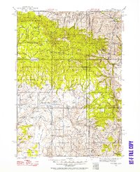
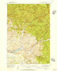
(147)- 1926 Map of Mitchell
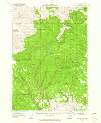
 1926 Mitchell1926 Print · USGSCentral Oregon ranching and geology are documented here in the mid-1920s, showing a landscape defined by the winding John River. Genealogists can locate family holdings like Old Frizzell Ranch and Laird Ranch alongside remote schoolhouses like Gable School.3 unique versions available
 - 1926 Map of Bend, 1963 Print
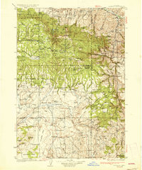
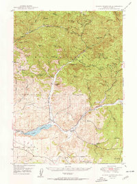
 1926 Bend1963 Print · USGSCentral Oregon in the mid-1920s was a landscape of emerging irrigation districts and busy timber rails centered around the growing hub of Bend. Researchers can trace early rural life through family-named landmarks like Gales Ranch and numerous country schoolhouses including Young Sch and Pine Ridge Sch.
 - 1929 Map of Bend
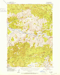
 1929 Bend1929 Print · USGSCentral Oregon in the late twenties shows a landscape shaped by irrigation and the expansion of the rail lines. Genealogists can locate family-named sites like Gates Ranch and numerous rural schoolhouses including Arnold Sch and Lava Rock Sch.5 unique versions available
 - 1932 Map of Dayville, 1958 Print
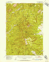
 1932 Dayville1958 Print · USGSCentral Oregon ranching and timber frontiers are captured here in the early 1930s, documenting a remote landscape of high plateaus and river valleys. Genealogists and historians can locate family landmarks like Congleton Ranch, the ruins of Camp Watson, and early rural school sites like Beaver Creek Sch.
 - 1936 Map of Dayville
 1936 Dayville1936 Print · USGSIn the early 1930s, this portion of Central Oregon was a landscape of high timber and remote cattle ranches along the John Day River. Researchers can trace the era's ranching families at Dexter Ranch and Mills Ranch, or find the location of the Old Bear Creek Sawmill and Fort Camp Watson.3 unique versions available
 - 1946 Map of Eagle Rock, 1963 Print
 1946 Eagle Rock1963 Print · USGSCrook County ranching culture is captured here in the mid-1940s, showing a landscape defined by the Crooked River canyon. Researchers can trace historic property boundaries and family landmarks like Shorty Davis Ranch, Kizer Ranch, and the Bailey Sch.2 unique versions available
 - 1948 Map of Eagle Rock
 1948 Eagle Rock1948 Print · USGSCrook County ranching life in the late 1940s is centered here on the winding Crooked River and the high country of the Maury Mountains. Researchers can trace old property boundaries and local landmarks like the Bailey Sch and numerous family holdings including Way Ranch and Bolletto Ranch.2 unique versions available
 - 1948 Map of Ochoco Reservoir, 1956 Print
 1948 Ochoco Reservoir1956 Print · USGSCovers Crook County, including United States, Oregon, and other nearby areas
 - 1950 Map of Ochoco Reservoir
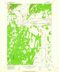
 1950 Ochoco Reservoir1950 Print · USGSCrook County at mid-century reveals a landscape of isolated forest lookouts and early ranching outposts within the Ochoco National Forest. Genealogists and local historians can trace legacy sites like the Keystone Ranch, Mill Cr Sch, and the distinctive Steins Pillar.4 unique versions available
 - 1951 Map of Post, 1953 Print
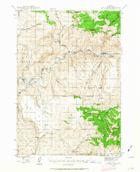
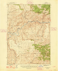
 1951 Post1953 Print · USGSCentral Oregon ranching and timber lands are frozen in time during the early fifties as the Crooked River winds through the high country. Researchers can trace the layout of Post, find the old Post School, or locate the Maury Mtn Mines in the southern peaks.3 unique versions available
 - 1951 Map of Lookout Mtn, 1954 Print
 1951 Lookout Mtn1954 Print · USGSHigh in the central Oregon mountains during the early fifties, this area reveals a landscape of isolated mines and forest service outposts. Researchers can trace the operations of the Ochoco Mine, locate the Nelson Monument, and find remote family sites like Simpson Place.2 unique versions available
 - 1955 Map of Crescent, 1963 Print
 1955 Crescent1963 Print · USGSCentral Oregon in the mid-1950s was a landscape of dense national forests and high desert expanses. Researchers can trace timber-era settlements like Gilchrist and Crescent or locate remote outposts such as Stauffer and Millican near the Wagontire Mountains.3 unique versions available
 - 1955 Map of Bend, 1964 Print
 1955 Bend1964 Print · USGSCentral Oregon was undergoing significant growth in the mid-1960s as irrigation and infrastructure transformed the high desert. Researchers can trace the path of the Oregon Trunk Line, locate old stops like Gateway, and find landmarks like Lava Butte or the Grange.3 unique versions available
 - 1955 Map of Burns, 1964 Print
 1955 Burns1964 Print · USGSHarney County's high desert ranching and timber heartland is captured here in the mid-fifties, centered on the hub of Burns and Hines. Genealogists and researchers can locate remote landmarks like the Suntex School, New Princeton P. O., and the Lumber Mill.3 unique versions available
 - 1955 Map of Canyon City, 1966 Print
 1955 Canyon City1966 Print · USGSCentral Oregon's high desert and timber country are captured here in the mid-fifties, showing the rugged ranching and logging landscape. Trace the path of the Sumpter Valley Ry or locate remote settlements like Izee, Whitney, and Ritter.4 unique versions available
 - 1957 Map of Crescent
 1957 Crescent1957 Print · USGSCentral Oregon’s high desert and volcanic rim are captured here in the late fifties, showing the region before the modernization of its wilderness corridors. Genealogists and local historians can trace rail-line outposts like Chemult and the early boundaries of the Klamath Indian Reservation.
 - 1957 Map of Bend
 1957 Bend1957 Print · USGSCentral Oregon in the mid-fifties is a landscape of transition between the high Cascades and the arid volcanic plateau. Local historians can trace the rail corridors of the Oregon Trunk and locate early settlements like Ashwood, Odin Falls, and Camp Sherman.
 - 1958 Map of Crescent
 1958 Crescent1958 Print · USGSCentral Oregon’s volcanic high desert and timber country are captured here in the mid-fifties, from the peaks of the Cascades to the arid basins. Researchers can trace the lines of the Southern Pacific RR, the northern reaches of the Klamath Indian Reservation, and remote outposts like Fort Rock.
 - 1958 Map of Burns
 1958 Burns1958 Print · USGSHarney County ranching and timber lands are captured here in the late fifties. Genealogists and local historians can trace family holdings and rural institutions, from the Kimball Flat School to remote outposts like Crow Camp Ranch and the Sutton Ranch.
 - 1958 Map of Bend
 1958 Bend1958 Print · USGSCentral Oregon in the late fifties was a land of high desert ranching and growing mountain towns. Researchers can trace the rail lines of the Oregon Trunk Railroad, find established settlements like Madras and Sisters, or locate landmarks such as Smith Rock and Lava Butte.
 - 1959 Map of Burns
 1959 Burns1959 Print · USGSHarney County in the late fifties remains a landscape of high-desert ranching and timber production, centered on the hubs of Burns and Hines. Researchers can locate remote rural institutions like the Suntex School or trace family landholdings such as the Stallard Ranch and O'Keefe Homestead.
 - 1959 Map of Canyon City
 1959 Canyon City1959 Print · USGSEastern Oregon in the late fifties was a landscape of high timber and remote river valleys shaped by the cattle and mining trades. Genealogists and historians can trace the paths of the Sumpter Valley RR and find early settlements like Antone, Richmond, and Dayville.2 unique versions available
 - 1961 Map of Delintment Lake, 1962 Print
 1961 Delintment Lake1962 Print · USGSHigh in the Ochoco Mountains during the early sixties, this area centered on Delintment Lake was a hub for forest management and back-country recreation. Researchers can locate remote sites like the Buck Spring Guard Sta, trace trails past Donnelly Butte, and find family-named landmarks like Williams Reservoir.2 unique versions available
 - 1962 Map of Oneil, 1963 Print
 1962 Oneil1963 Print · USGSCrook County ranch lands were defined by irrigation and river crossings in the early sixties as the high desert landscape began to modernize. Researchers can trace historic family routes along Huston Road and identify specific landmarks like the Crooked River Gorge and Forest Crossing.2 unique versions available
 - 1962 Map of Huston Lake, 1963 Print
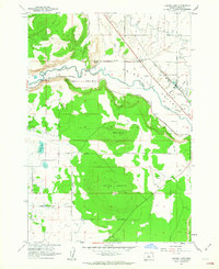 1962 Huston Lake1963 Print · USGSThe Prineville Valley in the early 1960s reveals a landscape of high-desert agriculture and industrial infrastructure. Researchers can trace the City of Prineville Railway as it parallels the Crooked River or locate family-named sites like Myers Butte.
Showing maps 1-25 of 147
Top cities of Crook County
Frequently asked questions
- What are the different types of historical maps available for Crook County?
- What is the oldest map of Crook County?
- Where can I purchase historical maps of Crook County for my home or office?
- Where can I download high-res historical maps of Crook County?
- Are there historical topographic maps available for Crook County?
- Is there historical aerial imagery available for Crook County?
- Where are historical maps of Crook County sourced from?