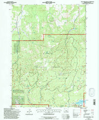
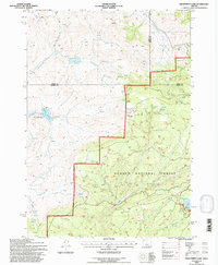
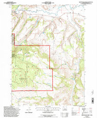
1990s Maps of Crook County, Oregon
Explore 60 historic maps of Crook County from the 1990s. These maps offer a rare glimpse into what life looked like during the 1990s — showing old roads, neighborhoods, homes, and landmarks that have changed or disappeared over time.
Whether you're researching your family's past, planning a metal detecting trip, or studying how Crook County's landscape evolved across the 1990s, these high-resolution maps are a powerful tool for exploring the history of this region.
- Focus on a specific era: All maps on this page are from the 1990s, giving you a focused view of this time period.
- See what’s changed: Compare century-old streets, trails, and buildings to today's modern landscape using overlays and satellite layers.
- Research with precision: Use these maps for genealogy, historical research, land use analysis, or educational projects.
- View, download, or print: Maps are fully viewable online in high resolution, and can be downloaded or printed for your own records.
Start exploring Crook County's history through authentic maps from the 1990s. This is your window into the past.
Crook County, OR maps
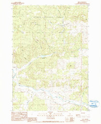
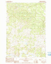
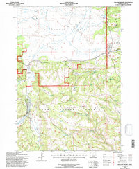
(60)- 1990 Map of Eagle Rock
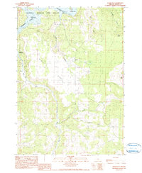
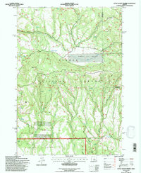
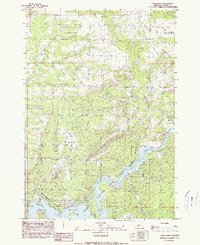 1990 Eagle Rock1990 Print · USGSThe Crooked River valley and its surrounding high desert plateaus are captured here in the 1990s. Researchers can trace land use through the Prineville Reservoir State Park, the Boa Ramp, and family-named drainages like Sanford Creek.
 - 1990 Map of Lookout Mountain
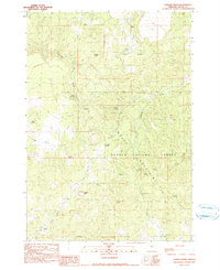
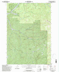
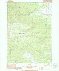 1990 Lookout Mountain1990 Print · USGSThe high Ochoco Mountains are documented here in the early nineties, showing a landscape defined by timber, water, and mineral extraction. Trace the locations of the Amity Mine and Independent Mine or locate high-country water sources like Kemp Spring and Lookout Spring.
 - 1990 Map of Gerow Butte
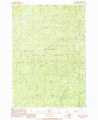 1990 Gerow Butte1990 Print · USGSHigh in the Ochoco Mountains during the 1990s, this survey documents a remote landscape of volcanic peaks and timbered ranges. Researchers can locate specific landmarks like the Nelson Monument, numerous prospects, and family-named features like Duncan Butte and Gerow Spring.
 - 1990 Map of Steins Pillar
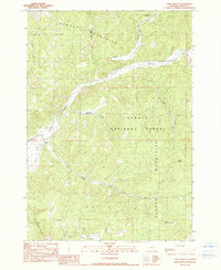
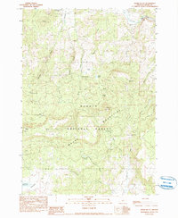
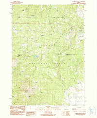
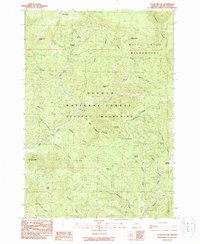 1990 Steins Pillar1990 Print · USGSCrook County’s high-country terrain is captured here during the late twentieth century, showing the protected reaches of the Ochogo National Forest. Researchers can trace the drainage of Mill Creek and locate landmarks like Steins Pillar, Twin Pillars, and Spears Meadow.
 - 1990 Map of Post
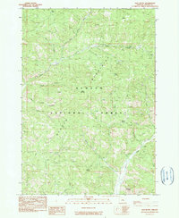
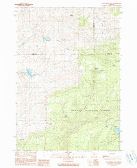
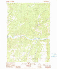
 1990 Post1990 Print · USGSThe rural landscape of central Oregon is captured here in the late twentieth century, centered on the Post settlement. Genealogists and researchers can trace family-named landmarks and water sources like Bonnieview Ranch and the Crooked River.
 - 1990 Map of Cadle Butte
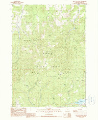
 1990 Cadle Butte1990 Print · USGSCrook County ranching and timberlands are captured here in the 1980s, revealing the isolated homesteads and high-country landmarks of the mountain interior. Genealogists and historians can trace family locations at Keystone Ranch, Watkins, and along the banks of Ochoco Creek.
 - 1990 Map of Salt Butte
 1990 Salt Butte1990 Print · USGSIn the Ochocco Mountains during the early 1990s, this forest survey documents a high-altitude landscape of timber and mineral prospects. Researchers can locate remote industrial traces like a Mine Tunnel and Mine Shaft alongside notable peaks like Salt Butte.
 - 1990 Map of Mule Deer Ridge
 1990 Mule Deer Ridge1990 Print · USGSThe high forest and ridge country of Central Oregon was a landscape of remote springs and reservoirs in the late twentieth century. Researchers can trace land-use patterns through family-named landmarks like Rarey Spring, Drake Butte, and the waters of Antelope Reservoir.
 - 1990 Map of Drake Butte
 1990 Drake Butte1990 Print · USGSHigh-desert forest land in central Oregon is documented here in the early nineties, showing a landscape defined by volcanic buttes and remote watersheds. You can locate family-named features and recreation sites such as Drake Butte Lookout Tower, Elkhorn Campground, and Ream Pond.
 - 1990 Map of Whistler Point
 1990 Whistler Point1990 Print · USGSThe high Ochoco Mountains of Central Oregon are captured here in the late twentieth century, showing a landscape of wilderness and forestry. Researchers can trace the drainage of Ochoco Creek or locate landmarks such as the Mine Shaft and Koch Reservoir.
 - 1990 Map of Ochoco Reservoir
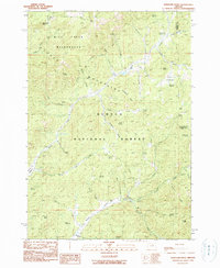
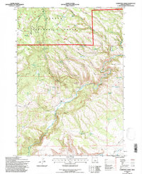
 1990 Ochoco Reservoir1990 Print · USGSCrook County in the early nineties is defined here by its water and forest boundaries, where the reservoir meets the mountains. You can trace the drainage of Johnson Creek into the Ochoco Reservoir or locate features like the Ochoco Dam and the nearby Quarry.
 - 1990 Map of Delintment Lake
 1990 Delintment Lake1990 Print · USGSHarney County in the late twentieth century is shown here as a high-forest landscape defined by the tri-county junction and the Ochocco National Forest. Researchers can trace remote water sources like Delintment Lake and family-named landmarks such as Jimmy McCuen Spring.
 - 1990 Map of Prairie Hill
 1990 Prairie Hill1990 Print · USGSThe Ochoco Mountains of Crook County come to life in this late-twentieth-century survey of the high forest and river valleys. Researchers can trace land use through specific landmarks like Prairie Hill and isolated water sources such as Sheep Rock Spring and Pipe Spring.
 - 1990 Map of Conant Basin
 1990 Conant Basin1990 Print · USGSCrook County ranching and timberlands are captured here in the late twentieth century as the high desert meets the forest. Researchers can trace historic property boundaries and water rights at Kizer Ranch, Adams Ranch, and throughout the Maury Mountains.
 - 1990 Map of Pilot Butte
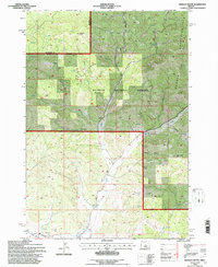
 1990 Pilot Butte1990 Print · USGSCrook County in the late eighties and early nineties is defined here by the winding course of the Crooked River and the forested slopes of the Ochoco Mountains. Researchers can trace old forest boundaries and topographic landmarks like Pilot Butte or remote water features including Dixie Meadows.
 - 1990 Map of Ochoco Butte
 1990 Ochoco Butte1990 Print · USGSThe high Ochoco Mountains come into focus in the 1990s as this survey details the timberlands and headwaters of the Wheeler and Crook county line. Researchers can trace the location of the Old Kelly Mill and locate springs and summits from Ochoco Butte to Walton Lake.
 - 1990 Map of Alkali Flat, 1999 Print
 1990 Alkali Flat1999 Print · USGSCrook County at the close of the twentieth century reveals a landscape where managed water resources meet the high desert. Researchers can trace the small settlement at Roberts, find a local Cem, and locate mineral Prospects near Alkali Flat.
 - 1992 Map of Mule Deer Ridge, 1997 Print
 1992 Mule Deer Ridge1997 Print · USGSIn the high country of Crook County during the early nineties, this area was a hub for forestry and ranching. Trace the locations of the Maury Mtn Mines, family-named water sources like Sherwood Spring, and the reach of Antelope Reservoir.
 - 1992 Map of Delintment Lake, 1997 Print
 1992 Delintment Lake1997 Print · USGSHarney County's high forest lands are captured here in the early nineties, showing a landscape defined by water management and ranching. Trace historical land use through the placement of the Grindstone Reservoir, the Corral, and Jimmy McCuen Spring.
 - 1992 Map of Arrowwood Point, 1997 Print
 1992 Arrowwood Point1997 Print · USGSThe Maury Mountains of central Oregon were meticulously documented in the early nineties, showing a landscape shaped by forest service management and high-country ranching. Researchers can locate the Maury Mtn Cem and several water resources like Poison Creek Reservoir and Jim Reservoir.
 - 1992 Map of Williams Prairie, 1997 Print
 1992 Williams Prairie1997 Print · USGSHigh-altitude grasslands and forest service operations define this Crook County region during the late twentieth century. Researchers can locate the Cold Springs Guard Sta, trace the Arvid Nelson Road, and find isolated landmarks like a mountain Grave.
 - 1992 Map of Hensley Butte, 1997 Print
 1992 Hensley Butte1997 Print · USGSThe Ochoco Mountains in the early nineties show a landscape of high summits and vital irrigation infrastructure. Trace the routes of the Main Canal and Ochoco Canal as they emerge from the rugged drainages of McKay Creek and Rail Hollow.
 - 1992 Map of Committee Creek, 1997 Print
 1992 Committee Creek1997 Print · USGSCentral Oregon's high canyons and forest lands appear in detail during the early nineties. Researchers can trace remote water sources like Old Faithful Reservoir and topographic features including Cabin Butte and Funeral Juniper Ridge.
 - 1992 Map of Gerow Butte, 1997 Print
 1992 Gerow Butte1997 Print · USGSThe Ochoco Mountains in the early nineties were a landscape of remote lookouts and mineral exploration. Researchers can find old mining sites like the Open Pit Mine and Prospects, alongside landmarks like Gerow Butte and the Nelson Monument.
 - 1992 Map of Little Summit Prairie, 1997 Print
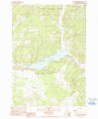
 1992 Little Summit Prairie1997 Print · USGSThe high meadows and volcanic buttes of the Ochoco Mountains are captured here in the early 1990s. Researchers can trace land use through water features like Ruby Reservoir, Morgan Reservoir, and the distinctive Little Summit Prairie.
Showing maps 1-25 of 60
Top cities of Crook County
Frequently asked questions
- What are the different types of historical maps available for Crook County?
- What is the oldest map of Crook County?
- Where can I purchase historical maps of Crook County for my home or office?
- Where can I download high-res historical maps of Crook County?
- Are there historical topographic maps available for Crook County?
- Is there historical aerial imagery available for Crook County?
- Where are historical maps of Crook County sourced from?