Old Maps of Port Orford, Oregon for Hiking & Exploration
Hike through history with 33 historic maps of Port Orford. Explore old trails, ghost towns, and forgotten backroads — perfect for outdoor adventurers and local explorers.
- Rediscover forgotten places: Map out old mining camps, roads, and footpaths that no longer exist on modern maps.
- Layer with modern tools: Combine with LiDAR or satellite views to plan hikes through historical terrain.
- Made for exploration: Popular among hikers, overlanders, and local history lovers.
Use these maps to find adventure and explore the hidden past of Port Orford.
Port Orford, OR maps
(33)- 1899 Map of Port Orford
 1899 Port Orford1899 Print · USGSThe Oregon coast at the end of the nineteenth century was a frontier of maritime trade and rugged interior river settlements. Trace early coastal geography from Cape Blanco to Port Orford, and find isolated communities like Agness and Denmark.
 - 1903 Map of Port Orford
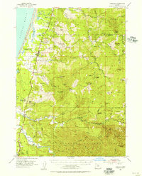
 1903 Port Orford1903 Print · USGSCoastal Curry County at the start of the twentieth century was a landscape of remote mountain outposts and rugged river valleys. Genealogists and historians can trace early settlements like Illahe, Agness, and Frankport, or locate landmarks such as Mountain Well and Floras Lake.7 unique versions available
 - 1954 Map of Coos Bay
 1954 Coos Bay1954 Print · USGSCoastal Oregon at mid-century shows a landscape of timber and tides, from the river ports to the edge of the Pacific. Researchers can trace family roots through coastal schools like Beachview School or follow the Southern Pacific RR through Reedsport and Coos Bay.
 - 1954 Map of Port Orford, 1956 Print
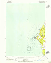
 1954 Port Orford1956 Print · USGSThe Oregon coast at the mid-century mark reveals a landscape of isolated shoreline settlements and dense national forest. Researchers can trace family history through the Cem at Ophir or locate old coastal landmarks like Frankport and the Coast Guard Sta at Port Orford.3 unique versions available
 - 1954 Map of Cape Blanco, 1956 Print
 1954 Cape Blanco1956 Print · USGSCoastal Curry County at the height of the 1950s shows a landscape defined by its maritime hazards and river-mouth agriculture. Researchers can trace the layout of the Cranberry Bogs, the grounds of Cape Blanco State Park, and dozens of named offshore rocks like Best Rock and Seal Rock.3 unique versions available
 - 1954 Map of Langlois, 1956 Print
 1954 Langlois1956 Print · USGSCoastal Curry County in the mid-fifties is a landscape of cranberry agriculture and rugged timberlands. Researchers can trace the early highway settlements of Denmark and Langlois or locate coastal landmarks like Floras Lake and the Cranberry Bogs.3 unique versions available
 - 1958 Map of Coos Bay, 1974 Print
 1958 Coos Bay1974 Print · USGSThe Southern Oregon coastline at mid-century reveals a bustling maritime and timber economy centered on Coos Bay and North Bend. Researchers can trace the legacy of coastal settlements from Bandon to Brookings, including rail lines of the Southern Pacific RR and the rugged reaches of the Siuslaw National Forest.
 - 1962 Map of Coos Bay
 1962 Coos Bay1962 Print · USGSThe Oregon coast at the end of the fifties reveals a landscape of timber ports and fishing villages connected by U.S. Highway 101. Researchers can trace the rail infrastructure of the Southern Pacific RR and locate early settlements from Florence down to Brookings.2 unique versions available
 - 1986 Map of Cape Blanco
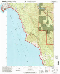
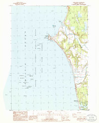 1986 Cape Blanco1986 Print · USGSThe Oregon coast at the mid-eighties reveals a landscape of lighthouse navigation, cranberry farming, and river mouths. Researchers can trace the grounds of the Lighthouse at Cape Blanco, locate the Cem near the cliffs, and map the early layout of Port Orford by Garrison Lake.
 - 1986 Map of Port Orford
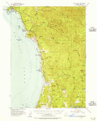
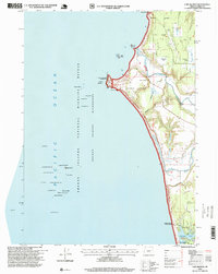
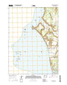
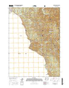
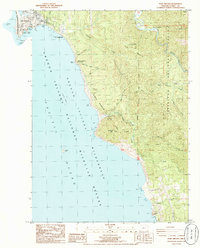 1986 Port Orford1986 Print · USGSCoastal Oregon life in the mid-eighties centered on the harbor at Port Orford and the dramatic shoreline of the Pacific Ocean. Trace local landmarks from the US Coast Guard Station to the Elk River State Fish Hatchery and the peaks of Humbug Mountain.
 - 1986 Map of Sixes
 1986 Sixes1986 Print · USGSCoastal Curry County is documented here in the mid-eighties, where the Sixes River meets the Pacific near rural timberlands. Researchers can locate the Pacific High Sch, the sprawling Cranberry Bogs, and the Port Orford Cedar Forest State Wayside.
 - 1992 Map of Port Orford, 1993 Print
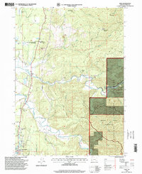
 1992 Port Orford1993 Print · USGSThe southern Oregon coast and the coastal ranges of the early nineties are captured here in both topographic and bathymetric detail. Researchers can trace landforms from the reefs of Oregon Islands to inland landmarks like Bingham Mountain and Albert H Powers Memorial State Park.
 - 1996 Map of Sixes, 1999 Print
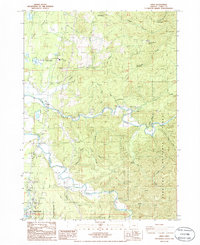
 1996 Sixes1999 Print · USGSThe coastal river valleys of Curry County are shown in the late 1990s as the landscape transitions from the small town of Sixes into deep timber country. Researchers can trace the Sixes River to the Grassy Knob Wilderness and locate the Pacific High School or the Port Orford Cedar Forest State Wayside.
 - 1996 Map of Cape Blanco, 1999 Print
 1996 Cape Blanco1999 Print · USGSThe Oregon coast at its westernmost extremity is captured in the mid-nineties, showing the intersection of maritime heritage and cranberry agriculture. Genealogists and local historians can locate the Lighthouse at Cape Blanco, several Cranberry Bogs, and the northern reaches of Port Orford.
 - 1996 Map of Port Orford, 1999 Print
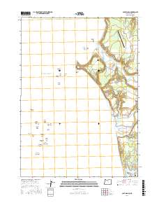
 1996 Port Orford1999 Print · USGSPort Orford and the Southern Oregon coast in the late twentieth century show a landscape shaped by maritime history and conservation. Trace local landmarks like the US Coast Guard Station, Graveyard Point, and the Elk River State Fish Hatchery.
 - 2011 Map of Sixes, 2011 Print
 2011 Sixes2011 Print · USGSCovers Port Orford, including Sixes, Curry County, and other nearby areas
 - 2011 Map of Cape Blanco, 2011 Print
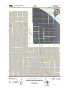
 2011 Cape Blanco2011 Print · USGSCovers Port Orford, including Curry County, United States, and other nearby areas
 - 2011 Map of Port Orford OE W, 2011 Print
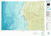
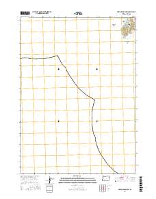
 2011 Port Orford OE W2011 Print · USGSCovers Port Orford, including Curry County, United States, and other nearby areas
 - 2014 Map of Sixes, 2014 Print
 2014 Sixes2014 Print · USGSCovers Port Orford, including Sixes, Curry County, and other nearby areas
 - 2014 Map of Cape Blanco, 2014 Print
 2014 Cape Blanco2014 Print · USGSCovers Port Orford, including Curry County, United States, and other nearby areas
 - 2014 Map of Port Orford OE W, 2014 Print
 2014 Port Orford OE W2014 Print · USGSCovers Port Orford, including Curry County, United States, and other nearby areas
 - 2017 Map of Port Orford OE W, 2017 Print
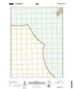
 2017 Port Orford OE W2017 Print · USGSCovers Port Orford, including Curry County, United States, and other nearby areas
 - 2017 Map of Port Orford, 2017 Print
 2017 Port Orford2017 Print · USGSCovers Port Orford, including Curry County, United States, and other nearby areas
 - 2017 Map of Cape Blanco, 2017 Print
 2017 Cape Blanco2017 Print · USGSCovers Port Orford, including Curry County, United States, and other nearby areas
 - 2020 Map of Port Orford OE W, 2020 Print
 2020 Port Orford OE W2020 Print · USGSCovers Port Orford, including Curry County, United States, and other nearby areas
Showing maps 1-25 of 33
Frequently asked questions
- What are the different types of historical maps available for Port Orford?
- What is the oldest map of Port Orford?
- Where can I purchase historical maps of Port Orford for my home or office?
- Where can I download high-res historical maps of Port Orford?
- Are there historical topographic maps available for Port Orford?
- Is there historical aerial imagery available for Port Orford?
- Where are historical maps of Port Orford sourced from?