1920s Maps of Douglas County, Oregon
Explore 4 historic maps of Douglas County from the 1920s. These maps offer a rare glimpse into what life looked like during the 1920s — showing old roads, neighborhoods, homes, and landmarks that have changed or disappeared over time.
Whether you're researching your family's past, planning a metal detecting trip, or studying how Douglas County's landscape evolved across the 1920s, these high-resolution maps are a powerful tool for exploring the history of this region.
- Focus on a specific era: All maps on this page are from the 1920s, giving you a focused view of this time period.
- See what’s changed: Compare century-old streets, trails, and buildings to today's modern landscape using overlays and satellite layers.
- Research with precision: Use these maps for genealogy, historical research, land use analysis, or educational projects.
- View, download, or print: Maps are fully viewable online in high resolution, and can be downloaded or printed for your own records.
Start exploring Douglas County's history through authentic maps from the 1920s. This is your window into the past.
Douglas County, OR maps
(4)- 1920 Map of Siltcoos Lake
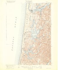 1920 Siltcoos Lake1920 Print · USGSThe Oregon coast at the end of the Great War reveals a landscape of river inlets and timber-driven rail lines. You can trace the Southern Pacific tracks past rural schoolhouses like Idlewild School and old stops at Cushman P.O. or Acme.3 unique versions available
 - 1921 Map of Cottage Grove
 1921 Cottage Grove1921 Print · USGSSouthern Lane County comes alive in this post-World War I survey, showing the valley floor before modern development. Genealogists can locate family homesteads near old schoolhouses like Green Door School or trace the early rail stops at Saginaw and Latham.3 unique versions available
 - 1923 Map of Reedsport
 1923 Reedsport1923 Print · USGSCoastal Oregon thrives in the 1920s as river commerce and rail lines connect the Umpqua estuary to the interior. Trace the old Southern Pacific line past Gardiner Sta or locate rural landmarks like Umpqua LH and Tenmile School.4 unique versions available
 - 1928 Map of Sitkum, 1939 Print
 1928 Sitkum1939 Print · USGSThe Oregon Coast Range in the late twenties was a land of timber and trails, where the Umpqua River met the edge of the Umpqua National Forest. Genealogists and historians can trace early river crossings at Shorts Ferry and follow the route of the Old Coos Trail through Camas Valley.
End of results
Showing maps 1-4 of 4
Top cities of Douglas County
- Roseburg historical maps
- Sutherlin historical maps
- Winston historical maps
- Reedsport historical maps
- Myrtle Creek historical maps
- Canyonville historical maps
See more
Frequently asked questions
- What are the different types of historical maps available for Douglas County?
- What is the oldest map of Douglas County?
- Where can I purchase historical maps of Douglas County for my home or office?
- Where can I download high-res historical maps of Douglas County?
- Are there historical topographic maps available for Douglas County?
- Is there historical aerial imagery available for Douglas County?
- Where are historical maps of Douglas County sourced from?