2000s (21st Century) Maps of Douglas County, Oregon
Explore 627 historic maps of Douglas County from the 2000s (21st Century). These maps offer a rare glimpse into what life looked like during the 2000s — showing old roads, neighborhoods, homes, and landmarks that have changed or disappeared over time.
Whether you're researching your family's past, planning a metal detecting trip, or studying how Douglas County's landscape evolved across the 2000s, these high-resolution maps are a powerful tool for exploring the history of this region.
- Focus on a specific era: All maps on this page are from the 2000s, giving you a focused view of this time period.
- See what’s changed: Compare century-old streets, trails, and buildings to today's modern landscape using overlays and satellite layers.
- Research with precision: Use these maps for genealogy, historical research, land use analysis, or educational projects.
- View, download, or print: Maps are fully viewable online in high resolution, and can be downloaded or printed for your own records.
Start exploring Douglas County's history through authentic maps from the 2000s. This is your window into the past.
Douglas County, OR maps
(627)- 2011 Map of Mount Bolivar, 2011 Print
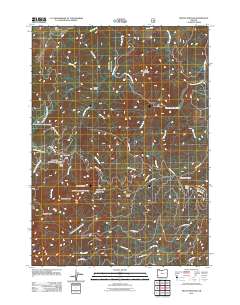 2011 Mount Bolivar2011 Print · USGSCoastal Oregon high country comes into focus in this early 21st-century survey of the Douglas County peaks. Map enthusiasts and hikers can trace the access roads leading to Fuller Mine, locate the remote Cold Spring Camp, or study the headwaters of the South Fork Coquille River.
 - 2011 Map of Abbott Butte, 2011 Print
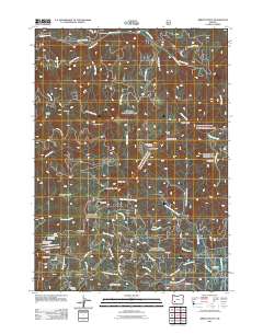 2011 Abbott Butte2011 Print · USGSJackson County’s high timber country is shown here at the start of the decade, dominated by the Abbott Butte Lookout and remote forest camps. Researchers can trace historic access routes like Old Buzzard Mine Rd and explore landmarks like Donegan Prairies and Whaleback.
 - 2011 Map of Thousand Springs, 2011 Print
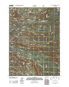 2011 Thousand Springs2011 Print · USGSJackson County’s high forest lands are captured here during the early twenty-first century, showing the complex web of timber roads and mountain streams. Researchers can trace the routes to Sunday Camp and Wagon Camp or follow the waters of Thousand Springs.
 - 2011 Map of Richter Mountain, 2011 Print
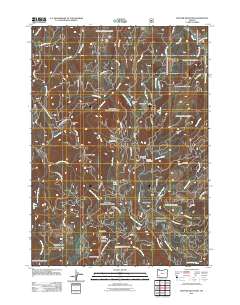 2011 Richter Mountain2011 Print · USGSJackson County's high ridges and mining history are preserved in this 2011 survey of the southern Cascades. Researchers can trace historic extraction sites like the Mammoth Lode Mine and Red Cloud Mine, alongside remote outposts like Richter Cabin.
 - 2011 Map of Miller Lake, 2011 Print
 2011 Miller Lake2011 Print · USGSMiller Lake and its surrounding Douglas County peaks are shown here as they appeared in the early 2010s. Outdoor enthusiasts and local historians can trace the access routes between Digit Point Trailhead, Adell Butte, and several remote water sources like Forked Horn Springs.
 - 2011 Map of Sugarpine Creek, 2011 Print
 2011 Sugarpine Creek2011 Print · USGSJackson County high country in the early twenty-first century is defined by remote timber camps and the rugged drainage of the Rogue River Range. You can trace historical access routes to isolated sites like Buckhorn Cabin, Johns Camp, and the mineral-named Bitter Lick.
 - 2011 Map of Quartz Mountain, 2011 Print
 2011 Quartz Mountain2011 Print · USGSThe Oregon Cascades in the early twenty-first century appear here as a network of timber roads and mountain meadows within Douglas County. You can locate isolated landmarks like the Snowbird Shelter and name several distinct cataracts including Yakso Falls and Hemlock Falls.
 - 2011 Map of Red Butte, 2011 Print
 2011 Red Butte2011 Print · USGSThe timbered highlands of Douglas County are shown here in the early twenty-first century, revealing a landscape of remote lookouts and rugged drainage basins. Trace mountain landmarks like Red Butte Lookout Tower and camps at Shadow Falls or Watson Cabin.
 - 2011 Map of Diamond Lake, 2011 Print
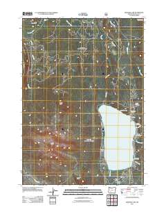 2011 Diamond Lake2011 Print · USGSDiamond Lake and the surrounding High Cascades are captured here in the early twenty-first century. Researchers can locate recreation-era landmarks and camp sites like the Diamond Lake Post Office, Howlock Mountain Horse Camp, and Clearwater Falls.
 - 2011 Map of Hamaker Butte, 2011 Print
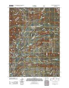 2011 Hamaker Butte2011 Print · USGSThe High Cascades of Douglas County are documented here in the early twenty-first century, showcasing a landscape of timbered ridges and volcanic peaks. Trace the primitive routes along Old Diamond Lake Rd to reach Muir Camp, Soda Spring, and Muir Creek Falls.
 - 2011 Map of Taft Mountain, 2011 Print
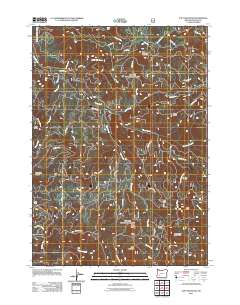 2011 Taft Mountain2011 Print · USGSDouglas County forest lands come into sharp focus during the early twenty-first century, showing the dense network of ridges and drainages. Researchers can trace forest management history through named routes like Boneyard TS and find landmarks such as Camp Grant and Grotto Falls.
 - 2011 Map of Chilcoot Mountain, 2011 Print
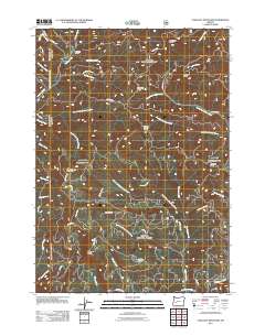 2011 Chilcoot Mountain2011 Print · USGSThe Oregon Cascades at the start of the 2010s are revealed here through a dense network of timber spurs and backcountry trails. Researchers can trace forest access routes to remote landmarks like Bona Fida Shelter, McKinley Rock, and Chilcoot Mountain.
 - 2011 Map of Dumont Creek, 2011 Print
 2011 Dumont Creek2011 Print · USGSDouglas County’s timberlands and river valleys are captured here in the early twenty-first century as the forest service road network matured. You can trace the rugged drainages of the South Umpqua River and locate landmarks like Campbell Falls and Hob Knob.
 - 2011 Map of Pumice Desert East, 2011 Print
 2011 Pumice Desert East2011 Print · USGSCrater Lake's northern gateway and the surrounding high Cascades are documented here in the early twenty-first century. Researchers can trace forest access routes and geographic landmarks like Summit Rock, the Pumice Desert, and Tiny Creek.
 - 2011 Map of Mace Mountain, 2011 Print
 2011 Mace Mountain2011 Print · USGSDouglas County forest lands are captured here in the early twenty-first century, centered on the North Umpqua River and its timber-producing tributaries. Trace local landmarks like Jobs Garden, the secluded Emile Falls, and high peaks including Gobblers Knob.
 - 2011 Map of Reynolds Ridge, 2011 Print
 2011 Reynolds Ridge2011 Print · USGSThe high country of the Calapooya Mountains is shown here in the early twenty-first century, featuring a dense network of timber roads and remote backcountry outposts. Researchers can trace forest management history through sites like the Reynolds Ridge Lookout, Slim Chance Campground, and the City Creek Shelter.
 - 2011 Map of Fish Creek Desert, 2011 Print
 2011 Fish Creek Desert2011 Print · USGSThe high timber country of Douglas County is shown here in the early twenty-first century, detailing the forest service infrastructure and water systems of the Umpqua region. Researchers can locate remote waypoints and landmarks like French Junction, the Toketee- US Forest Service Airfield, and the dramatic Watson Falls.
 - 2011 Map of Mount Thielsen, 2011 Print
 2011 Mount Thielsen2011 Print · USGSThe Oregon High Cascades are shown here in the early twenty-first century, centered on the heights of the recreation area. Outdoor enthusiasts and researchers can trace the drainages of Thielsen Creek and Cottonwood Creek or locate landmarks like Thielsen Camp and Wits End.
 - 2011 Map of Tolo Mountain, 2011 Print
 2011 Tolo Mountain2011 Print · USGSDouglas County’s high volcanic ridges and alpine basins are captured in the early 21st century, showing a landscape defined by seasonal access and water. Trace the routes through Windigo Pass and locate remote landmarks like Slim Prairie and Kelsay Valley Horse Camp.
 - 2011 Map of Garwood Butte, 2011 Print
 2011 Garwood Butte2011 Print · USGSDouglas County’s high timber country in the Cascades is captured here in the early twenty-first century. Researchers can locate remote forest infrastructure like the Skookum Prairie Lookout, the Dog Prairie Shelter, and the historical site of Old Man Camp.
 - 2011 Map of Silica Mountain, 2011 Print
 2011 Silica Mountain2011 Print · USGSThe high ridges of the Oregon Cascades foothills come into focus in the early twenty-first century. Trace the old network of timber and access roads near Silica Camp, Calapooya Divide, and the many drainages feeding East Fork Mosby Creek.
 - 2011 Map of Fish Mountain, 2011 Print
 2011 Fish Mountain2011 Print · USGSDouglas County’s high Cascade wilderness is documented in the early twenty-first century, showing a landscape of named peaks and forest drainages. Researchers can locate the Fish Creek Shelter and trace the roads leading to Bear Camp, Rabbit Ears, and Castle Rock.
 - 2011 Map of Staley Ridge, 2011 Print
 2011 Staley Ridge2011 Print · USGSThe Willamette National Forest in the early twenty-first century is a landscape of high ridges and isolated prairies accessed by an intricate forest road system. Local history researchers can trace the locations of Bog Camp Cabin, Loletta Lakes, and named clearings like Bristow Prairie.
 - 2011 Map of Potter Mountain, 2011 Print
 2011 Potter Mountain2011 Print · USGSThe high ridges and hydroelectric corridors of Douglas County are documented here in the early twenty-first century. Researchers can trace the plumbing of the North Umpqua River via the Lemolo Number 2 Canal and locate remote landmarks like Winter Knight Camp or Watson Butte.
 - 2011 Map of Deadman Mountain, 2011 Print
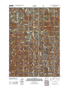 2011 Deadman Mountain2011 Print · USGSDouglas County’s high-elevation timber and mining lands are recorded here in the early 2000s, showing a landscape defined by forestry and resource extraction. Researchers can locate the Umpqua Mine, trace the road network around Deadman Mountain, and find the Windy Camp Lookout.
Showing maps 1-25 of 627
Top cities of Douglas County
- Roseburg historical maps
- Sutherlin historical maps
- Winston historical maps
- Reedsport historical maps
- Myrtle Creek historical maps
- Canyonville historical maps
See more
Frequently asked questions
- What are the different types of historical maps available for Douglas County?
- What is the oldest map of Douglas County?
- Where can I purchase historical maps of Douglas County for my home or office?
- Where can I download high-res historical maps of Douglas County?
- Are there historical topographic maps available for Douglas County?
- Is there historical aerial imagery available for Douglas County?
- Where are historical maps of Douglas County sourced from?