1900s (20th Century) Maps of Douglas County, Oregon
Explore 255 historic maps of Douglas County from the 1900s (20th Century). These maps offer a rare glimpse into what life looked like during the 1900s — showing old roads, neighborhoods, homes, and landmarks that have changed or disappeared over time.
Whether you're researching your family's past, planning a metal detecting trip, or studying how Douglas County's landscape evolved across the 1900s, these high-resolution maps are a powerful tool for exploring the history of this region.
- Focus on a specific era: All maps on this page are from the 1900s, giving you a focused view of this time period.
- See what’s changed: Compare century-old streets, trails, and buildings to today's modern landscape using overlays and satellite layers.
- Research with precision: Use these maps for genealogy, historical research, land use analysis, or educational projects.
- View, download, or print: Maps are fully viewable online in high resolution, and can be downloaded or printed for your own records.
Start exploring Douglas County's history through authentic maps from the 1900s. This is your window into the past.
Douglas County, OR maps
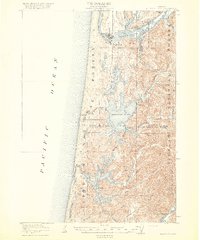
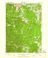
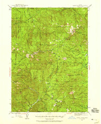
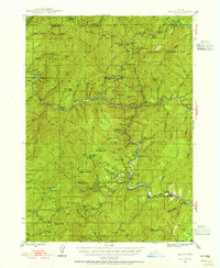
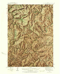
(255)- 1900 Map of Roseburg
 1900 Roseburg1900 Print · USGSDouglas County at the turn of the century shows a landscape transitioning through the arrival of the Southern Pacific railroad. Genealogists and local historians can trace early river crossings like Lone Rock Ferry and explore the layouts of Oakland, Winchester, and Myrtle Creek.5 unique versions available
 - 1904 Map of Riddle
 1904 Riddle1904 Print · USGSSouthern Oregon's mining and railroad corridor is captured here at the start of the twentieth century. Genealogists can trace family footprints through early settlements like Riddles and Galesville or locate specific claims like the Placer Star Mine.5 unique versions available
 - 1917 Map of Diamond Lake
 1917 Diamond Lake1917 Print · USGSThe high Cascades of Douglas and Klamath Counties are captured here just before the First World War. Local historians and hikers can trace early forest service outposts like Higdon Ranger Sta and remote routes including the Ft Klamath Road and Bradley Trail.3 unique versions available
 - 1919 Map of Earl
 1919 Earl1919 Print · USGSThe Oregon Coast Range in the years after the Great War shows a landscape of isolated homesteads and river-carved canyons. Researchers can trace early family sites like Fiske Ranch and Stokes Ranch or locate remote rural schoolhouses such as Sulphur Springs School.
 - 1920 Map of Siltcoos Lake
 1920 Siltcoos Lake1920 Print · USGSThe Oregon coast at the end of the Great War reveals a landscape of river inlets and timber-driven rail lines. You can trace the Southern Pacific tracks past rural schoolhouses like Idlewild School and old stops at Cushman P.O. or Acme.3 unique versions available
 - 1921 Map of Cottage Grove
 1921 Cottage Grove1921 Print · USGSSouthern Lane County comes alive in this post-World War I survey, showing the valley floor before modern development. Genealogists can locate family homesteads near old schoolhouses like Green Door School or trace the early rail stops at Saginaw and Latham.3 unique versions available
 - 1923 Map of Reedsport
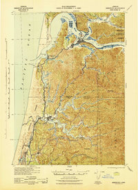
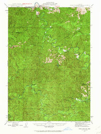
 1923 Reedsport1923 Print · USGSCoastal Oregon thrives in the 1920s as river commerce and rail lines connect the Umpqua estuary to the interior. Trace the old Southern Pacific line past Gardiner Sta or locate rural landmarks like Umpqua LH and Tenmile School.4 unique versions available
 - 1928 Map of Sitkum, 1939 Print
 1928 Sitkum1939 Print · USGSThe Oregon Coast Range in the late twenties was a land of timber and trails, where the Umpqua River met the edge of the Umpqua National Forest. Genealogists and historians can trace early river crossings at Shorts Ferry and follow the route of the Old Coos Trail through Camas Valley.
 - 1935 Map of Lowell
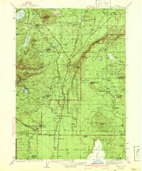
 1935 Lowell1935 Print · USGSIn the mid-1930s, this region of the Willamette foothills was a busy landscape of timber and rail. Researchers can trace rural school districts like Unity Sch, small post offices at Fall Creek PO, and the path of the Southern Pacific railroad.
 - 1935 Map of Chemult
 1935 Chemult1935 Print · USGSUpper Klamath County in the mid-1930s was a landscape defined by industrial logging camps and high-desert rail sidings. Researchers can locate vanished timber operations like Pelican Bay Lumber Co Camp No 2 and remote outposts such as Rosedale and Paunina.5 unique versions available
 - 1941 Map of Chemult
 1941 Chemult1941 Print · USGSUpper Klamath County in the mid-1930s is a landscape of high-altitude timber camps and critical rail junctions. Genealogy researchers can trace remote family holdings and logging outposts like Hoey Ranch, Beaver Marsh, and Lumber Camp 2 along the competing railroad lines.2 unique versions available
 - 1941 Map of Siltcoos Lake, 1958 Print
 1941 Siltcoos Lake1958 Print · USGSThe Oregon coast at the onset of World War II was a landscape of timber, dunes, and vital freshwater lakes. Researchers can trace the early path of the Oregon Coast Highway past Idlewilde Sch and through settlements like Westlake and Cushman.
 - 1942 Map of Lowell
 1942 Lowell1942 Print · USGSThe Willamette River valley and the foothills of the Cascades are captured here before the construction of major dams and reservoirs. Genealogists can trace family locations at the Smithson Homestead, early schools like Unity Sch, and the remote Bohemia Post Office.3 unique versions available
 - 1942 Map of Siltcoos Lake
 1942 Siltcoos Lake1942 Print · USGSCoastal Lane County at the start of the 1940s reveals a landscape of massive freshwater lakes and timber-rich national forest. Genealogists and historians can trace the rail stops at Cushman and Ada Sta or locate family landmarks near Siltcoos Lake and the Siuslaw River.
 - 1942 Map of Reedsport
 1942 Reedsport1942 Print · USGSThe Oregon coast at the onset of the 1940s reveals a landscape shaped by the Umpqua River and the Southern Pacific railroad. Genealogists and historians can trace old school sites like Scholfield Sch and find early landmarks including the Umpqua River LH and Lakeside.2 unique versions available
 - 1942 Map of Crow, 1960 Print
 1942 Crow1960 Print · USGSLane and Douglas counties appear here during the early war years, showing a landscape shaped by timber management and remote ranching. Genealogists can locate family landmarks like Gillespie Corners, Hadleyville Sch, and the South Fork Guard Sta.2 unique versions available
 - 1942 Map of Roman Nose Mtn, 1962 Print
 1942 Roman Nose Mtn1962 Print · USGSThe Oregon Coast Range during the early 1940s is revealed here as a landscape of isolated homesteads and river-carved valleys. Researchers can locate remote schools like Alma Sch, the Southern Pacific rail line, and family landmarks including Hess Ranch and Luce Place.2 unique versions available
 - 1943 Map of Goodwin Peak
 1943 Goodwin Peak1943 Print · USGSCoastal range wilderness and isolated homesteads define this mid-century survey of the Lane and Douglas County line. Genealogists and researchers can locate family-named sites like Townsend Ranch, the North Fork Sch, and landmarks such as Smith River Falls.3 unique versions available
 - 1944 Map of Tiller, 1946 Print
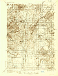
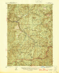 1944 Tiller1946 Print · USGSDouglas County and Jackson County meet along high ridges during the mid-1940s, where remote ranching and timber mills defined the South Umpqua valley. Researchers can trace family homesteads like Lucas Ranch or search for old industrial sites such as the Banfield Mine and Old Johnson Mill.5 unique versions available
 - 1944 Map of Abbott Butte, 1958 Print
 1944 Abbott Butte1958 Print · USGSSouthern Oregon's high timber country is documented here in the mid-1940s, showing the intersection of the Rogue River and Umpqua National Forests. Genealogists and historians can trace isolated mountain life through Ash Homestead, the Al Sarena (Buzzard) Mine, and several historic ranger stations.3 unique versions available
 - 1945 Map of Crow
 1945 Crow1945 Print · USGSThe rural borderlands of Lane and Douglas Counties appear here at the height of the mid-century timber era. Genealogists and historians can trace family-named landmarks and remote outposts such as Gillespie Corners, Hadleyville Sch, and the Wolf Creek Store.
 - 1945 Map of Roman Nose Mtn
 1945 Roman Nose Mtn1945 Print · USGSCoastal Oregon's winding river valleys and timberlands are captured here during the mid-1940s, showing a remote landscape of forest guard stations and isolated homesteads. Researchers can locate family-named landmarks like Luce Place and Hess Ranch, or trace the Southern Pacific line through Linslaw.2 unique versions available
 - 1946 Map of Galice, 1955 Print
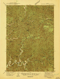
 1946 Galice1955 Print · USGSSouthern Oregon's Rogue River corridor is documented here in the mid-forties, highlighting a period when gold mining and forest service outposts defined the region. Researchers can trace the heritage of local claims like the Almeda Mine and settlements such as Galice and Rand.4 unique versions available
 - 1946 Map of Dutchman Butte, 1958 Print
 1946 Dutchman Butte1958 Print · USGSThe high timber country of Douglas and Josephine counties is captured here in the mid-1940s during the height of fire-watch forestry. Researchers can trace the early Pacific Trail and locate isolated outposts like the Dutchman Butte Lookout and Bradford Warden Sta.6 unique versions available
 - 1947 Map of Abbott Butte
 1947 Abbott Butte1947 Print · USGSThe Oregon Cascades during the 1940s reveal a high-country landscape of ranger stations, mining claims, and early homesteads. Researchers can locate remote sites like the Al Sarena (Buzzard) Mine and the Ash Homestead or trace the Rogue River Trail.2 unique versions available
Showing maps 1-25 of 255
Top cities of Douglas County
- Roseburg historical maps
- Sutherlin historical maps
- Winston historical maps
- Reedsport historical maps
- Myrtle Creek historical maps
- Canyonville historical maps
See more
Frequently asked questions
- What are the different types of historical maps available for Douglas County?
- What is the oldest map of Douglas County?
- Where can I purchase historical maps of Douglas County for my home or office?
- Where can I download high-res historical maps of Douglas County?
- Are there historical topographic maps available for Douglas County?
- Is there historical aerial imagery available for Douglas County?
- Where are historical maps of Douglas County sourced from?