1990s Maps of Douglas County, Oregon
Explore 74 historic maps of Douglas County from the 1990s. These maps offer a rare glimpse into what life looked like during the 1990s — showing old roads, neighborhoods, homes, and landmarks that have changed or disappeared over time.
Whether you're researching your family's past, planning a metal detecting trip, or studying how Douglas County's landscape evolved across the 1990s, these high-resolution maps are a powerful tool for exploring the history of this region.
- Focus on a specific era: All maps on this page are from the 1990s, giving you a focused view of this time period.
- See what’s changed: Compare century-old streets, trails, and buildings to today's modern landscape using overlays and satellite layers.
- Research with precision: Use these maps for genealogy, historical research, land use analysis, or educational projects.
- View, download, or print: Maps are fully viewable online in high resolution, and can be downloaded or printed for your own records.
Start exploring Douglas County's history through authentic maps from the 1990s. This is your window into the past.
Douglas County, OR maps
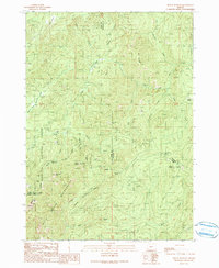
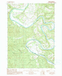
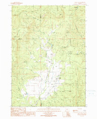
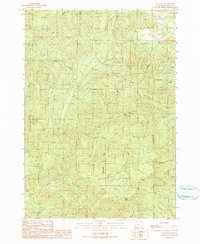
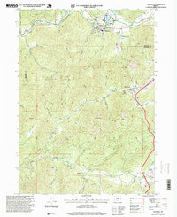
(74)- 1990 Map of Rabbit Mountain
 1990 Rabbit Mountain1990 Print · USGSDouglas County’s rugged interior is documented here in the late twentieth century as timber and mining roads crisscross the ridges. Researchers can identify former habitation points like Cow Creek (Site) and Brandt (Site) or trace the winding course of the West Fork.
 - 1990 Map of Cedar Creek
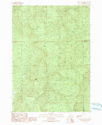
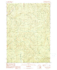
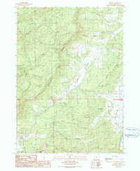
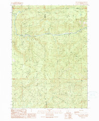
 1990 Cedar Creek1990 Print · USGSThe Oregon Coast Range at the turn of the 1990s was a landscape of deep drainages and limited back-roads access. Researchers can trace the rugged intersection of the Williams River and Cedar Creek, or locate high points like Green Peak and the remote 4WD trails.
 - 1990 Map of Mount Bolivar
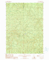
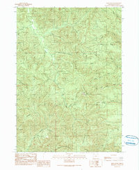
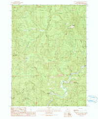
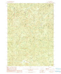
 1990 Mount Bolivar1990 Print · USGSThe Oregon Coast Range at the turn of the 1990s reveals a landscape of protected wilderness and legacy resource extraction. Researchers can locate remote mining sites like Fuller Mine and trace the headwaters of the South Fork Coquille River near Mount Bolivar.
 - 1990 Map of Tenmile
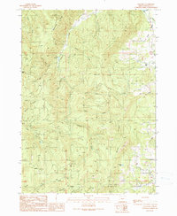
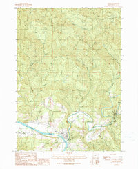
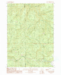
 1990 Tenmile1990 Print · USGSDouglas County’s rural valleys come into focus in the early nineties, showing a landscape defined by water and family history. Researchers can locate the Ben Irving Reservoir, tracing old homesteads near Byron and cemeteries like McGuire Cemetery and McCulloch Cemetery.
 - 1990 Map of Kenyon Mountain
 1990 Kenyon Mountain1990 Print · USGSThe Oregon Coast Range at the start of the nineties is captured here, showing the ridgelines along the COOS CO and DOUGLAS CO line. Researchers can locate the Radio Facility Camas Lookout and trace the paths of Sandy Creek or Upper Rock Creek.
 - 1990 Map of Ivers Peak
 1990 Ivers Peak1990 Print · USGSThe rugged timberlands along the Coos and Douglas county border are documented here in the late twentieth century. Researchers can trace the steep drainages of the East Fork Millicoma River and find evidence of industry at the Quarry or Tailings.
 - 1990 Map of Callahan
 1990 Callahan1990 Print · USGSThe timberlands of Douglas County are captured here in the final decade of the millennium, showing a landscape defined by forestry and ridge-top lookouts. Researchers can trace the layout of Callahan, locate the remote Lookout Tower, or explore the drainages around Coles Valley and Grier Reservoir.
 - 1990 Map of Kellogg
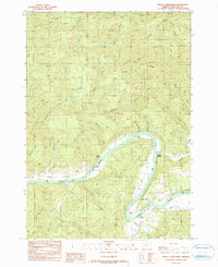
 1990 Kellogg1990 Print · USGSThe Umpqua River dominates this Douglas County landscape during the 1990s, where the community of Kellogg sits within a dramatic horseshoe bend. Family historians can locate specific landmarks like the Dimmick Cemetery, Kellogg Grange Hall, and Smith Ferry Rapids.
 - 1990 Map of Chipmunk Ridge
 1990 Chipmunk Ridge1990 Print · USGSCoastal range timberlands in Douglas County are shown here as they were managed in the late eighties. Researchers can trace the 4WD networks through Chipmunk Ridge or locate specific natural landmarks like Buck Spring and Big Dutchman Butte.
 - 1990 Map of Kelly Butte
 1990 Kelly Butte1990 Print · USGSDouglas County’s high ridges and drainage networks are captured in detail in the late twentieth century. Genealogists and local historians can trace the locations of the Kelly Butte Lookout Tower, Bateman 2 Lookout Tower, and Bear Quarry.
 - 1990 Map of Elkton
 1990 Elkton1990 Print · USGSThe Umpqua River and Elk Creek wind through Douglas County in the 1990s, centering on the town of Elkton. Researchers can trace old family sites near Grubbe, locate the Cem, and explore the terrain around Elk Creek Tunnel State Park.
 - 1990 Map of Camas Valley
 1990 Camas Valley1990 Print · USGSCamas Valley sits at the meeting of the Coquille River forks in the final decade of the twentieth century. Genealogists can locate several historic family plots including Martindale Cemetery, Murry Cemetery, and the Day Cemetery.
 - 1990 Map of Reston
 1990 Reston1990 Print · USGSThe rural settlement of Reston and its surrounding valleys are captured here during the late 1980s. Local researchers can trace old timber and ranching access through landmarks like the Quarry, Eagle Rock, and the waters of Lookingglass Creek.
 - 1990 Map of Dutchman Butte
 1990 Dutchman Butte1990 Print · USGSThe Douglas and Josephine county lines meet in this high timber country during the late twentieth century. Trace the rugged drainage of West Fork Cow Creek to find remote landmarks like Dutchman Lookout, Ninemile Spring, and the Goat Trail.
 - 1990 Map of Live Oak Mountain
 1990 Live Oak Mountain1990 Print · USGSDouglas County’s river-carved interior is captured here during the late twentieth century, showing a landscape of steep timbered ridges and small riverside outposts. Researchers can locate remote sites like Byers and Peck along Cow Creek, or trace the historical Dads Creek (Site) near Iron Mountain.
 - 1990 Map of Mount Gurney
 1990 Mount Gurney1990 Print · USGSThe Douglas and Coos county line crosses a landscape of deep timber and high ridges in the late twentieth century. Genealogists and local historians can trace family-named landmarks and recreation sites like Severt Iverson Memorial County Park, Tioga, and the heights of Mount Gurney.
 - 1990 Map of Old Blue
 1990 Old Blue1990 Print · USGSDouglas County’s timber and creek lands are captured here during the 1990s as the modern road network matured. Genealogists and hikers can trace the paths around Old Blue Lookout Tower, Rainy Peak, and the industrial footprint of the local Quarry.
 - 1990 Map of Tyee
 1990 Tyee1990 Print · USGSThe Umpqua River valley in Douglas County is captured here in the early 1990s, showing a landscape shaped by river bends and steep ridges. You can trace the small communities of Tyee and Millwood alongside river landmarks like Myrtle Island and Golden Bar.
 - 1990 Map of Bone Mountain
 1990 Bone Mountain1990 Print · USGSCoastal mountain timberlands in the late eighties and early nineties are shown here at the Coos and Douglas county line. Researchers can trace forest management through numerous quarries, the Bear Creek Campground, and landmarks like Bone Mountain and Ketchin Butte.
 - 1990 Map of Tioga
 1990 Tioga1990 Print · USGSThe Coos and Douglas county borderlands come into focus in the early nineties, showing a landscape defined by timber access and river forks. Researchers can trace the rugged network of logging roads connecting Farrin Camp, Tioga, and the South Fork Coos River.
 - 1990 Map of Devils Graveyard
 1990 Devils Graveyard1990 Print · USGSThe Umpqua River loops through Douglas County during the late twentieth century, showing a landscape defined by its timbered ridges and river-bottom flats. Researchers can locate specific river landmarks like Sawyers Ferry, Paradise, and the Scott Creek County Park.
 - 1996 Map of King Mountain, 1999 Print
 1996 King Mountain1999 Print · USGSThe high peaks of southern Oregon were a hub for mineral exploration and modern communications in the mid-1990s. Genealogists and historians can trace old mining claims and landmarks like Quartzmill Peak, Ark Prairie, and a Placer Mine along Grave Creek.
 - 1996 Map of Glendale, 1999 Print
 1996 Glendale1999 Print · USGSThe rugged canyonlands of southern Oregon are captured here in the late twentieth century, showing the mining and timber landscapes of Glendale and Wolf Creek. Researchers can locate historic gold claims like Steam Beer Placer and Glory Hole Placer, or trace local landmarks such as the Covered Bridge.
 - 1996 Map of Golden, 1999 Print
 1996 Golden1999 Print · USGSThe mining camps of Golden and Sunny Valley are shown here as the nineteenth-century extraction era transitioned into modern forestry management. Researchers can trace numerous historic claims and lodes, including the Greenback Mine, MacAbee Mine, and Oro Grande Mine.
 - 1997 Map of Rigdon Point, 1998 Print
 1997 Rigdon Point1998 Print · USGSThe Oregon backcountry near the Lane and Douglas county line is captured here in the late 1990s. Researchers can trace forest development and water resources through landmarks like Indigo Springs, Lighthouse Rock, and several industrial Quarry sites.
Showing maps 1-25 of 74
Top cities of Douglas County
- Roseburg historical maps
- Sutherlin historical maps
- Winston historical maps
- Reedsport historical maps
- Myrtle Creek historical maps
- Canyonville historical maps
See more
Frequently asked questions
- What are the different types of historical maps available for Douglas County?
- What is the oldest map of Douglas County?
- Where can I purchase historical maps of Douglas County for my home or office?
- Where can I download high-res historical maps of Douglas County?
- Are there historical topographic maps available for Douglas County?
- Is there historical aerial imagery available for Douglas County?
- Where are historical maps of Douglas County sourced from?