1950s Maps of Douglas County, Oregon
Explore 42 historic maps of Douglas County from the 1950s. These maps offer a rare glimpse into what life looked like during the 1950s — showing old roads, neighborhoods, homes, and landmarks that have changed or disappeared over time.
Whether you're researching your family's past, planning a metal detecting trip, or studying how Douglas County's landscape evolved across the 1950s, these high-resolution maps are a powerful tool for exploring the history of this region.
- Focus on a specific era: All maps on this page are from the 1950s, giving you a focused view of this time period.
- See what’s changed: Compare century-old streets, trails, and buildings to today's modern landscape using overlays and satellite layers.
- Research with precision: Use these maps for genealogy, historical research, land use analysis, or educational projects.
- View, download, or print: Maps are fully viewable online in high resolution, and can be downloaded or printed for your own records.
Start exploring Douglas County's history through authentic maps from the 1950s. This is your window into the past.
Douglas County, OR maps
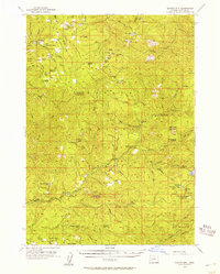
(42)- 1954 Map of Coos Bay
 1954 Coos Bay1954 Print · USGSCoastal Oregon at mid-century shows a landscape of timber and tides, from the river ports to the edge of the Pacific. Researchers can trace family roots through coastal schools like Beachview School or follow the Southern Pacific RR through Reedsport and Coos Bay.
 - 1954 Map of Bone Mountain, 1955 Print
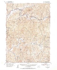
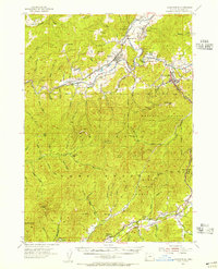
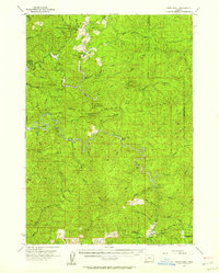
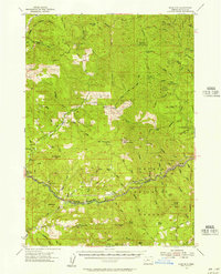
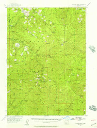
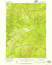 1954 Bone Mountain1955 Print · USGSThe timber-rich backcountry of Coos and Douglas counties is seen here in the mid-fifties, during the height of the region's logging era. Researchers can trace old forest outposts and industry landmarks like Camp No 2, the Wooden Rock Guard Sta, and the Fuller Mine.2 unique versions available
 - 1954 Map of Dixonville, 1956 Print
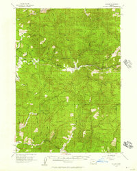
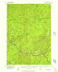
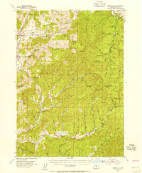 1954 Dixonville1956 Print · USGSDouglas County in the mid-fifties shows a rugged landscape of timber and mining between Dixonville and the Umpqua National Forest. Genealogists and local historians can trace family locations near the Cedar Grove Church, North Myrtle School, and early mining operations like the Continental Mine.2 unique versions available
 - 1954 Map of Sutherlin, 1956 Print
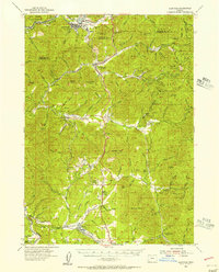
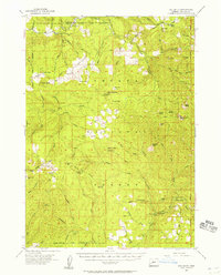
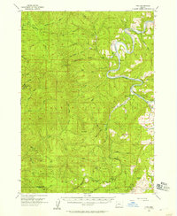
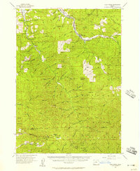
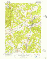 1954 Sutherlin1956 Print · USGSDouglas County in the mid-1950s shows a region defined by the meeting of the North and South Umpqua Rivers and a growing timber economy. Researchers can locate vanished landmarks and family sites like Eden Ch, the Camas Logging RR, and the community of Stephens.3 unique versions available
 - 1954 Map of Drain, 1956 Print
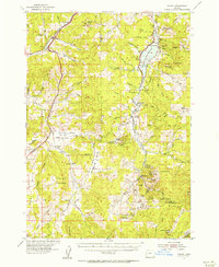
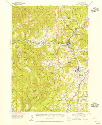 1954 Drain1956 Print · USGSDouglas County’s timber and rail corridors come alive in this mid-fifties study of the northern Umpqua basin. Genealogists can trace several vanished rural hubs like the Cold Spring Sch or locate family plots at the Applegate Cemetery.2 unique versions available
 - 1954 Map of Days Creek, 1956 Print
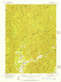
 1954 Days Creek1956 Print · USGSThe South Fork Umpqua River valley is shown in the mid-1950s as a landscape of remote mountain lookouts and small riverside communities. Local historians can locate early landmarks like Lavadoure Community Hall, the Mallery Mine, and the Galesville School.3 unique versions available
 - 1954 Map of Glendale, 1956 Print
 1954 Glendale1956 Print · USGSThe timber and mining country of Douglas and Josephine Counties is captured here in the mid-fifties, centered on the Southern Pacific line. You can trace the lineage of local claims at the Greenback Mine and Steam Beer Placer or find the sites of the Merlin Sanitarium and Aman Ranch.3 unique versions available
 - 1954 Map of Anlauf, 1956 Print
 1954 Anlauf1956 Print · USGSThe Southern Pacific railroad and the Calapooya Divide define this Douglas County landscape in the mid-1950s. Trace old mercury mining operations at Elkhead Mines, locate the Anlauf Cemetery, or follow the early boundaries of the Cottage Grove Reservoir.3 unique versions available
 - 1954 Map of Wimer, 1956 Print
 1954 Wimer1956 Print · USGSSouthern Oregon's timber and mountain country comes to life in the mid-fifties as the forest service network expands. Local historians can trace early rural life at Wimer, the Evans Valley Sch, and remote outposts like Salt Creek Guard Sta.3 unique versions available
 - 1954 Map of Canyonville, 1956 Print
 1954 Canyonville1956 Print · USGSSouthern Douglas County at mid-century shows a landscape shaped by timber, mining, and the vital rail corridor of the Southern Pacific. Researchers can trace the development of Riddle and Canyonville, locate the industrial site at Nickel Mine, and identify historical locations like Galesville.2 unique versions available
 - 1954 Map of Glide, 1957 Print
 1954 Glide1957 Print · USGSDouglas County’s timber and river country is captured in the mid-1950s, showing the early infrastructure of the North Umpqua valley. Researchers can trace the Private Logging Railroad, the Rock Creek Fish Hatchery, and rural centers like English Settlement and Glide.3 unique versions available
 - 1955 Map of Camas Valley, 1957 Print
 1955 Camas Valley1957 Print · USGSDouglas County’s timber country comes into focus in the mid-1950s, showing the networks of water and road that sustained these mountain communities. Researchers can locate early family burial sites like Noah Cem and Patterson Cemetery or trace the early paths of Wagon Road and Callahan Rd.3 unique versions available
 - 1955 Map of Scottsburg, 1957 Print
 1955 Scottsburg1957 Print · USGSCoastal Oregon's timber and river country is recorded here in the mid-fifties, centered on the historic river landing of Scottsburg. Researchers can trace the early footprints of the Elliott State Forest and locate specific landmarks like Loon Lake, Ash Valley, and Elk Peak.3 unique versions available
 - 1955 Map of Quartz Mtn, 1957 Print
 1955 Quartz Mtn1957 Print · USGSDouglas County forest lands come into sharp focus in the mid-fifties, showing the high-country lookouts and river ranches of the Cascades. Researchers can trace remote sites like Erlsbach Ranch, South Umpqua Guard Sta, and Acker Rock Lookout.2 unique versions available
 - 1955 Map of Ivers Peak, 1957 Print
 1955 Ivers Peak1957 Print · USGSThe Oregon Coast Range is captured here in the mid-1950s, showing a rugged landscape of state parks and timber outposts. Trace the remote Tioga Guard Station, the Coos River Fish Hatchery, and landmarks like Golden Falls.3 unique versions available
 - 1955 Map of Sitkum, 1957 Print
 1955 Sitkum1957 Print · USGSThe Oregon backcountry in the mid-1950s was a network of timbered ridges and river-dependent settlements. Researchers can trace the early road systems through Sitkum and Dora, locating fire watch points like Brewster Rock Lookout and Kenyon Lookout.3 unique versions available
 - 1955 Map of Red Butte, 1957 Print
 1955 Red Butte1957 Print · USGSMid-century Douglas County reveals a landscape of high-altitude forest camps and mining claims within the Umpqua National Forest. Researchers can trace old mountain infrastructure like Wolf Creek Guard Sta, remote shelters, and historical workings at the Umpqua Mine.2 unique versions available
 - 1955 Map of Mace Mtn, 1957 Print
 1955 Mace Mtn1957 Print · USGSThe Umpqua National Forest in the 1950s was a hub of forest service activity and early mountain recreation. Researchers can trace historic outposts and campsites like the Rock Cr Guard Sta, Old Fairview, and Smith Springs Campground.2 unique versions available
 - 1955 Map of Illahee Rock, 1957 Print
 1955 Illahee Rock1957 Print · USGSUpper Douglas County in the mid-1950s was a landscape of forest service outposts and remote mountain camps along the river. Researchers can trace early backcountry locations like Illahee Guard Sta, the settlement of Steamboat, and the Winslow Cabin Spring.3 unique versions available
 - 1955 Map of Tyee, 1957 Print
 1955 Tyee1957 Print · USGSThe winding Umpqua River and the timbered ridges of Douglas County are captured here in the mid-fifties. Local historians can trace the early riverside settlements of Tyee and Millwood or locate the fire lookouts at Bateman Lookout and Kelly Butte.3 unique versions available
 - 1955 Map of Roseburg, 1957 Print
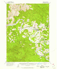
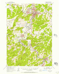 1955 Roseburg1957 Print · USGSMid-century Douglas County comes to life through this record of the river valleys south of Roseburg. Genealogists and historians can trace family locations near Melrose Cem, identify old school sites like Green School, or locate the Sawmill and Southern Pacific rail stops that drove the local timber economy.4 unique versions available
 - 1955 Map of Fairview Peak, 1957 Print
 1955 Fairview Peak1957 Print · USGSThe Oregon Cascades mining districts come to life in this mid-1950s survey of the Bohemia and Fairview mountain areas. Genealogists and researchers can trace the roads and trails leading to the Champion Mine, Musick Guard Station, and the Laying Creek Ranger Station.3 unique versions available
 - 1955 Map of Elkton, 1957 Print
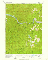
 1955 Elkton1957 Print · USGSThe Umpqua River bends sharply through Douglas County in the mid-1950s, anchoring a landscape of timber and river-bottom settlements. Researchers can trace local genealogy and land use through Kellogg Grange Cem, the Elk Creek Guard Sta, and the historic Elkton township.2 unique versions available
 - 1955 Map of Culp Creek, 1957 Print
 1955 Culp Creek1957 Print · USGSEastern Lane County in the mid-fifties is defined by the logging and rail corridor along the Row River. Researchers can trace the path of the Oregon and Eastern Railroad through settlements like Dorena and Disston, and locate landmarks like the Broumbaugh Cem.3 unique versions available
 - 1955 Map of Crescent, 1963 Print
 1955 Crescent1963 Print · USGSCentral Oregon in the mid-1950s was a landscape of dense national forests and high desert expanses. Researchers can trace timber-era settlements like Gilchrist and Crescent or locate remote outposts such as Stauffer and Millican near the Wagontire Mountains.3 unique versions available
Showing maps 1-25 of 42
Top cities of Douglas County
- Roseburg historical maps
- Sutherlin historical maps
- Winston historical maps
- Reedsport historical maps
- Myrtle Creek historical maps
- Canyonville historical maps
See more
Frequently asked questions
- What are the different types of historical maps available for Douglas County?
- What is the oldest map of Douglas County?
- Where can I purchase historical maps of Douglas County for my home or office?
- Where can I download high-res historical maps of Douglas County?
- Are there historical topographic maps available for Douglas County?
- Is there historical aerial imagery available for Douglas County?
- Where are historical maps of Douglas County sourced from?