Old Maps of Salem Township, Pennsylvania for Academic Research
Study the evolution of Salem Township with 39 high-resolution historic maps. Whether you're teaching, researching, or modeling changes in land use, these maps provide essential visual documentation of urban, environmental, and geographic change.
- Analyze long-term change: Track patterns in development, transportation, and natural features.
- Ideal for environmental or urban studies: Support academic projects with primary historical map data.
- Use in the classroom or lab: Educators and researchers rely on these maps to bring historical context to life.
These maps are a powerful tool for teaching, research, and visualizing how Salem Township has changed over the decades.
Salem Township, PA maps
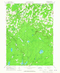
(39)- 1928 Map of Ariel, 1953 Print
 1928 Ariel1953 Print · USGSWayne County was undergoing a significant transformation in the late twenties as the waters of Lake Wallenpaupack rose. Genealogists and historians can trace local family roots through sites like Haags Mill, German Valley Sch, and the Erie RR corridor.4 unique versions available
 - 1932 Map of Ariel
 1932 Ariel1932 Print · USGSWayne and Pike counties are seen here in the early 1930s as the regional landscape adjusted to the presence of Lake Wallenpaupack. Trace family roots at Ammerman Sch or follow the Erie RR past Gravity and Lake Ariel.3 unique versions available
 - 1950 Map of Scranton, 1952 Print
 1950 Scranton1952 Print · USGSMid-century Northeast Pennsylvania and the Hudson Valley come alive in this survey of the tri-state region. Genealogists and historians can trace the dense rail networks of the Erie RR and DL&W RR between industrial hubs like Scranton and Wilkes-Barre.
 - 1953 Map of Scranton
 1953 Scranton1953 Print · USGSNortheastern Pennsylvania and the Catskills are shown in great detail during the early fifties, a time when rail lines and river valleys dictated the region's growth. Genealogists and historians can trace the industrial hearts of Scranton and Wilkes-Barre or locate remote landmarks like High Point and Lake Wallenpaupack.
 - 1959 Map of Scranton
 1959 Scranton1959 Print · USGSThe northern coalfields and the Hudson Valley meet in this mid-century survey of the Pennsylvania and New York borderlands. Genealogists and historians can trace the intricate rail networks of the Erie Railroad and the vast waters of Lake Wallenpaupack.2 unique versions available
 - 1959 Map of Pocono
 1959 Pocono1959 Print · USGSThe Pocono Mountains region is captured here in the late fifties, showcasing its evolution from a railway-dependent timber and ice landscape to a premier resort destination. Researchers can locate dozens of country schoolhouses like Maplewood Sch and trace the paths of the Erie RR through Hawley and Kimbles.
 - 1962 Map of Scranton, 1977 Print
 1962 Scranton1977 Print · USGSThe industrial heart of eastern Pennsylvania and the New York Catskills are captured here in the early sixties. Genealogists and historians can trace the dense valley settlements from Scranton to Wilkes-Barre and the rail lines of the Erie Lackawanna Railroad.2 unique versions available
 - 1965 Map of Scranton
 1965 Scranton1965 Print · USGSThe tri-state highlands of Pennsylvania, New York, and New Jersey come alive in the mid-sixties as industry and recreation converge. Trace the intricate rail lines of the Erie Lackawanna RR or locate landmarks like the U S Military Academy.2 unique versions available
 - 1965 Map of Sterling, 1967 Print
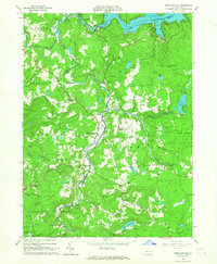
 1965 Sterling1967 Print · USGSWayne and Lackawanna Counties are seen here in the mid-sixties as the ERIE-LACKAWANNA railroad still shaped the rural landscape. Genealogists can locate family sites near Freytown Cem, Madisonville, and the small settlement of Jericho.3 unique versions available
 - 1966 Map of Lake Ariel, 1967 Print
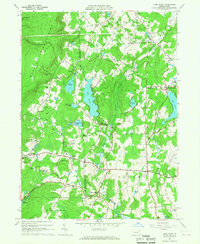 1966 Lake Ariel1967 Print · USGSIn the mid-1960s, the Wayne and Lackawanna county line was a landscape of mountain ridges and thriving lakeside communities connected by the Erie-Lackawanna rail line. Researchers can locate vanished landmarks and family sites like Kizer Cem, Hollisterville, and the Jefferson Sch.3 unique versions available
 - 1966 Map of Lakeville, 1967 Print
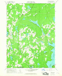 1966 Lakeville1967 Print · USGSWayne and Pike Counties in the mid-1960s reveal a landscape of glacial lakes and growing recreational retreats. Researchers can trace the early developments of Lakeville, locate the Drive-in Theater near Pink, or find family sites like St Marys Church.3 unique versions available
 - 1966 Map of Newfoundland, 1967 Print
 1966 Newfoundland1967 Print · USGSPike and Wayne counties are captured here in the mid-1960s, showing a landscape defined by the Wallenpaupack waters and forested ridges. Trace family history through Newfoundland, Angels, and local landmarks like Pine Grove Cem.3 unique versions available
 - 1986 Map of Scranton
 1986 Scranton1986 Print · USGSNortheastern Pennsylvania in the mid-eighties shows an era of transition between its deep-rooted mining history and modern transit growth. Researchers can trace the industrial footprint of a Strip Mine, locate the Tobyhanna Army Depot, or find family sites near St Marys Cem and Wilkes College.2 unique versions available
 - 1992 Map of Newfoundland, 1995 Print
 1992 Newfoundland1995 Print · USGSThe headwaters of the Wallenpaupack in Wayne and Pike Counties appear here as a landscape of small villages and forested slopes in the early nineties. Researchers can trace family sites at Newfoundland, Haags Mill, and Angels, or locate old landmarks like Pine Grove Cem.
 - 1994 Map of Sterling, 1995 Print
 1994 Sterling1995 Print · USGSWayne and Lackawanna counties transitioned from traditional farming and mining to recreational residential hubs by the mid-1990s. Researchers can trace old family landmarks and local institutions like Peoples Ch, Drinker Sch, and the quiet Jericho Cem.
 - 1994 Map of Lake Ariel, 1995 Print
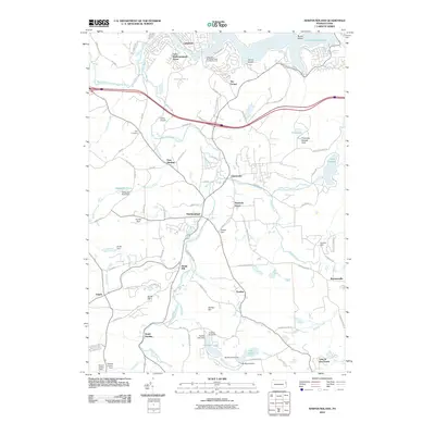
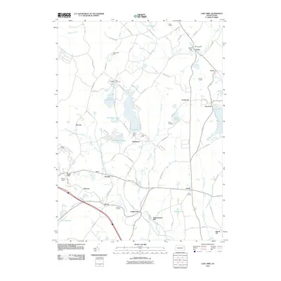
 1994 Lake Ariel1995 Print · USGSThe Lake Ariel region of Wayne County is captured here in the mid-1990s, showing a landscape defined by glacial ponds and small mountain hamlets. Researchers can trace family history through sites like Salem Cem, Wallenpaupack Mills, and the old rail paths of the Old RR Grade.
 - 1994 Map of Lakeville, 1996 Print
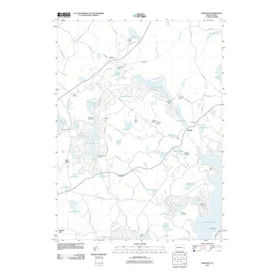
 1994 Lakeville1996 Print · USGSWayne County and Pike County meet along the western shore of Lake Wallenpaupack in the mid-1990s as the area's lake-centered communities continue to grow. Family historians can locate family-named landmarks and old rural sites like Tisdale Cem, St Marys Ch, and the settlement of Arlington.
 - 1997 Map of Sterling, 2000 Print
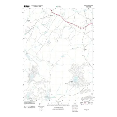
 1997 Sterling2000 Print · USGSWayne and Lackawanna counties appear here in the late twentieth century, showing a landscape of upland swamps and growing lakeside communities. Local researchers can locate family landmarks like Drinker Sch Cem, the Spring Hill Airpark, and the rural settlement at Madisonville.
 - 1999 Map of Newfoundland, 2001 Print
 1999 Newfoundland2001 Print · USGSThe Wallenpaupack Creek valley at the turn of the millennium shows a landscape of deep forests and quiet crossroads. Researchers can trace family sites at Zion Cem or explore established settlements like Newfoundland and South Sterling.
 - 2010 Map of Newfoundland, 2010 Print
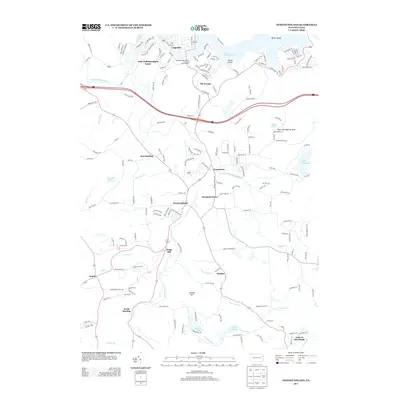
 2010 Newfoundland2010 Print · USGSCovers Salem Township, including Sterling Township, Greene Township, and other nearby areas
 - 2010 Map of Lakeville, 2010 Print
 2010 Lakeville2010 Print · USGSCovers Salem Township, including Cherry Ridge Township, South Canaan Township, and other nearby areas
 - 2010 Map of Lake Ariel, 2010 Print
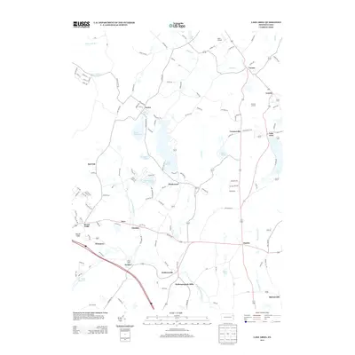
 2010 Lake Ariel2010 Print · USGSCovers Salem Township, including South Canaan Township, Sterling Township, and other nearby areas
 - 2010 Map of Sterling, 2010 Print
 2010 Sterling2010 Print · USGSCovers Salem Township, including Sterling Township, Clifton Township, and other nearby areas
 - 2013 Map of Lake Ariel, 2013 Print
 2013 Lake Ariel2013 Print · USGSCovers Salem Township, including South Canaan Township, Sterling Township, and other nearby areas
 - 2013 Map of Newfoundland, 2013 Print
 2013 Newfoundland2013 Print · USGSCovers Salem Township, including Sterling Township, Greene Township, and other nearby areas
Showing maps 1-25 of 39
Top cities near Salem Township
- Carbondale historical maps
- Tobyhanna historical maps
- Blakely historical maps
- Archbald historical maps
- Lackawaxen Township historical maps
- Scott Township historical maps
See more
Top neighborhoods of Salem Township
- Ledgedale historical maps
- Arlington historical maps
- Wallenpaupack Mills historical maps
- Hamlin historical maps
- Hollisterville historical maps
- Little Chapel historical maps
See more
Frequently asked questions
- What are the different types of historical maps available for Salem Township?
- What is the oldest map of Salem Township?
- Where can I purchase historical maps of Salem Township for my home or office?
- Where can I download high-res historical maps of Salem Township?
- Are there historical topographic maps available for Salem Township?
- Is there historical aerial imagery available for Salem Township?
- Where are historical maps of Salem Township sourced from?