1960s Maps of Stanley County, South Dakota
Explore 6 historic maps of Stanley County from the 1960s. These maps offer a rare glimpse into what life looked like during the 1960s — showing old roads, neighborhoods, homes, and landmarks that have changed or disappeared over time.
Whether you're researching your family's past, planning a metal detecting trip, or studying how Stanley County's landscape evolved across the 1960s, these high-resolution maps are a powerful tool for exploring the history of this region.
- Focus on a specific era: All maps on this page are from the 1960s, giving you a focused view of this time period.
- See what’s changed: Compare century-old streets, trails, and buildings to today's modern landscape using overlays and satellite layers.
- Research with precision: Use these maps for genealogy, historical research, land use analysis, or educational projects.
- View, download, or print: Maps are fully viewable online in high resolution, and can be downloaded or printed for your own records.
Start exploring Stanley County's history through authentic maps from the 1960s. This is your window into the past.
Stanley County, SD maps
(6)- 1966 Map of Joe Creek NW, 1967 Print
 1966 Joe Creek NW1967 Print · USGSThe Missouri River valley in the mid-1960s reveals a landscape transformed by the waters of Lake Sharpe along the reservation borders. Genealogists and historians can trace local landmarks like Holy Faith Cem, La Roche Sch, and the Clark Ranch.
 - 1967 Map of Pierre NE, 1968 Print
 1967 Pierre NE1968 Print · USGSNorth of the South Dakota state capital in the late sixties, the landscape shows a transition from urban development to open prairie bluffs. Researchers can trace the Old RR Grade, locate the Mentor Sch, and find the mid-century Drive-in Theater near Snake Butte.
 - 1967 Map of Ft. George Butte NW, 1969 Print
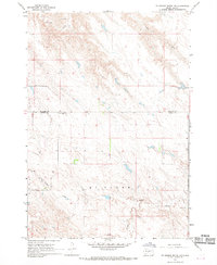 1967 Ft. George Butte NW1969 Print · USGSThe high plains of Lyman and Stanley Counties are shown here in the late sixties, a landscape of ranch lands and isolated rural outposts. Genealogists and local historians can locate the Cedar Valley Sch and trace the winding courses of Antelope Creek and Cedar Creek.
 - 1967 Map of Ft. George Butte, 1969 Print
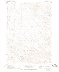 1967 Ft. George Butte1969 Print · USGSLyman and Stanley counties are captured here in the late sixties, divided by the Lower Brule Indian Reservation Boundary. Researchers can trace old water sources and landforms like Ft George Butte, Apple Creek, and Cedar Creek.
 - 1969 Map of Rousseau Creek, 1972 Print
 1969 Rousseau Creek1972 Print · USGSThe Cheyenne River breaks into the Missouri River basin during the late sixties as the reservoir waters reshape the landscape. Trace the shifting shoreline of Lake Oahe and find landmarks like the lone Cem and the winding Rousseau Creek.
 - 1969 Map of No Heart Creek SW, 1972 Print
 1969 No Heart Creek SW1972 Print · USGSThe confluence of the Missouri and Cheyenne rivers in central South Dakota is captured here just as the landscape was transformed by the waters of Lake Oahe. Researchers can trace the Cheyenne River Indian Reservation Boundary and the many inlets formed by No Heart Creek and Tall Prairie Chicken Creek.
End of results
Showing maps 1-6 of 6
Top cities of Stanley County
Frequently asked questions
- What are the different types of historical maps available for Stanley County?
- What is the oldest map of Stanley County?
- Where can I purchase historical maps of Stanley County for my home or office?
- Where can I download high-res historical maps of Stanley County?
- Are there historical topographic maps available for Stanley County?
- Is there historical aerial imagery available for Stanley County?
- Where are historical maps of Stanley County sourced from?