1900s (20th Century) Maps of Stanley County, South Dakota
Explore 59 historic maps of Stanley County from the 1900s (20th Century). These maps offer a rare glimpse into what life looked like during the 1900s — showing old roads, neighborhoods, homes, and landmarks that have changed or disappeared over time.
Whether you're researching your family's past, planning a metal detecting trip, or studying how Stanley County's landscape evolved across the 1900s, these high-resolution maps are a powerful tool for exploring the history of this region.
- Focus on a specific era: All maps on this page are from the 1900s, giving you a focused view of this time period.
- See what’s changed: Compare century-old streets, trails, and buildings to today's modern landscape using overlays and satellite layers.
- Research with precision: Use these maps for genealogy, historical research, land use analysis, or educational projects.
- View, download, or print: Maps are fully viewable online in high resolution, and can be downloaded or printed for your own records.
Start exploring Stanley County's history through authentic maps from the 1900s. This is your window into the past.
Stanley County, SD maps
(59)- 1924 Map of Pierre
 1924 Pierre1924 Print · USGSThe state capital and its Missouri River crossing are captured here in the mid-1920s during a period of steady prairie expansion. Researchers can trace early railroad development along the Chicago and Northwestern and locate local landmarks like Giddings School and Snake Butte.2 unique versions available
 - 1934 Map of Canning
 1934 Canning1934 Print · USGSCentral South Dakota comes to life in the mid-1930s as the Missouri River valley supports a network of ranches and small schools. Genealogists can trace family landmarks like Petrus Ranch or locate local centers including Elm Grove Sch and the Holy Name Chapel.
 - 1937 Map of Canning
 1937 Canning1937 Print · USGSHughes County ranching and river life are captured here in the mid-1930s as the Missouri River flowed freely past historic islands and rail sidings. Genealogists can locate family landmarks like Pietrus Ranch, Finder Ranch, and numerous country schools such as Pleasantview Sch.3 unique versions available
 - 1937 Map of Oahe
 1937 Oahe1937 Print · USGSStanley County ranching and river life are captured here in the mid-thirties before the Missouri was transformed by modern dams. Genealogists can locate family-named landmarks like Madison Ranch and rural schoolhouses such as Riverview Sch or Willow Creek Butte Sch.3 unique versions available
 - 1951 Map of Van Metre, 1953 Print
 1951 Van Metre1953 Print · USGSThe Bad River valley comes into focus during the early fifties, documenting the remote rail outposts of Stanley County. Genealogists and historians can trace the tracks of the Chicago and North Western through Van Metre and along the banks of White Clay Creek.3 unique versions available
 - 1951 Map of Capa NW, 1953 Print
 1951 Capa NW1953 Print · USGSStanley and Jones Counties are mapped here in the early fifties, showing the rural landscape along the Bad River. Researchers can trace the mid-century education system and transport networks through features like Twin Butte School and the Chicago and North Western railroad.2 unique versions available
 - 1953 Map of Teton, 1955 Print
 1953 Teton1955 Print · USGSStanley County ranching and rail life are centered on the Bad River valley during the early fifties. Genealogists and historians can trace the Chicago and North Western line through the settlement of Teton and various family-named landmarks like Powell Creek.2 unique versions available
 - 1953 Map of Oahe SW, 1955 Print
 1953 Oahe SW1955 Print · USGSStanley County was a landscape of dissected plains and vital rail corridors during the early fifties. Genealogists and historians can trace the paths of Broken Neck Creek and Tomahawk Creek toward the Bad River valley and the Chicago and North Western line.2 unique versions available
 - 1953 Map of Pierre SW, 1955 Print
 1953 Pierre SW1955 Print · USGSThe confluence of the Bad River and the Missouri Basin defines this mid-century look at the plains west of Fort Pierre. Researchers can trace the Old Lower Brule Indian Reservation Boundary or locate landmarks like Cedar Hill Cem and the Chicago and North Western rail line.2 unique versions available
 - 1953 Map of Wendte, 1955 Print
 1953 Wendte1955 Print · USGSCentral South Dakota ranchlands are captured here in the early fifties, where the river and rail lines dictated the pace of rural life. Trace the old corridor of the Chicago and North Western railroad near Wendte or locate the site of the Matthew Sch.3 unique versions available
 - 1953 Map of Wendte NE, 1955 Print
 1953 Wendte NE1955 Print · USGSStanley and Jones County ranch lands are documented here in the early fifties before modern development changed the prairie landscape. Genealogists and historians can locate the Werckman Sch and trace the winding paths of Crow Eagle Creek and the Bad River.
 - 1953 Map of Pierre 3 NW, 1955 Print
 1953 Pierre 3 NW1955 Print · USGSStanley and Jones Counties appear here in the early fifties, documenting the remote ranching landscape of central South Dakota. Genealogists and local historians can trace family-named sites like Bradley, Wooten, and Rose along the War Creek drainage.2 unique versions available
 - 1953 Map of Huron, 1959 Print
 1953 Huron1959 Print · USGSCentral South Dakota comes alive in the mid-1950s as a thriving rail and agricultural corridor between the Missouri and James Rivers. Trace the legacy of family farms and prairie towns like Huron, Faulkton, and Wessington Springs along the historic Chicago and North Western rail lines.3 unique versions available
 - 1954 Map of Pierre, 1968 Print
 1954 Pierre1968 Print · USGSThe Missouri River and the newly formed Oahe Reservoir define central South Dakota in the 1950s. Genealogists and local historians can trace early settlements and rail stops like Eakin Siding, Mission Ridge, and Ottumwa.2 unique versions available
 - 1954 Map of Huron, 1977 Print
 1954 Huron1977 Print · USGSCentral South Dakota was a landscape of grain elevators and river bends during the mid-fifties. Genealogists and historians can trace the development of the James River valley through railroad towns like Redfield and the sprawling Crow Creek Indian Reservation.
 - 1956 Map of Alleman Station, 1957 Print
 1956 Alleman Station1957 Print · USGSHaakon and Ziebach counties appear here in the mid-1950s, just as the Missouri River Basin development began to reshape the Cheyenne River valley. Local historians can trace ranching history at Pearman Ranch or locate the community roots of Alleman Station and Dupree Ch.3 unique versions available
 - 1956 Map of Rousseau Creek SW, 1957 Print
 1956 Rousseau Creek SW1957 Print · USGSDewey and Stanley Counties are captured in the mid-1950s just before the landscape was altered by the Missouri River Basin development. Researchers can trace the riverfront holdings of Holloway Ranch, Chisholm Ranch, and the waters of Fishgut Creek.3 unique versions available
 - 1956 Map of Sansarc NE, 1957 Print
 1956 Sansarc NE1957 Print · USGSStanley and Dewey counties are captured here in the mid-fifties, just before the landscape was altered by the Oahe Reservoir project. Researchers can trace family ranch lands like Young Ranch and find remote burials at Walking Horse Cem or Lindsay Cem.3 unique versions available
 - 1956 Map of Crockett Mountains, 1957 Print
 1956 Crockett Mountains1957 Print · USGSStanley County ranch lands are documented here in the mid-fifties, showing the intersection of tribal and county borders along the Cheyenne River. Family history researchers can locate the Rousseau Cem and Webb Ranch among landmarks like Lindsay Butte.2 unique versions available
 - 1958 Map of Pierre
 1958 Pierre1958 Print · USGSCentral South Dakota is documented during the mid-fifties, just as the Missouri River valley was being transformed by the massive Oahe Dam project. Researchers can trace the early Oahe Reservoir shoreline and find remote outposts like Milesville, Onida, and Giddings Flat.
 - 1966 Map of Joe Creek NW, 1967 Print
 1966 Joe Creek NW1967 Print · USGSThe Missouri River valley in the mid-1960s reveals a landscape transformed by the waters of Lake Sharpe along the reservation borders. Genealogists and historians can trace local landmarks like Holy Faith Cem, La Roche Sch, and the Clark Ranch.
 - 1967 Map of Pierre NE, 1968 Print
 1967 Pierre NE1968 Print · USGSNorth of the South Dakota state capital in the late sixties, the landscape shows a transition from urban development to open prairie bluffs. Researchers can trace the Old RR Grade, locate the Mentor Sch, and find the mid-century Drive-in Theater near Snake Butte.
 - 1967 Map of Ft. George Butte NW, 1969 Print
 1967 Ft. George Butte NW1969 Print · USGSThe high plains of Lyman and Stanley Counties are shown here in the late sixties, a landscape of ranch lands and isolated rural outposts. Genealogists and local historians can locate the Cedar Valley Sch and trace the winding courses of Antelope Creek and Cedar Creek.
 - 1967 Map of Ft. George Butte, 1969 Print
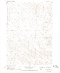 1967 Ft. George Butte1969 Print · USGSLyman and Stanley counties are captured here in the late sixties, divided by the Lower Brule Indian Reservation Boundary. Researchers can trace old water sources and landforms like Ft George Butte, Apple Creek, and Cedar Creek.
 - 1969 Map of Rousseau Creek, 1972 Print
 1969 Rousseau Creek1972 Print · USGSThe Cheyenne River breaks into the Missouri River basin during the late sixties as the reservoir waters reshape the landscape. Trace the shifting shoreline of Lake Oahe and find landmarks like the lone Cem and the winding Rousseau Creek.
Showing maps 1-25 of 59
Top cities of Stanley County
Frequently asked questions
- What are the different types of historical maps available for Stanley County?
- What is the oldest map of Stanley County?
- Where can I purchase historical maps of Stanley County for my home or office?
- Where can I download high-res historical maps of Stanley County?
- Are there historical topographic maps available for Stanley County?
- Is there historical aerial imagery available for Stanley County?
- Where are historical maps of Stanley County sourced from?