1950s Maps of Giles County, Tennessee
Explore 21 historic maps of Giles County from the 1950s. These maps offer a rare glimpse into what life looked like during the 1950s — showing old roads, neighborhoods, homes, and landmarks that have changed or disappeared over time.
Whether you're researching your family's past, planning a metal detecting trip, or studying how Giles County's landscape evolved across the 1950s, these high-resolution maps are a powerful tool for exploring the history of this region.
- Focus on a specific era: All maps on this page are from the 1950s, giving you a focused view of this time period.
- See what’s changed: Compare century-old streets, trails, and buildings to today's modern landscape using overlays and satellite layers.
- Research with precision: Use these maps for genealogy, historical research, land use analysis, or educational projects.
- View, download, or print: Maps are fully viewable online in high resolution, and can be downloaded or printed for your own records.
Start exploring Giles County's history through authentic maps from the 1950s. This is your window into the past.
Giles County, TN maps
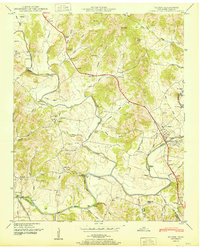
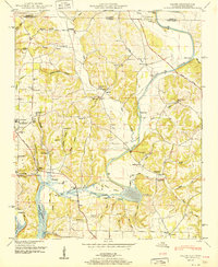
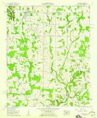
(21)- 1950 Map of Bodenham
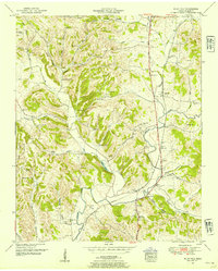
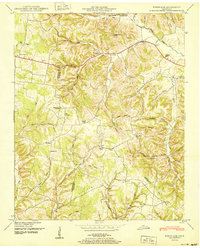 1950 Bodenham1950 Print · USGSGiles County in the years following World War II was a landscape of ridge-top farms and country schools. You can trace early property lines near New Prospect or locate family sites like Chestnut Grove Church and Copperas Sch.
 - 1950 Map of Appleton
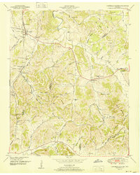
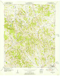
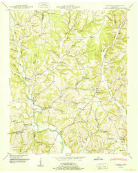 1950 Appleton1950 Print · USGSGiles County in the late 1940s is captured here as a network of creek-side communities and family homesteads. Genealogists and local historians can trace legacy sites like the Sam Davis Monument, Minor Hill, and schools including Appleton Sch and Puncheon Sch.3 unique versions available
 - 1950 Map of Aspen Hill
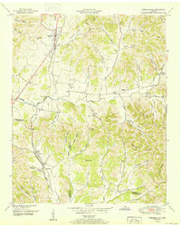
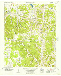
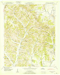 1950 Aspen Hill1950 Print · USGSGiles County at mid-century reveals a landscape of high ridges and deep hollows connected by the Louisville and Nashville railroad. You can trace early family roots through dozens of local identifiers like Davis Academy, Hanna Ch, and Mt Carmel Cem.3 unique versions available
 - 1951 Map of Pulaski
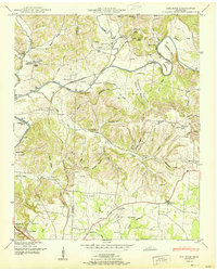
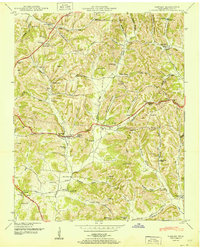
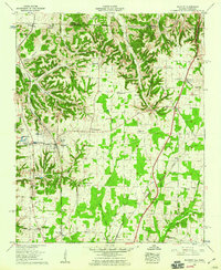
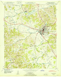 1951 Pulaski1951 Print · USGSGiles County at mid-century reveals a landscape shaped by the Louisville and Nashville railroad and the growth of Pulaski. Genealogists can locate family landmarks such as Maplewood Cem, Anthony Hill School, and Zuccarella Cem.
 - 1951 Map of Elkton
 1951 Elkton1951 Print · USGSGiles County in the early fifties is captured here at a time when the Elk River and local rail lines dictated the pace of life. Researchers can trace the legacy of rural communities through sites like Vinta Mill, Ephesus Church, and Aspen Hill.2 unique versions available
 - 1951 Map of Union Hill
 1951 Union Hill1951 Print · USGSThe Alabama-Tennessee state line runs through this mid-century rural landscape, marked by family farms and the rising influence of the Tennessee Valley Authority. Researchers can trace the legacy of early settlements like Lester and Union Hill or locate old community hubs like Ridgway Mill and Rockaway Sch.2 unique versions available
 - 1951 Map of Campbells Station
 1951 Campbells Station1951 Print · USGSThe hills of Maury and Marshall counties are captured here in the early fifties, showing the rural communities along the Louisville and Nashville railroad. Genealogists can locate numerous family burial grounds and community hubs like Culleoka, Lowery Chapel, and the Mooresville School.3 unique versions available
 - 1951 Map of Cornersville
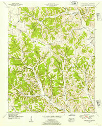
 1951 Cornersville1951 Print · USGSCornersville and the surrounding Tennessee hills are captured in the early 1950s just as the rail-and-river landscape remained central to rural life. Researchers can locate family landmarks like Beechwood Cemetery, the County Farm, and the Louisville and Nashville rail line.2 unique versions available
 - 1951 Map of Dellrose
 1951 Dellrose1951 Print · USGSThe Elk River valley on the Giles and Lincoln county line is shown here in the early fifties, just as the rural river-and-rail economy remained intact. Trace local family roots at Hamilton Mill, the Stone Bluff Bridge, or old church sites like Washington Temple.3 unique versions available
 - 1951 Map of Salem
 1951 Salem1951 Print · USGSLimestone County life is captured here in the early fifties as the Elk River meets the Wheeler Reservoir. Genealogists and local historians can trace family landmarks like Browning Cem, the community of Salem, and the Elk River Fish Hatchery.3 unique versions available
 - 1951 Map of Tarpley
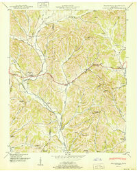
 1951 Tarpley1951 Print · USGSGiles County at the mid-century reveals a rural landscape of ridges and hollows defined by long-established family names and crossroads communities. Trace genealogical roots through dozens of local sites like Aymett Town, New Zion School, and the Rocky Mount Cem.
 - 1951 Map of Frankewing
 1951 Frankewing1951 Print · USGSGiles and Lincoln counties are captured here just after the war, showing a landscape defined by ridge-top gaps and valley railroads. Researchers can trace family history through several rural cemeteries and schools, including Garrett Cem, Center Ridge School, and the settlement of McBurg.
 - 1951 Map of Campbellsville, 1954 Print
 1951 Campbellsville1954 Print · USGSGiles and Lawrence Counties are shown here in the early 1950s, revealing a landscape of rural schoolhouses and family-named hollows. Genealogists can trace family roots through numerous sites like Kimbrough Cem, Rose Hill Church, and the Owen School.4 unique versions available
 - 1951 Map of Milky Way, 1954 Print
 1951 Milky Way1954 Print · USGSGiles County at the mid-century reveals a rural landscape anchored by rail and river. Genealogists can trace family names through dozens of landmarks like Abernathy Cem, Lilburn Sch, and the community of Riversburg.2 unique versions available
 - 1951 Map of Lynnville, 1956 Print
 1951 Lynnville1956 Print · USGSThe hills of Middle Tennessee are captured here in the early 1950s, showing the ridge-and-hollow terrain along the Maury and Giles County line. Researchers can locate numerous family cemeteries and remote churches like Taylor Chapel and the Old Camping Ground Cemetery.2 unique versions available
 - 1951 Map of Sandy Hook, 1956 Print
 1951 Sandy Hook1956 Print · USGSSouthern Maury County and neighboring Giles and Lawrence counties were dominated by phosphate mining and rail transit in the early fifties. Genealogists and historians can trace the foundations of local life through the L and N RR, rural strip mines, and community landmarks like Willis Chapel and Scotts Mill.2 unique versions available
 - 1956 Map of Columbia, 1960 Print
 1956 Columbia1960 Print · USGSMiddle Tennessee in the mid-fifties presents a landscape of established river towns and critical rail hubs before the arrival of the modern interstate system. Researchers can trace the routes of the Louisville and Nashville railroad or locate historic landmarks like Stones River National Military Park and the Tennessee National Wildlife Refuge.6 unique versions available
 - 1956 Map of Gadsden, 1966 Print
 1956 Gadsden1966 Print · USGSNorth Alabama in the mid-1950s shows a region transformed by river engineering and federal industry. Genealogists and local historians can trace the development of the Tennessee Valley through the growth of Huntsville, the sprawling Redstone Arsenal, and the expansive Guntersville Lake.3 unique versions available
 - 1958 Map of Gadsden
 1958 Gadsden1958 Print · USGSNorth Alabama comes alive in the late 1950s as the Tennessee Valley Authority’s massive river projects and the rise of the space industry reshaped the landscape. Researchers can trace the mid-century footprints of Huntsville, Redstone Arsenal, and the riverside rail networks of the Southern railroad.
 - 1958 Map of Elkmont, 1959 Print
 1958 Elkmont1959 Print · USGSLimestone County and the Tennessee borderlands are captured here in the late fifties, showcasing a landscape of rail-stop towns and rural agriculture. Genealogists can trace family names at the Antioch Cem or Robinson Cem, while historians can locate the old Holland Gin and Woodin Mill.2 unique versions available
 - 1958 Map of Ardmore, 1959 Print
 1958 Ardmore1959 Print · USGSArdmore and the surrounding borderlands of Alabama and Tennessee appear here during the late fifties as a network of rail-side settlements and rural parishes. Genealogists can trace family landmarks like the Delap-Clement Cem, Wooley Springs Sch, and New Zion Church.4 unique versions available
End of results
Showing maps 1-21 of 21
Top cities of Giles County
Frequently asked questions
- What are the different types of historical maps available for Giles County?
- What is the oldest map of Giles County?
- Where can I purchase historical maps of Giles County for my home or office?
- Where can I download high-res historical maps of Giles County?
- Are there historical topographic maps available for Giles County?
- Is there historical aerial imagery available for Giles County?
- Where are historical maps of Giles County sourced from?