1900s (20th Century) Maps of Hickman County, Tennessee
Explore 39 historic maps of Hickman County from the 1900s (20th Century). These maps offer a rare glimpse into what life looked like during the 1900s — showing old roads, neighborhoods, homes, and landmarks that have changed or disappeared over time.
Whether you're researching your family's past, planning a metal detecting trip, or studying how Hickman County's landscape evolved across the 1900s, these high-resolution maps are a powerful tool for exploring the history of this region.
- Focus on a specific era: All maps on this page are from the 1900s, giving you a focused view of this time period.
- See what’s changed: Compare century-old streets, trails, and buildings to today's modern landscape using overlays and satellite layers.
- Research with precision: Use these maps for genealogy, historical research, land use analysis, or educational projects.
- View, download, or print: Maps are fully viewable online in high resolution, and can be downloaded or printed for your own records.
Start exploring Hickman County's history through authentic maps from the 1900s. This is your window into the past.
Hickman County, TN maps
(39)- 1901 Map of Colombia
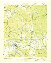
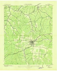
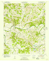
 1901 Colombia1901 Print · USGSMiddle Tennessee at the close of the century reveals a landscape shaped by river bends and a dense network of turnpikes. Genealogists can trace family roots through settlements like Santa Fe and Warner or locate landmarks such as the U.S. Arsenal and Zion Ch.3 unique versions available
 - 1936 Map of Graves Spring
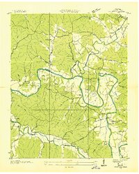
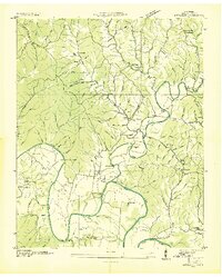
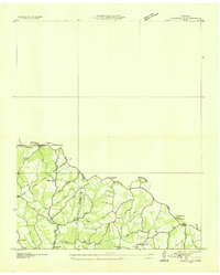
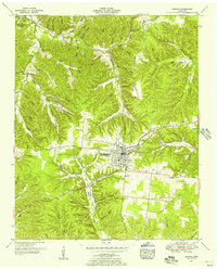
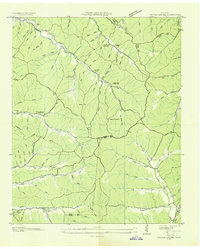 1936 Graves Spring1936 Print · USGSMid-depression Tennessee highlands are captured here at the intersection of Perry, Lewis, and Hickman Counties. Researchers can locate remote family burial sites like Poplin Hollow Cem and early educational landmarks including Upper Coon Creek Sch.
 - 1936 Map of Pleasantville
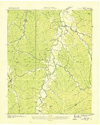
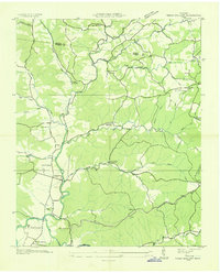
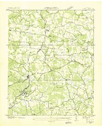
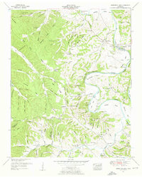
 1936 Pleasantville1936 Print · USGSHickman County's rugged creek valleys are captured in the mid-1930s just as the Tennessee Valley Authority began modernizing the region. Local historians can trace old homesteads and community centers like Farmers Exchange, Pleasantville School, and the remote Bethel Church.
 - 1936 Map of Coble
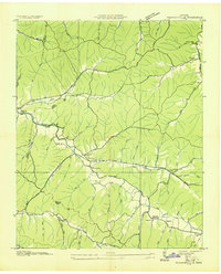
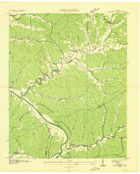
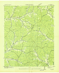
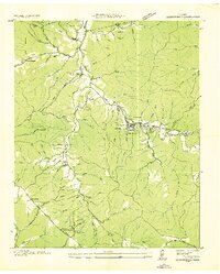
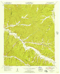
 1936 Coble1936 Print · USGSHickman County settlement is centered around the sinuous path of the Duck River during the mid-thirties. Researchers can trace family history through numerous sites like Only, Coble, Perogue Ford, and the Macedonia Sch.
 - 1936 Map of Williamsport
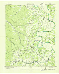
 1936 Williamsport1936 Print · USGSMaury County's river valleys and phosphate industry are detailed in this mid-1930s survey of the region surrounding the Williamsport settlement. Genealogists can trace family landmarks and rural life through Zion Chapel, Jones Cem, and the Armour Phosphate Co works.
 - 1936 Map of Primm
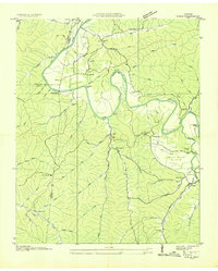
 1936 Primm1936 Print · USGSThe rural borders of Maury, Hickman, and Williamson counties are captured here in the mid-1930s as the TVA began modernizing the landscape. Researchers can trace family history through local landmarks like Johnsons Mill, Elmo Sch, and the Warf Cem.
 - 1936 Map of Beaverdam Springs
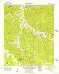
 1936 Beaverdam Springs1936 Print · USGSHickman and Lewis Counties were characterized by small crossroads settlements and ridge-line roads in the mid-1930s. Genealogists can trace family footprints through sites like Wade Cem, Byers Chapel, and the vanished Beaverdam Springs Sch.
 - 1936 Map of Nunnelly
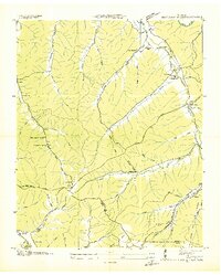
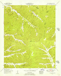
 1936 Nunnelly1936 Print · USGSHickman County in the mid-1930s is a landscape of river-bend settlements and emerging industrial power. Researchers can trace the legacy of local mining at Nunnelly Mines, locate family sites near Defeated Creek Sch, or find the CCC Camp No 1468 near Nunnelly.
 - 1936 Map of Whitfield
 1936 Whitfield1936 Print · USGSHickman County settlement is captured here in the mid-1930s, showing the intricate network of hollows and river bends along the Duck River. Researchers can locate several rural schools and family cemeteries like Settle Point Sch, Hickman Cem, and Mt Pillar Sch.
 - 1936 Map of Sunrise
 1936 Sunrise1936 Print · USGSThe rural landscape of Hickman County is captured here in the mid-1930s, showing a transition toward electrification and modern transit. Researchers can locate early schools and churches like Brushy Sch and Raleigh Chapel or trace the Nashville Chattanooga and St Louis Ry through Deans.
 - 1936 Map of Bucksnort
 1936 Bucksnort1936 Print · USGSLife along the Humphreys and Hickman county line in the mid-1930s was defined by the winding Duck River and its deep hollows. Researchers can trace family roots at Pruett Cem or locate community hubs like Bold Spring and Old Furnace Sch.2 unique versions available
 - 1936 Map of Littlelot
 1936 Littlelot1936 Print · USGSMid-1930s Hickman County shows a landscape shaped by the winding Duck River as electrification begins to reach rural Tennessee. Genealogists can trace family landmarks like Little Rock Mills, Poplar Union Sch, and the Fort Cooper Cem among the steep hollows.
 - 1936 Map of Texas Hollow
 1936 Texas Hollow1936 Print · USGSHickman and Dickson counties come into focus during the mid-1930s, showing a rural landscape organized around the Piney River. Genealogists and local historians can trace schoolhouse locations like Mt Gossett Sch, family sites such as Petty Cem, and the early aviation Airway Beacon.
 - 1936 Map of Spot
 1936 Spot1936 Print · USGSHickman County is shown in the mid-1930s as a landscape of isolated hollows and rural school districts before modern development. You can trace family footprints at Wilkens Cem and Turner Cem, or locate landmarks like Spot Sch and the Lookout Tower.
 - 1936 Map of Greenfield Bend
 1936 Greenfield Bend1936 Print · USGSThe Duck River valley comes to life in the mid-1930s, showing a network of rural schoolhouses and family cemeteries along the Hickman and Maury county lines. Researchers can trace the local landscape through landmarks like Kettle Mills, the Gordon Ferry Bridge, and Sheboss Cem.
 - 1936 Map of Kimmins
 1936 Kimmins1936 Print · USGSLewis County life in the mid-1930s revolves around the rail town of Hohenwald. Genealogists can trace family landmarks like Skelton Sch and the Swiss Cem, while historians can follow the Nashville Chattanooga and St Louis railway.
 - 1936 Map of Craigfield
 1936 Craigfield1936 Print · USGSThe Hickman and Williamson county border comes alive in the mid-1930s, showing a rural Tennessee landscape defined by narrow creek valleys and the Basin Divide. Genealogists can locate family-named sites like McCord Cem, Tidwell Sch, and Shady Grove Ch.
 - 1936 Map of Lyles
 1936 Lyles1936 Print · USGSHickman and Dickson counties come into focus during the mid-1930s, showing a landscape defined by the Tennessee Basin Divide and the Nashville, Chattanooga and St. Louis Railway. Researchers can locate vanished rural landmarks such as Frazier Cem, Porter Sch, and the Steam Pumping Station at Mill Creek.
 - 1936 Map of Gordonsburg
 1936 Gordonsburg1936 Print · USGSGordonsburg and the surrounding Lewis County hollows are captured here during the peak of local phosphate extraction in the mid-1930s. Researchers can trace family sites near Mt Sinai Ch or locate industrial landmarks like the Phosphate Mines and the Louisville and Nashville RR.
 - 1951 Map of Williamsport, 1956 Print
 1951 Williamsport1956 Print · USGSMaury County at mid-century reveals a landscape shaped by the winding Duck River and burgeoning industrial mining. Researchers can trace family sites at Williamsport, find old rural landmarks like Woodrow Sch, or locate numerous cemeteries including McKennon Cem and Greenfield Cem.3 unique versions available
 - 1951 Map of Kimmins, 1956 Print
 1951 Kimmins1956 Print · USGSLewis County in the early fifties is shown here at the intersection of traditional hill-country life and new postwar infrastructure. Researchers can trace family sites like Skelton Sch, find the Swiss Cem near Hohenwald, or locate the dismantled railroad bed.3 unique versions available
 - 1951 Map of Greenfield Bend, 1957 Print
 1951 Greenfield Bend1957 Print · USGSThe Duck River valley on the border of Hickman and Maury Counties is shown here in the early fifties, a landscape of deep hollows and river bends. Researchers can trace family sites like Kettle Mills, the Forty Thicket School, and Bingham Cem.3 unique versions available
 - 1951 Map of Pleasantville, 1957 Print
 1951 Pleasantville1957 Print · USGSThe Hickman and Perry County line in the early fifties is a maze of hollows and family-named creek valleys. Genealogists can trace rural life through sites like Pleasantville, Farmers Exchange, and the Sulphur Creek Church.2 unique versions available
 - 1951 Map of Gordonsburg, 1957 Print
 1951 Gordonsburg1957 Print · USGSLewis County in the early fifties is defined by the legacy of the wilderness road and the activity of the local mineral industry. Local historians can locate the Meriwether Lewis National Monument and trace family roots at Little Swan Church or Stoney Lonesome Cem.2 unique versions available
 - 1951 Map of Graves Spring, 1957 Print
 1951 Graves Spring1957 Print · USGSThe rural borderlands of Perry, Hickman, and Lewis Counties are captured here in the early fifties, showing a landscape of deep hollows and family homesteads. Genealogists can trace local roots through landmarks like Sinking Creek Church, Upper Brush Creek School, and Graves Cem.3 unique versions available
Showing maps 1-25 of 39
Top cities of Hickman County
Frequently asked questions
- What are the different types of historical maps available for Hickman County?
- What is the oldest map of Hickman County?
- Where can I purchase historical maps of Hickman County for my home or office?
- Where can I download high-res historical maps of Hickman County?
- Are there historical topographic maps available for Hickman County?
- Is there historical aerial imagery available for Hickman County?
- Where are historical maps of Hickman County sourced from?