Old Maps of Stewart County, Tennessee for Academic Research
Study the evolution of Stewart County with 144 high-resolution historic maps. Whether you're teaching, researching, or modeling changes in land use, these maps provide essential visual documentation of urban, environmental, and geographic change.
- Analyze long-term change: Track patterns in development, transportation, and natural features.
- Ideal for environmental or urban studies: Support academic projects with primary historical map data.
- Use in the classroom or lab: Educators and researchers rely on these maps to bring historical context to life.
These maps are a powerful tool for teaching, research, and visualizing how Stewart County has changed over the decades.
Stewart County, TN maps
(144)- 1931 Map of Erin
 1931 Erin1931 Print · USGSThe Cumberland River corridor and the railroad hub of Erin define this landscape in the late 1920s. Genealogists can trace family footprints through dozens of rural schools and churches, from Blooming Grove Ch to the remote Cave Orchard Sch.
 - 1936 Map of Poplar Creek
 1936 Poplar Creek1936 Print · USGSBenton and Henry counties are shown in the mid-1930s as the Tennessee Valley Authority began shaping the region's river systems. Researchers can trace rural life through numerous country schools and landmarks like Sulphur Well, Murphy Landing, and Odem Sch.
 - 1936 Map of Tharpe
 1936 Tharpe1936 Print · USGSStewart County's river-dependent landscape comes to life in the mid-1930s, showing a network of landings and ridge-top communities before major regional changes. Genealogists can locate family landmarks like Stone Cem, Tharpe Sch, and Brandon Landing.
 - 1936 Map of Tantrough Hollow
 1936 Tantrough Hollow1936 Print · USGSHouston County at the height of the mid-1930s reveals a landscape of limestone industry and ridge-top settlements. Genealogists can trace family names across Lockhart Cem, locate the Cedar Valley Ch, or find vanished school sites like Bateman Sch.
 - 1936 Map of McKinnon
 1936 McKinnon1936 Print · USGSThe Tennessee River valley in the 1930s is revealed as a bustling hub of river landings and rail traffic before the landscape was transformed. Researchers can trace the river economy through the Danville Ferry, community ties at Griffin Ch, and the local rail stop at McKinnon.
 - 1936 Map of Hamlin
 1936 Hamlin1936 Print · USGSThe Tennessee River valley at the Kentucky-Tennessee line appears here in the mid-1930s, prior to the creation of Kentucky Lake. Researchers can trace historic river access points like the Pine Bluff Ferry and ancestral sites such as Elkins Cem or Hickory Grove Ch.
 - 1936 Map of Stewart
 1936 Stewart1936 Print · USGSIn the mid-1930s, the rural border of Houston and Stewart counties was defined by the Louisville and Nashville rail line. Genealogists can trace family names through Stewart Cem, Crossroads Ch, and river crossings like Crosswell Ford.
 - 1936 Map of Centerville Landing
 1936 Centerville Landing1936 Print · USGSThe Tennessee and Big Sandy Rivers meet here in the mid-1930s, showing a landscape defined by seasonal landings and rural family settlements. Researchers can trace numerous country schools and churches like Mullins Sch, Hephzibah Ch, and St Mary Ch.2 unique versions available
 - 1936 Map of Rushing
 1936 Rushing1936 Print · USGSLife along the Tennessee River is documented here just before major dam projects reshaped the border of Kentucky and Tennessee. Genealogists and historians can trace old river access points like Dilday Landing and local landmarks such as Futrell Store or the Hendon Cem.
 - 1936 Map of Standing Rock
 1936 Standing Rock1936 Print · USGSStewart County's interior ridges and hollows are captured here in the late 1930s, showing a landscape defined by small-scale farming and isolated valleys. Genealogists can trace family footprints through sites like Sykes Cem, McGee Sch, and the Standing community.
 - 1936 Map of Dover
 1936 Dover1936 Print · USGSStewart County's river-driven economy and Civil War heritage are on full display in the mid-1930s, centered on the strategic bends of the Cumberland. Genealogists can trace family landmarks like Moore Cem or visit old community hubs like Carlisle and Asbury Ch.
 - 1949 Map of Poplar Creek, 1953 Print
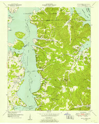 1949 Poplar Creek1953 Print · USGSBenton County river life and upland farming are documented here just after the war, as the reservoir system reshaped the shoreline. Researchers can locate dozens of family sites and landmarks, including Culpepper Cem, Antioch Boat Harbor, and the Louisville and Nashville rail stop at Faxon.3 unique versions available
 - 1950 Map of Rushing Creek, 1953 Print
 1950 Rushing Creek1953 Print · USGSThe Tennessee and Kentucky borderlands appear here just after the filling of the reservoir, capturing a landscape defined by the new shoreline. Researchers can locate family burial grounds like Rushing Creek Cem and landmarks such as the Lookout Tower and Turkey Creek Ch.5 unique versions available
 - 1950 Map of Paris Landing, 1953 Print
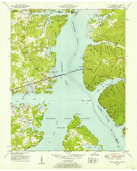 1950 Paris Landing1953 Print · USGSKentucky Lake and the Tennessee River valley are shown here just as the post-war recreational and conservation landscape began to take shape. Researchers can locate family homesteads near Old Liberty Ch, Bradford Cem, and the Cypress Creek Cabin Area.5 unique versions available
 - 1950 Map of Stewart, 1953 Print
 1950 Stewart1953 Print · USGSThe Tennessee and Kentucky borderlands come alive in this mid-century portrait of the ridge-and-hollow country before modern expansion. Researchers can trace the Louisville and Nashville rail line through old Stewart and locate family burial grounds like McIntosh Cem or the Abandoned limekiln.3 unique versions available
 - 1950 Map of Standing Rock, 1953 Print
 1950 Standing Rock1953 Print · USGSStewart County, Tennessee, is captured here in the early fifties as its communities adapted to the formation of the Tennessee River reservoirs. Researchers can trace rural life through landmarks like Standing Rock Church, Midway Sch, and the Martin Cem.4 unique versions available
 - 1950 Map of Hamlin, 1954 Print
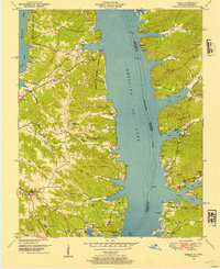 1950 Hamlin1954 Print · USGSThe shorelines of the Tennessee River valley are shown here just after the filling of the reservoir. Researchers can trace the proximity of Fort Henry and Fort Heiman or locate family burial sites like Blood River Cem and Campbell Cem.3 unique versions available
 - 1950 Map of Dover, 1954 Print
 1950 Dover1954 Print · USGSStewart County in the early fifties is mapped here at the height of its river-and-ridge character. Genealogists and historians can locate family-named landmarks and rural centers like the Lower Long Creek School, Settle Cem, and Fort Donelson National Military Park.4 unique versions available
 - 1950 Map of Mc Kinnon, 1954 Print
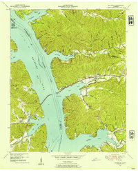 1950 Mc Kinnon1954 Print · USGSThe Tennessee River valley is shown shortly after the creation of Kentucky Lake, when the rising waters reshaped local life. Genealogists and historians can trace numerous family burial sites like Wynns Cem and rail-era landmarks such as the Louisville and Nashville line and McKinnon.3 unique versions available
 - 1951 Map of Model, 1953 Print
 1951 Model1953 Print · USGSThe Kentucky-Tennessee state line follows the ridge tops and river bends of the 1950s Cumberland Valley. Genealogists can trace family names through dozens of hilltop burial sites like Bethlehem Cem and rural centers such as Model and Tobaccoport.
 - 1951 Map of Roaring Spring, 1953 Print
 1951 Roaring Spring1953 Print · USGSThe Kentucky and Tennessee borderlands appear in the early fifties as the military presence transformed the landscape. Trace rural roots at Corinth Ch or find former homesites now marked as ruins inside the Fort Campbell Military Reservation.
 - 1951 Map of Johnson Hollow, 1953 Print
 1951 Johnson Hollow1953 Print · USGSThe Trigg County and Stewart County borderlands are captured here in the early fifties as the Fort Campbell Military Reservation expanded. Local historians can trace family roots through numerous burial sites and schools like McKinney Cem, Moore Cem, and Delmont Sch.
 - 1951 Map of Tharpe, 1953 Print
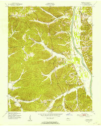 1951 Tharpe1953 Print · USGSStewart County's river-bottoms and ridges come alive in this early 1950s survey of the Cumberland River valley. Researchers can trace dozens of family landmarks and community hubs, from Neville and Tharpe to the St Johns Sch and Hickory Grove Ch.
 - 1951 Map of Indian Mound, 1953 Print
 1951 Indian Mound1953 Print · USGSStewart County at the start of the fifties shows the transition between established rural communities and the expansion of the Fort Campbell Military Reservation. Genealogists can locate family landmarks like the Lineberry Cem, Rose Valley Ch, and the Atkins Sch.
 - 1951 Map of Bumpus Mills, 1953 Print
 1951 Bumpus Mills1953 Print · USGSStewart County settlement patterns are frozen in time during the early fifties, from the banks of the river to the military boundary. Genealogists can trace family roots at Wallace Cem or locate vanished schools like Oak Hill Sch and Antioch Sch.
Showing maps 1-25 of 144
Top cities of Stewart County
Frequently asked questions
- What are the different types of historical maps available for Stewart County?
- What is the oldest map of Stewart County?
- Where can I purchase historical maps of Stewart County for my home or office?
- Where can I download high-res historical maps of Stewart County?
- Are there historical topographic maps available for Stewart County?
- Is there historical aerial imagery available for Stewart County?
- Where are historical maps of Stewart County sourced from?