2020s Maps of Pearland, Texas
Explore 4 historic maps of Pearland from the 2020s. These maps offer a rare glimpse into what life looked like during the 2020s — showing old roads, neighborhoods, homes, and landmarks that have changed or disappeared over time.
Whether you're researching your family's past, planning a metal detecting trip, or studying how Pearland's landscape evolved across the 2020s, these high-resolution maps are a powerful tool for exploring the history of this region.
- Focus on a specific era: All maps on this page are from the 2020s, giving you a focused view of this time period.
- See what’s changed: Compare century-old streets, trails, and buildings to today's modern landscape using overlays and satellite layers.
- Research with precision: Use these maps for genealogy, historical research, land use analysis, or educational projects.
- View, download, or print: Maps are fully viewable online in high resolution, and can be downloaded or printed for your own records.
Start exploring Pearland's history through authentic maps from the 2020s. This is your window into the past.
Pearland, TX maps
(4)- 2022 Map of Almeda, 2022 Print
 2022 Almeda2022 Print · USGSThe southern fringes of the Houston metro area come into focus in the 2020s, showing a landscape shaped by both bayous and beltways. Researchers can trace family history at the Almeda Cem or locate regional landmarks like the Houston/Southwest Airport.
 - 2022 Map of Juliff, 2022 Print
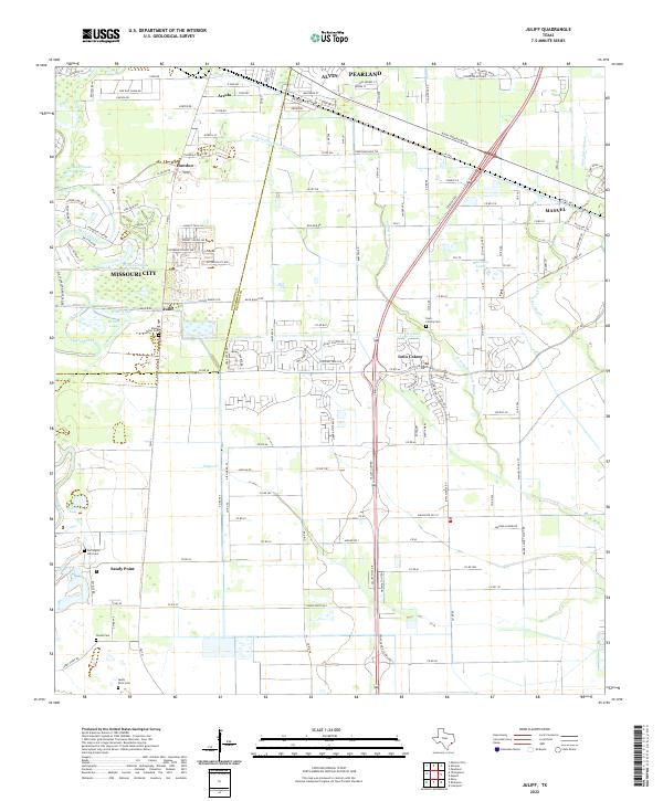 2022 Juliff2022 Print · USGSBrazoria County meets Fort Bend County in the early twenty-first century as suburban expansion reaches historic ranchlands. Researchers can locate several burial sites, including Iowa Colony Cem and Woods Cem, or trace the path of the Old Sugarland Railroad.
 - 2022 Map of Friendswood, 2022 Print
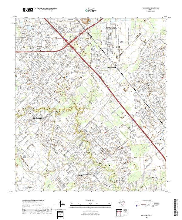 2022 Friendswood2022 Print · USGSThe Gulf Coast suburbs south of Houston were rapidly maturing by the early 2020s, dominated by modern aviation and intricate waterways. Researchers can trace local heritage at the Friendswood Friends Church Cemetery or explore the aviation footprints of Ellington Airport and Polly Ranch Airport.
 - 2022 Map of Pearland, 2022 Print
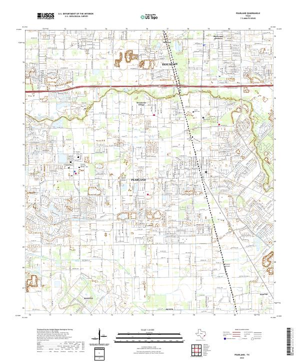 2022 Pearland2022 Print · USGSThe Pearland area in the early twenty-first century shows a landscape where historic burial grounds and small airfields meet modern suburban expansion. Genealogists can locate Old Settlers Cem and Southern Memorial Gardens among the newer developments.
End of results
Showing maps 1-4 of 4
Top cities near Pearland
- Houston historical maps
- Pasadena historical maps
- League City historical maps
- Missouri City historical maps
- Galveston historical maps
- Friendswood historical maps
See more
Top neighborhoods of Pearland
- Hastings historical maps
- Green Tee Terrace historical maps
- Banbury Cross historical maps
- Cabot Cove historical maps
- Canterbury Park historical maps
- Stonebridge historical maps
See more
Frequently asked questions
- What are the different types of historical maps available for Pearland?
- What is the oldest map of Pearland?
- Where can I purchase historical maps of Pearland for my home or office?
- Where can I download high-res historical maps of Pearland?
- Are there historical topographic maps available for Pearland?
- Is there historical aerial imagery available for Pearland?
- Where are historical maps of Pearland sourced from?