1970s Maps of Culberson County, Texas
Explore 71 historic maps of Culberson County from the 1970s. These maps offer a rare glimpse into what life looked like during the 1970s — showing old roads, neighborhoods, homes, and landmarks that have changed or disappeared over time.
Whether you're researching your family's past, planning a metal detecting trip, or studying how Culberson County's landscape evolved across the 1970s, these high-resolution maps are a powerful tool for exploring the history of this region.
- Focus on a specific era: All maps on this page are from the 1970s, giving you a focused view of this time period.
- See what’s changed: Compare century-old streets, trails, and buildings to today's modern landscape using overlays and satellite layers.
- Research with precision: Use these maps for genealogy, historical research, land use analysis, or educational projects.
- View, download, or print: Maps are fully viewable online in high resolution, and can be downloaded or printed for your own records.
Start exploring Culberson County's history through authentic maps from the 1970s. This is your window into the past.
Culberson County, TX maps
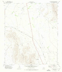
(71)- 1970 Map of Boracho, 1973 Print
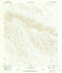
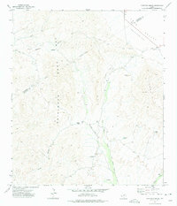
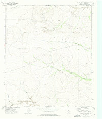
 1970 Boracho1973 Print · USGSCulberson County in the early seventies shows a landscape of rail-side settlements and high-desert ranching. Genealogists can find family landmarks like Stewart Windmill and the Cem near Boracho, along with a network of water-collection sites like Badger Tank.
 - 1970 Map of East Hunter Canyon, 1973 Print
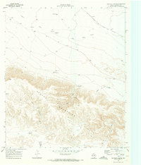
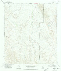
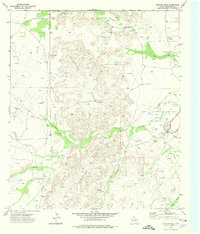
 1970 East Hunter Canyon1973 Print · USGSThe Apache Mountains of west Texas are captured here in the early 1970s, revealing a landscape defined by ranching and resource extraction. Trace the locations of Gentry Ranch, Krouse, and several scattered mines and prospects throughout the canyons.
 - 1970 Map of Panther Canyon, 1973 Print
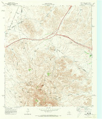
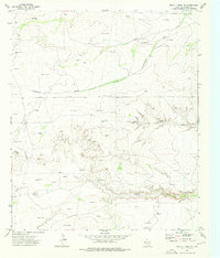
 1970 Panther Canyon1973 Print · USGSCulberson County ranch lands and the rugged Apache Mountains are captured here in the early seventies. Genealogists and historians can trace the vital water network of the era, from Foster Ranch to the Jackson Windmill and the Texas and Pacific rail line.
 - 1970 Map of San Martine, 1973 Print
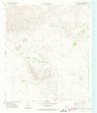
 1970 San Martine1973 Print · USGSThe West Texas ranchlands and the Culberson-Reeves county line come into focus during the early seventies. Researchers can trace the infrastructure of the desert economy through landmarks like the T Diamond Ranch, Seven Heart Crossing, and the Texas and Pacific railroad.
 - 1970 Map of Gomez Peak, 1973 Print
 1970 Gomez Peak1973 Print · USGSThe High Desert ranchlands of West Texas are captured here at the start of the 1970s. Trace old family outfits and remote outposts like Dyer Camp, Cowden Ranch, and the Cowan Homestead among the peaks and springs.2 unique versions available
 - 1970 Map of Kent, 1973 Print
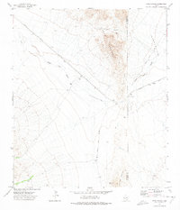
 1970 Kent1973 Print · USGSNear the Apache Mountains in the early seventies, the Texas and Pacific railroad and local ranching interests define the landscape. Researchers can trace the layout of Kent, locate old water tanks like Lippy Tank, and find the Patterson settlement.
 - 1970 Map of Iron Mountain, 1973 Print
 1970 Iron Mountain1973 Print · USGSCulberson County ranching and rail infrastructure are captured here in the early seventies, showing a landscape shaped by water scarcity. Researchers can find old cattle industry landmarks like Pistola Windmill and Goat Shed Waterhole alongside the Texas and Pacific rail line.
 - 1970 Map of Fencepost Draw, 1973 Print
 1970 Fencepost Draw1973 Print · USGSCulberson and Jeff Davis counties are captured here in the early seventies, showcasing a landscape defined by ranching outposts and railroad transit. Trace the Texas and Pacific line or locate remote camps like Fencepost and Middle Horse Camp Tank.
 - 1972 Map of Chispa Mountain NW, 1974 Print
 1972 Chispa Mountain NW1974 Print · USGSCulberson County ranchlands and desert basins are revealed in this early 1970s survey. Researchers can trace the isolated Landing Strips and essential water sources like a Well or Tank tucked into the Wylie Mountains.
 - 1972 Map of Van Horn Wells, 1974 Print
 1972 Van Horn Wells1974 Print · USGSCulberson County in the early seventies is a landscape of vast basins and isolated ranching outposts along the rail line. Researchers can trace the Southern Pacific tracks past the Waddell Ranch or locate the historic Grave near the Van Horn Wells.
 - 1972 Map of Lobo, 1975 Print
 1972 Lobo1975 Print · USGSThe Trans-Pecos desert in the early seventies centers on the rail siding of Lobo and the massive Van Horn Mountains. Researchers can trace ranching infrastructure like the High Lonesome Windmill and the path of the Southern Pacific railroad.
 - 1972 Map of Lobo SW, 1975 Print
 1972 Lobo SW1975 Print · USGSThe Trans-Pecos highlands are captured here in the early 1970s, showing a landscape of mining prospects and remote ranching. Trace old industrial paths along the Old Railroad Grade or locate historic operations like the Plata Verde Mine and Mica Mine.
 - 1972 Map of Mesquite Spring, 1975 Print
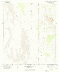
 1972 Mesquite Spring1975 Print · USGSThe High Desert borderlands along the Rio Grande appear in detail in the early 1970s. Researchers can trace remote water sources like Mesquite Spring, isolated outposts at Sixty Six, and the winding path of the Green River.
 - 1972 Map of Bass Canyon, 1975 Print
 1972 Bass Canyon1975 Print · USGSThe Trans-Pecos desert comes alive in the early seventies as ranching and mining operations dot the landscape between the Carrizo Mountains and Van Horn Mountains. Trace the Southern Pacific rail line and find the Plata Verde Mines or Piñon Ranch.
 - 1972 Map of Ninetysix Ranch, 1975 Print
 1972 Ninetysix Ranch1975 Print · USGSJeff Davis and Culberson Counties in the early 1970s reveal a high-desert landscape defined by the Van Horn Mountains. Trace the isolated Ninetysix Ranch, an Old Railroad Grade, and remote water features like Baldy Tank.
 - 1972 Map of Chispa Mountain, 1975 Print
 1972 Chispa Mountain1975 Print · USGSThe Trans-Pecos high desert of the early seventies is revealed here, where the Southern Pacific rail line bisects the Lobo Valley. Researchers can trace the county line across Chispa Mountain or locate the site at Danube.
 - 1972 Map of Seven Heart Gap, 1976 Print
 1972 Seven Heart Gap1976 Print · USGSCulberson County ranchland in the early seventies is defined by isolated outposts and vital water catchments among the high desert peaks. Trace the locations of family-run operations at Stanton Ranch and remote landmarks like Old Baldy and Seven Heart Gap.
 - 1972 Map of Square Mesa, 1976 Print
 1972 Square Mesa1976 Print · USGSCulberson County ranching lands are captured here in the early seventies, showcasing the remote desert geography of West Texas. Researchers can locate family-named water sources like Hammett Well and Stark North Well near the prominent Square Mesa.
 - 1973 Map of Dellahunt Draw West, 1975 Print
 1973 Dellahunt Draw West1975 Print · USGSCulberson County ranching and early energy exploration are documented here in the early 1970s. Researchers can trace land use through named livestock infrastructure like Sulphur Windmill and West Humphrey Tank, alongside various Drill Holes.
 - 1973 Map of Seven L Peak, 1975 Print
 1973 Seven L Peak1975 Print · USGSCulberson County ranch lands are detailed in the early 1970s, showing a high desert landscape shaped by water and wind. Researchers can trace remote ranching sites and landmarks like Seven L Well, High Lonesome Well, and The Pinnacle.
 - 1973 Map of Two Mill Draw West, 1976 Print
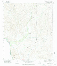
 1973 Two Mill Draw West1976 Print · USGSCulberson County ranching life is preserved here in the early seventies, showing a landscape shaped by water and isolation. Researchers can trace historic sites like Old Christian Place, the settlement at Walker, and remote water markers such as Canyon Spring.
 - 1973 Map of Bitter Well Mountain NW, 1976 Print
 1973 Bitter Well Mountain NW1976 Print · USGSThe high desert border of Hudspeth and Culberson Counties in the early 1970s shows a landscape shaped by water scarcity. Researchers can locate remote ranching landmarks like Hardluck Well, Black John Well, and Soda Wells, alongside a secluded Landing Strip.
 - 1973 Map of Owl Hills, 1976 Print
 1973 Owl Hills1976 Print · USGSThe Texas-New Mexico borderland comes into focus in the early 1970s, showing a landscape shaped by the Delaware River and high-desert ranching. Genealogists and historians can trace local landmarks like Prewit Ranch, Owl Spring, and early energy exploration at various Drill Hole sites.
 - 1973 Map of Seven L Peak NE, 1976 Print
 1973 Seven L Peak NE1976 Print · USGSCulberson County ranch lands and exploration sites are mapped here in the early 1970s. Local researchers can trace water infrastructure and prospecting history through scattered drill holes and landmarks like Salt Grass Windmill, Virginia Draw, and Flowing Well.
 - 1973 Map of Rustler Hills, 1976 Print
 1973 Rustler Hills1976 Print · USGSCulberson County's arid landscape is captured here in the early seventies, showcasing a rugged environment shaped by sulfur mining and rail transport. Researchers can trace industrial sites like the Old Michigan Mine, the Sulfur Plant, and the Atchison Topeka and Santa Fe railroad.
Showing maps 1-25 of 71
Top cities of Culberson County
Frequently asked questions
- What are the different types of historical maps available for Culberson County?
- What is the oldest map of Culberson County?
- Where can I purchase historical maps of Culberson County for my home or office?
- Where can I download high-res historical maps of Culberson County?
- Are there historical topographic maps available for Culberson County?
- Is there historical aerial imagery available for Culberson County?
- Where are historical maps of Culberson County sourced from?