1960s Maps of Culberson County, Texas
Explore 9 historic maps of Culberson County from the 1960s. These maps offer a rare glimpse into what life looked like during the 1960s — showing old roads, neighborhoods, homes, and landmarks that have changed or disappeared over time.
Whether you're researching your family's past, planning a metal detecting trip, or studying how Culberson County's landscape evolved across the 1960s, these high-resolution maps are a powerful tool for exploring the history of this region.
- Focus on a specific era: All maps on this page are from the 1960s, giving you a focused view of this time period.
- See what’s changed: Compare century-old streets, trails, and buildings to today's modern landscape using overlays and satellite layers.
- Research with precision: Use these maps for genealogy, historical research, land use analysis, or educational projects.
- View, download, or print: Maps are fully viewable online in high resolution, and can be downloaded or printed for your own records.
Start exploring Culberson County's history through authentic maps from the 1960s. This is your window into the past.
Culberson County, TX maps
(9)- 1964 Map of Goat Canyon, 1967 Print
 1964 Goat Canyon1967 Print · USGSCulberson County ranching life in the mid-1960s centered on the high-desert drainages of the Apache Mountains. Researchers can trace the layout of family-run outposts like Munn Ranch and Stansberry Ranch alongside vital water sources such as Threemile Tank.
 - 1964 Map of Wild Horse, 1967 Print
 1964 Wild Horse1967 Print · USGSCulberson County in the mid-sixties reveals a remote ranching and transit landscape where the mountains meet the basin floor. Researchers can trace the Texas and Pacific rail line and locate landmarks like Harper Ranch and Durrill Camp.2 unique versions available
 - 1964 Map of Hackett Peak, 1967 Print
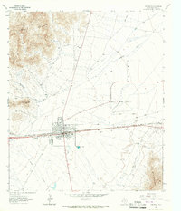
 1964 Hackett Peak1967 Print · USGSWest Texas ranching and mining define this landscape during the mid-sixties, where the Texas and Pacific cuts through the high desert. Researchers can locate family outposts like Sammons Ranch, find old Prospects, and trace the route to Allamoore.
 - 1964 Map of Watson Ranch, 1967 Print
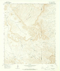
 1964 Watson Ranch1967 Print · USGSCulberson County ranching country is documented here in the mid-1960s, showing a landscape defined by water access and mountain foothills. Researchers can trace remote sites like Watson Ranch, the Medley Double Wells, and the Landing Strip.
 - 1964 Map of Van Horn, 1967 Print
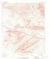
 1964 Van Horn1967 Print · USGSVan Horn sits at a vital Texas mountain pass during the mid-sixties, where rail and ranching cultures intersected. Genealogists and historians can locate the Eagle Sch, Neal Ranch, and the Texas and Pacific tracks that shaped this desert community.2 unique versions available
 - 1964 Map of Sheep Peak, 1967 Print
 1964 Sheep Peak1967 Print · USGSThe Trans-Pecos ranching and mining landscape of the 1960s is preserved here in the shadows of the Sierra Diablo. Researchers can trace remote mining sites like Mohawk Mine and Sancho Panza Mine alongside family holdings at Circle Ranch.
 - 1964 Map of Nutt Ranch, 1967 Print
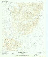 1964 Nutt Ranch1967 Print · USGSCulberson County ranching life in the mid-1960s is preserved here, showing the remote outposts that anchored the high desert. Researchers can trace land use through a Corral, the Nutt Ranch, and a Jeep Trail winding through the Baylor Mountains.
 - 1964 Map of Plateau, 1967 Print
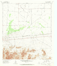
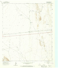 1964 Plateau1967 Print · USGSCulberson County's high desert landscape comes into focus during the mid-1960s, centered on the transit and ranching outpost of Plateau. Researchers can trace the path of the Texas and Pacific railroad and locate old water features like Plateau Tank and Sacaton Draw.2 unique versions available
 - 1965 Map of Marfa
 1965 Marfa1965 Print · USGSBig Bend ranching and high-desert rail travel come together in the 1960s along the Rio Grande and the southern reaches of the Davis Mountains. Researchers can trace the lineage of cattle outfits like Brite Ranch and historic stops like Valentine and Candelaria.
End of results
Showing maps 1-9 of 9
Top cities of Culberson County
Frequently asked questions
- What are the different types of historical maps available for Culberson County?
- What is the oldest map of Culberson County?
- Where can I purchase historical maps of Culberson County for my home or office?
- Where can I download high-res historical maps of Culberson County?
- Are there historical topographic maps available for Culberson County?
- Is there historical aerial imagery available for Culberson County?
- Where are historical maps of Culberson County sourced from?