Old Maps of Culberson County, Texas for Genealogy
Trace your family roots with 228 historic maps of Culberson County. These high-res maps reveal old neighborhoods, homesites, landmarks, and streets — helping you uncover where your ancestors lived and how the area evolved over time.
- Explore historic neighborhoods: Identify where your relatives may have lived in the 1800s or 1900s.
- Compare maps over time: Trace the changes in streets, buildings, and landmarks for multi-generational research.
- Perfect for genealogy & ancestry research: Used by family historians and researchers to map out lineage and migration.
These maps are an incredible resource for exploring your personal connection to Culberson County's past.
Culberson County, TX maps
(228)- 1892 Map of Chispa, 1957 Print
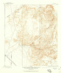
 1892 Chispa1957 Print · USGSWest Texas railroad outposts and mountain passes are documented here in the final decade of the nineteenth century. Genealogists and historians can trace the early rail stops at Arno, Chispa, and Van Horn Wells along the original Southern Pacific line.
 - 1894 Map of Valentine, 1959 Print
 1894 Valentine1959 Print · USGSThe high peaks of West Texas come to life in this late-frontier survey of the Trans-Pecos ranching country. Researchers can trace the early rail influence at Valentine and locate numerous historic homesteads including Hardwicks Ranch and Newmans Ranch.
 - 1895 Map of Chispa
 1895 Chispa1895 Print · USGSWest Texas rail travel was in its prime during the late nineteenth century as steam engines traversed the mountain passes. Genealogists and rail historians can trace early sidings and stops like Van Horns Wells, Chispa, and the natural crossing at Vieja Pass.
 - 1897 Map of Valentine
 1897 Valentine1897 Print · USGSThe Davis Mountains frontier and the railroad town of Valentine are shown here in the mid-1890s. Researchers can locate remote high-country outposts like Prude's Ranch and Newman's Ranch or trace the early course of the Southern Pacific R. R.6 unique versions available
 - 1897 Map of Chispa
 1897 Chispa1897 Print · USGSWest Texas rail culture and high-desert landscapes take center stage in the 1890s as steam power bridges the vast distances between the Rio Grande and the interior mountains. Genealogists and historians can trace the early rail stops at Chispa and Dalberg, or locate the critical water source at Van Horn Wells.3 unique versions available
 - 1906 Map of Van Horn
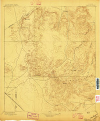
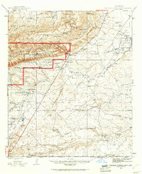
 1906 Van Horn1906 Print · USGSThe Trans-Pecos frontier is captured here at the turn of the century as the railroad and mining industry reshaped the high desert. Trace early family landholdings like Jones Ranch and Millican's Ranch, or locate historic operations like the Hazel Mine.5 unique versions available
 - 1928 Map of Kent
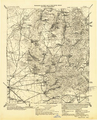
 1928 Kent1928 Print · USGSWest Texas ranching and rail life at the end of the 1920s are captured here as the region transitioned toward modern highway travel. Genealogists and historians can trace early outposts like Kent, family ranch sites such as Diamond Ranch, and the route of the Old Spanish Trail.
 - 1933 Map of Guadalupe Peak
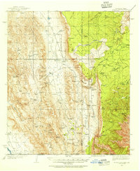
 1933 Guadalupe Peak1933 Print · USGSThe high desert of Culberson County meets the Texas peaks in the 1930s, documenting a landscape of remote ranching outposts and high-altitude mining. Genealogists and historians can trace family-named sites like Ables PO, Williams Ranch, and Sid Ables Well alongside early mountain retreats.6 unique versions available
 - 1935 Map of El Paso Gap, 1954 Print
 1935 El Paso Gap1954 Print · USGSThe Guadalupe Mountains of the mid-thirties are captured here as a landscape of isolated ranching outposts and vital water tanks. Genealogists and historians can trace family homesteads like Thayer Ranch and Carpenter Ranch, or locate the rural schoolhouses at Queen Sch and Dog Canyon Sch.2 unique versions available
 - 1936 Map of El Paso Gap
 1936 El Paso Gap1936 Print · USGSThe high desert ranching frontier along the New Mexico-Texas border is captured here during the mid-1930s. Researchers can locate remote schools and outposts like Queen Sch, the El Paso Gap PO, and family-named landmarks including Thayer Ranch.
 - 1940 Map of El Paso Gap
 1940 El Paso Gap1940 Print · USGSThe Guadalupe Mountains of southern New Mexico are shown in the mid-1930s, defined by a network of remote livestock ranches and isolated mountain schools. Genealogists and historians can trace family landholdings at Hepler Ranch or Lewis Ranch and locate vanished local landmarks like Queen Sch and the Old Post Place.3 unique versions available
 - 1940 Map of Guadalupe Peak, 1949 Print
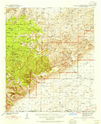
 1940 Guadalupe Peak1949 Print · USGSCulberson County ranching and the high peaks of West Texas are captured here in the decade before the national park's founding. Genealogists and historians can trace family landholdings like Williams Ranch, Hegler Ranch, and the remote settlement at Frijole.2 unique versions available
 - 1940 Map of Carlsbad Caverns West, 1955 Print
 1940 Carlsbad Caverns West1955 Print · USGSThe Guadalupe Mountains of southern New Mexico are shown here just before the mid-century, revealing a remote ranching and caving landscape. Researchers can trace early family outposts like Able Ranch and Thurman Ranch or locate the numerous karst features such as Mudgetts Cave and Painted Grotto.5 unique versions available
 - 1943 Map of Carlsbad Caverns West
 1943 Carlsbad Caverns West1943 Print · USGSEddy County ranching outposts and the subterranean wonders of the Guadalupe Mountains are captured here in the early 1940s. Genealogists and historians can trace family land at Montgomery Ranch, visit the site of Queen (Ruins), or explore the springs at Sitting Bull Falls.
 - 1943 Map of Valentine
 1943 Valentine1943 Print · USGSValentine and the Davis Mountains come alive in this mid-century look at the cattle and rail country of West Texas. Genealogists and historians can trace family-named holdings like Means Ranch Hdqrs., Prude's Ranch, and the isolated Foster Cabin.
 - 1945 Map of Carlsbad Caverns East, 1961 Print
 1945 Carlsbad Caverns East1961 Print · USGSSoutheast New Mexico in the mid-1940s reveals a rugged landscape of ranching outposts and high desert canyons. Genealogists and researchers can locate family sites like the W W Smith & Sons Ranch, explore the early footprint of White City, or find the Julian Smith Cem.2 unique versions available
 - 1945 Map of Malaga, 1970 Print
 1945 Malaga1970 Print · USGSEddy County ranchlands and river valleys are captured here at the end of the war, as the rail-and-ranch economy shaped southern New Mexico. Genealogists and historians can locate specific family holdings like the Delaware Ranch and Welch Ranch, alongside a vintage Bombing Target.
 - 1946 Map of Malaga
 1946 Malaga1946 Print · USGSSouthern New Mexico ranching and river life are frozen in time just after the war. Researchers can trace family ranch lands like Cottonwood Ranch and Reeves Ranch or locate unique landmarks like the Bombing Target and Harkey Double Mills.
 - 1947 Map of Carlsbad Caverns East
 1947 Carlsbad Caverns East1947 Print · USGSThe Guadalupe Mountains and the high desert of Eddy County are captured here just after the war. Researchers can trace early ranching boundaries and landmarks like White City, the Cavern Entrance, and a remote Bombing Target.
 - 1954 Map of Carlsbad, 1963 Print
 1954 Carlsbad1963 Print · USGSSoutheastern New Mexico's desert peaks and river valleys appear in this mid-century study of the borderlands. Researchers can locate vanished sites like Sacramento City, trace the Pecos River reservoirs, and explore Carlsbad Caverns.3 unique versions available
 - 1954 Map of Van Horn, 1964 Print
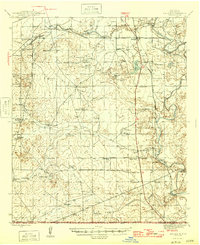
 1954 Van Horn1964 Print · USGSThe Trans-Pecos region of West Texas comes into focus in the mid-1950s as a vital corridor of rail and desert commerce. Researchers can trace the path of the Texas and Pacific through Van Horn or locate remote rail sidings like Borracho and Laska Siding.2 unique versions available
 - 1958 Map of Van Horn
 1958 Van Horn1958 Print · USGSWest Texas ranching and rail history come alive in this 1950s survey of the Trans-Pecos desert during the era of major steam-to-diesel transition. Genealogists and historians can trace family-named outposts like Mayfield Ranch or locate the ruins of Presidio Viejo along the Rio Grande.
 - 1958 Map of Carlsbad
 1958 Carlsbad1958 Print · USGSSoutheastern New Mexico in the mid-1950s shows a landscape of deep desert basins and high forest ranges during a period of steady ranching and early tourism. Researchers can trace the path of the Atchison Topeka and Santa Fe railroad or find vanished locales like Sacramento City (abandoned) and Whites City.2 unique versions available
 - 1959 Map of Marfa, 1976 Print
 1959 Marfa1976 Print · USGSThe Trans-Pecos frontier is captured here in the mid-twentieth century as cattle ranching and high-altitude science shaped the landscape. Researchers can trace the Southern Pacific rail line through Valentine or locate remote border outposts like Ruidosa and Indian Hot Springs Resort.2 unique versions available
 - 1964 Map of Goat Canyon, 1967 Print
 1964 Goat Canyon1967 Print · USGSCulberson County ranching life in the mid-1960s centered on the high-desert drainages of the Apache Mountains. Researchers can trace the layout of family-run outposts like Munn Ranch and Stansberry Ranch alongside vital water sources such as Threemile Tank.
Showing maps 1-25 of 228
Top cities of Culberson County
Frequently asked questions
- What are the different types of historical maps available for Culberson County?
- What is the oldest map of Culberson County?
- Where can I purchase historical maps of Culberson County for my home or office?
- Where can I download high-res historical maps of Culberson County?
- Are there historical topographic maps available for Culberson County?
- Is there historical aerial imagery available for Culberson County?
- Where are historical maps of Culberson County sourced from?