Old Maps of Dallam County, Texas for Genealogy
Trace your family roots with 269 historic maps of Dallam County. These high-res maps reveal old neighborhoods, homesites, landmarks, and streets — helping you uncover where your ancestors lived and how the area evolved over time.
- Explore historic neighborhoods: Identify where your relatives may have lived in the 1800s or 1900s.
- Compare maps over time: Trace the changes in streets, buildings, and landmarks for multi-generational research.
- Perfect for genealogy & ancestry research: Used by family historians and researchers to map out lineage and migration.
These maps are an incredible resource for exploring your personal connection to Dallam County's past.
Dallam County, TX maps
(269)- 1954 Map of Dalhart, 1967 Print
 1954 Dalhart1967 Print · USGSThe High Plains at the junction of four states come alive in the mid-fifties, showing a landscape of rail-hub towns and cattle country. Trace the Old Santa Fe Trail or locate mid-century industrial sites like the Dry ice plant and Carbon Dioxide Works.2 unique versions available
 - 1958 Map of Dalhart
 1958 Dalhart1958 Print · USGSThe High Plains of the tri-state border region come alive in this mid-century survey of the ranching and rail territory around the Texas Panhandle. Genealogists and historians can trace the paths of the Atchison Topeka & Santa Fe Ry, military outposts like Dalhart Air Force No 1, and early settlements such as Pasamonte and Texline.2 unique versions available
 - 1962 Map of Dalhart
 1962 Dalhart1962 Print · USGSThe High Plains and volcanic peaks of the tri-state area are shown in detail during the early sixties. Genealogists and historians can trace the rail corridors of the Fort Worth and Denver and find industrial sites like the Cactus Ordnance Works or the Beaver Meade & Englewood Grain Elevator.
 - 1964 Map of Brickel, 1966 Print
 1964 Brickel1966 Print · USGSThe high plains of the Texas Panhandle near the Sherman County line are captured in the mid-sixties. Researchers can trace the path of the Chicago Rock Island and Pacific railroad and the winding course of Coldwater Creek.
 - 1964 Map of Kerrick, 1966 Print
 1964 Kerrick1966 Print · USGSDallam County at the edge of the Texas Panhandle is captured here in the mid-1960s, showing a landscape shaped by rail and agriculture. Researchers can trace the Atchison Topeka and Santa Fe railroad through Kerrick and past rural landmarks like Mallett and local Oil Wells.
 - 1964 Map of Stratford 2 SE, 1966 Print
 1964 Stratford 2 SE1966 Print · USGSDallam County in the mid-1960s is shown as a landscape defined by ranching and resource extraction across the high plains. Researchers can trace the winding course of Coldwater Creek or locate vital water infrastructure like the scattered Wells and a remote Cistern.2 unique versions available
 - 1964 Map of Stratford 2 NE, 1966 Print
 1964 Stratford 2 NE1966 Print · USGSThe Texas-Oklahoma borderlands come into focus in the mid-sixties, revealing a rural landscape shaped by energy and agriculture. Researchers can trace early industrial footprints through features like the northern Pipeline, a utility Substation, and scattered Gas Wells.2 unique versions available
 - 1965 Map of Wilco, 1966 Print
 1965 Wilco1966 Print · USGSThe high plains of the Texas Panhandle in the mid-1960s reveal a landscape of long-distance rail and remote community centers. Researchers can trace the Chicago Rock Island and Pacific railroad and locate local social hubs like Coloney Community House.
 - 1965 Map of Conlen, 1966 Print
 1965 Conlen1966 Print · USGSDallam and Sherman counties in the mid-1960s reveal a quiet landscape of agricultural transport and groundwater development. Researchers can trace the rail-side infrastructure at Conlen, from the Grain Elevator to the nearby Landing Strip and Quarry.
 - 1965 Map of Wilco NE, 1966 Print
 1965 Wilco NE1966 Print · USGSThe Texas Panhandle's railroad-driven growth is on display in the mid-1960s. Researchers can trace the diagonal route of the Chicago Rock Island and Pacific and identify small stops at Irwin and Chamberlin.
 - 1965 Map of Exum, 1966 Print
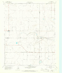 1965 Exum1966 Print · USGSThe Texas Panhandle plains meet at a four-county junction during the mid-1960s, showing a landscape defined by grain transport and emerging energy. You can trace the CHICAGO ROCK ISLAND AND PACIFIC rail line to the Storage Bins at Exum and follow the seasonal waters of North Palo Duro Creek.
 - 1969 Map of Felt SW, 1971 Print
 1969 Felt SW1971 Print · USGSThe Oklahoma Panhandle is captured here at the turn of the 1970s, where the high plains meet the New Mexico and Texas borders. Genealogists and historians can trace the remote section lines of Wheeless and Gresham or locate landmarks like Roadside Park.
 - 1969 Map of Boise City SW, 1971 Print
 1969 Boise City SW1971 Print · USGSThe Oklahoma Panhandle and Texas borderlands meet in this late-sixties survey of the High Plains. Genealogists and local historians can locate the Bertrand Cem and trace the paths of the North Canadian River and Aqua Fria Creek.
 - 1969 Map of Felt, 1971 Print
 1969 Felt1971 Print · USGSThe Oklahoma Panhandle is captured here in the late sixties, centered on the settlement of Felt near the Texas state line. Researchers can trace rural life through numerous wells, the North Canadian River valley, and landmarks like Gresham.
 - 1969 Map of Boise City SE, 1971 Print
 1969 Boise City SE1971 Print · USGSHigh Plains ranching and border history define this Oklahoma Panhandle survey from the late sixties. Researchers can trace the Oklahoma Texas boundary and locate numerous remote ranch sites identified by their Wells and local terrain like Cleveland.2 unique versions available
 - 1970 Map of Texline South, 1973 Print
 1970 Texline South1973 Print · USGSThe high plains of the New Mexico and Texas border come alive in this early 1970s survey of the railroad town of Texline. Genealogists and researchers can trace rural infrastructure along the Fort Worth and Denver rail line, Perico Creek, and Carrizo Creek.
 - 1970 Map of Texline North, 1973 Print
 1970 Texline North1973 Print · USGSThe high plains borderland at the New Mexico and Texas line is captured here in the early seventies as a hub of rail and ranching life. Researchers can trace the junction of the Ft Worth and Denver railroad near Texline and locate local landmarks like the Rodeo Ground and Worsham.
 - 1970 Map of Sedan SE, 1973 Print
 1970 Sedan SE1973 Print · USGSThe high plains along the border of New Mexico and Texas are captured here during the 1970 field check. Researchers can locate the isolated Shaha Cem and trace the path of Tramperos Creek across the county lines of Union, Dallam, and Hartley.
 - 1970 Map of Sedan NE, 1973 Print
 1970 Sedan NE1973 Print · USGSThe high plains of the New Mexico and Texas border come into focus in the early 1970s, showing a landscape defined by ranching and water management. Researchers can trace the settlement at Campsey and follow the path of Carrizo Creek past numerous remote wells.2 unique versions available
 - 1971 Map of Griggs SW, 1973 Print
 1971 Griggs SW1973 Print · USGSThe Oklahoma-Texas borderlands are captured here in the early seventies as the High Plains drop into the river breaks. Researchers can locate the Marella Cem, trace the Beaver River, and find the rural Plainview Sch near active Oil Fields.
 - 1971 Map of Conrad SW, 1973 Print
 1971 Conrad SW1973 Print · USGSThe Oklahoma-Texas borderlands are captured in the early seventies, showing a landscape of high plains and river drainage. Researchers can trace the path of the A T & S F railroad or locate remote infrastructure like the Landing Strip and Caliche Pit.
 - 1971 Map of Conrad, 1973 Print
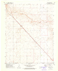 1971 Conrad1973 Print · USGSThe Oklahoma Panhandle and North Texas borderlands meet in this early 1970s survey of the high plains. Researchers can trace the Atchison Topeka and Santa Fe rail line past Conrad toward the Beaver River and Ritner Lake.
 - 1972 Map of Rardin Hill, 1975 Print
 1972 Rardin Hill1975 Print · USGSThe high plains of Union County meet the Oklahoma and Texas borders in the early 1970s, showing a ranching landscape defined by survey lines and water. Genealogists and historians can locate Creeds Chapel Cem, the settlement of Hoover, and family-named landmarks like Mason Windmill.
 - 1973 Map of Stratford 2 NW, 1975 Print
 1973 Stratford 2 NW1975 Print · USGSThe northern Panhandle landscape during the early 1970s reveals a quiet ranching territory straddling the Oklahoma-Texas line. Researchers can trace the winding course of Coldwater Creek past isolated landmarks like Sneed and Lost Camp.2 unique versions available
 - 1973 Map of Buffalo Springs, 1975 Print
 1973 Buffalo Springs1975 Print · USGSThe northern Texas Panhandle meets the Oklahoma border in this early 1970s survey. Genealogists and researchers can trace the landscape around Buffalo Springs, Thompson Grove, and the seasonal Alkali Lakes.
Showing maps 1-25 of 269
Top cities of Dallam County
Frequently asked questions
- What are the different types of historical maps available for Dallam County?
- What is the oldest map of Dallam County?
- Where can I purchase historical maps of Dallam County for my home or office?
- Where can I download high-res historical maps of Dallam County?
- Are there historical topographic maps available for Dallam County?
- Is there historical aerial imagery available for Dallam County?
- Where are historical maps of Dallam County sourced from?