Old Maps of DeWitt County, Texas for Genealogy
Trace your family roots with 69 historic maps of DeWitt County. These high-res maps reveal old neighborhoods, homesites, landmarks, and streets — helping you uncover where your ancestors lived and how the area evolved over time.
- Explore historic neighborhoods: Identify where your relatives may have lived in the 1800s or 1900s.
- Compare maps over time: Trace the changes in streets, buildings, and landmarks for multi-generational research.
- Perfect for genealogy & ancestry research: Used by family historians and researchers to map out lineage and migration.
These maps are an incredible resource for exploring your personal connection to DeWitt County's past.
DeWitt County, TX maps
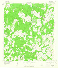
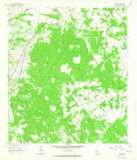
(69)- 1920 Map of Smiley
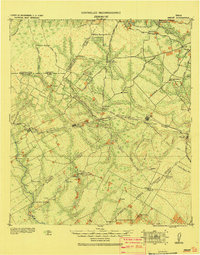 1920 Smiley1920 Print · USGSSouth Texas ranching and rail life are preserved here in the era following the first World War. Genealogists can trace family roots through labeled landmarks like Willow Springs Ranch, the Southern Pacific Railroad, and the settlement at Nixon.
 - 1953 Map of Beeville
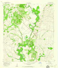
 1953 Beeville1953 Print · USGSThe Texas Coastal Bend in the early fifties shows a landscape of growing regional hubs and vital maritime corridors. Trace the rail-and-river economy through Goliad, locate the Matagorda Lighthouse, and explore the sprawling Aransas National Wildlife Refuge.
 - 1953 Map of Seguin, 1965 Print
 1953 Seguin1965 Print · USGSSouth Texas in the early fifties shows a thriving river-and-rail economy across the Guadalupe and Colorado basins. Genealogists and historians can trace rail routes like the Southern Pacific through Seguin, locate oil wells, or find the Gary AAF near San Marcos.4 unique versions available
 - 1956 Map of Beeville
 1956 Beeville1956 Print · USGSCoastal Texas and the brush country interior are shown in the mid-fifties, from the coastal bays to the inland oil fields. Trace the old rail lines of the Southern Pacific RR or locate the historic Matagorda Lighthouse and the Aransas National Wildlife Refuge.2 unique versions available
 - 1958 Map of Seguin
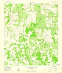
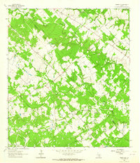
 1958 Seguin1958 Print · USGSSouth Texas in the late fifties was a network of river-valley settlements and active oilfields tied together by major rail lines. Genealogists and historians can trace family-named sites across Rabb Prairie, locate the Behring Store, or follow the Southern Pacific through Schulenburg.
 - 1959 Map of Hochheim, 1960 Print
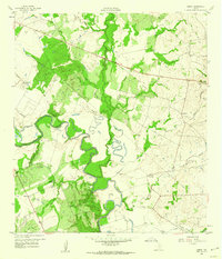
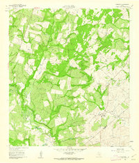
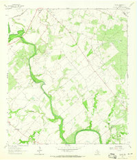
 1959 Hochheim1960 Print · USGSThe Guadalupe River valley in the late fifties was a landscape of winding oxbows and rural crossings at the DeWitt-Gonzales county line. Researchers can locate family landmarks like Ebenezer Ch, the community of Dreyer, and several Gravel Pits.3 unique versions available
 - 1959 Map of Hamon, 1960 Print
 1959 Hamon1960 Print · USGSThe Guadalupe River valley in Gonzales County appears here in the late fifties, during a period of shifting rural settlements. Researchers can locate the Hamon (Original Townsite), find the Hamon Ch, and trace old industrial sites like the local Clay Pits.2 unique versions available
 - 1960 Map of Beeville
 1960 Beeville1960 Print · USGSCoastal Texas in the mid-fifties reveals a landscape of growing towns and vital military outposts like Foster AFB. Researchers can trace old rail lines including the Missouri Pacific and explore the vast Aransas National Wildlife Refuge.
 - 1960 Map of Cuero, 1961 Print
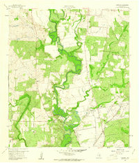
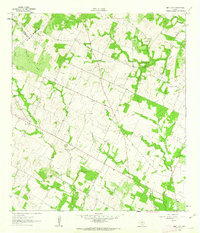
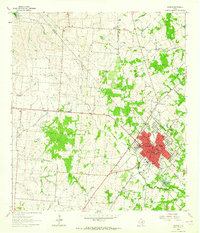
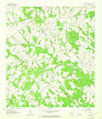
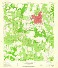 1960 Cuero1961 Print · USGSCuero and the surrounding DeWitt County ranching and rail lands are captured here at the start of the 1960s. Genealogists and local historians can trace family locations through several burial grounds like Hillside Cem and Westville Cem, alongside rural schools such as Ratcliffe Sch.3 unique versions available
 - 1960 Map of Concrete, 1961 Print
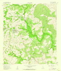
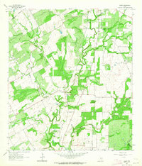
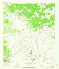
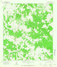
 1960 Concrete1961 Print · USGSDeWitt County appears in the early sixties as a landscape of river bends and rail lines at the height of its mid-century rural character. Genealogists and local historians can trace family locations near Nelms Cem, the Valley View Sch, and the community hub of Concrete.3 unique versions available
 - 1960 Map of Blackwell Lake, 1962 Print
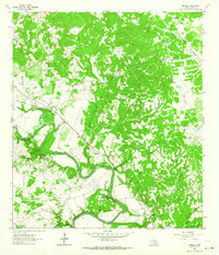
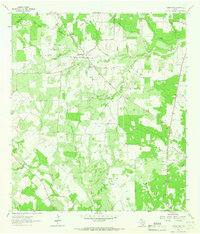
 1960 Blackwell Lake1962 Print · USGSDeWitt County ranchlands come into focus in 1960, showing the rural lifestyle of Central Texas during the mid-century. Genealogists and historians can trace family properties like Respondek Ranch and locate community landmarks such as St John Ch and the Woods Cem.3 unique versions available
 - 1960 Map of Cheapside, 1962 Print
 1960 Cheapside1962 Print · USGSThe rural landscape near the Gonzales and De Witt County line comes to life in this early 1960s survey. Genealogists and local historians can trace family ties at Mt Enon Cemetery and Rupert Cemetery or explore the geography around Cheapside and Five Mile Lake.2 unique versions available
 - 1960 Map of Westhoff, 1962 Print
 1960 Westhoff1962 Print · USGSThe rural crossing at Westhoff during the early 1960s reveals a classic South Texas landscape of family ranches and rail-side industry. Genealogists and historians can locate legacy landmarks like St Aloysius Cem, the Du Bose Ranch Headquarters, and the Texas and New Orleans rail line.2 unique versions available
 - 1961 Map of Sample, 1963 Print
 1961 Sample1963 Print · USGSThe rural borderlands of Gonzales and De Witt counties come to life in the early sixties, showing the agricultural landscape anchored by the Southern Pacific rail line. Researchers can locate the Sample settlement, family-named landmarks like Van Cleave Mound, and the Billings Cem or Sample Cem burial sites.3 unique versions available
 - 1961 Map of New Davy, 1963 Print
 1961 New Davy1963 Print · USGSDeWitt County ranch land and rural crossroads are captured here in the early sixties at the intersection of three Texas counties. Researchers can locate family landmarks like Sand Gate Cem and trace the paths of Little Salt Creek and Fifteenmile Creek.2 unique versions available
 - 1961 Map of Ecleto, 1964 Print
 1961 Ecleto1964 Print · USGSThe rural border of Karnes and Wilson Counties comes into focus during the early sixties, showing a landscape defined by oil and ranching. Researchers can locate family landmarks like Treybig Cem and Gillett Sch or trace the Person Oil Field and Ecleto Creek.2 unique versions available
 - 1962 Map of Verhelle, 1964 Print
 1962 Verhelle1964 Print · USGSDeWitt County in the early 1960s was defined by the winding Guadalupe River and a growing energy economy. Trace the footprint of the Thomaston Oil Field or locate historic burial sites like Panteon San Isidro Labrador Cem and Taylor Cem.2 unique versions available
 - 1962 Map of Edgar, 1964 Print
 1962 Edgar1964 Print · USGSDeWitt County in the early 1960s shows a landscape of South Texas ranching and oil production along the rail lines. Local researchers can locate Edgar and Stratton, alongside family-history sites like Alexander Cem and Mt Zion Ch.3 unique versions available
 - 1962 Map of Terryville, 1964 Print
 1962 Terryville1964 Print · USGSDeWitt and Lavaca counties are shown here in the early 1960s as the local economy balanced ranching with a growing petroleum industry. Researchers can trace family sites at Terryville, locate the BRUSHY CREEK OIL FIELD, and find the Cook-Holland Cem or Hebron Ch.2 unique versions available
 - 1963 Map of Yoakum, 1964 Print
 1963 Yoakum1964 Print · USGSIn the early sixties, the railroad town of Yoakum served as a bustling crossroads for the Southern Pacific. Genealogists and historians can trace numerous rural landmarks, including the Sons of Herman Cem, Pearl City, and Morris Sch.2 unique versions available
 - 1963 Map of Fordtran, 1964 Print
 1963 Fordtran1964 Print · USGSThe rural border of De Witt and Victoria counties comes into focus in the early 1960s as a hub for petroleum and ranching. Researchers can trace the Railroad Grade near Fordtran or locate specific well sites within the Barry Oil Field.2 unique versions available
 - 1963 Map of Sweet Home, 1964 Print
 1963 Sweet Home1964 Print · USGSLavaca County's ranching and energy landscape is captured here during the early sixties, showing the rural community of Sweet Home. Researchers can trace family history through numerous sites like Queen of Peace Cem or explore the industrial footprint of the South Yoakum Oilfield.2 unique versions available
 - 1963 Map of Meyersville, 1965 Print
 1963 Meyersville1965 Print · USGSMeyersville and Arneckeville appear at a peak of energy production in the early sixties, as gas fields began to overlay the older ranching landscape. Researchers can trace family sites at St Peter and Pauls Ch, the De Witt Sch, and St Joseph Cem.2 unique versions available
 - 1963 Map of Choate, 1965 Print
 1963 Choate1965 Print · USGSSouth Texas petroleum production and ranching define this area in the early sixties as the oil industry expanded across Karnes County. Researchers can locate the settlement of Choate, trace the Southern Pacific rail line, and find the Cabeza Creek Refinery.2 unique versions available
 - 1963 Map of Weesatche, 1965 Print
 1963 Weesatche1965 Print · USGSThe rural crossing of Goliad and De Witt counties comes into focus in the 1960s as a landscape of ranching and energy. Genealogists and historians can trace family ties at Weesatche Cem or locate the old community at Barnes amidst the Weesatche Gas Field.2 unique versions available
Showing maps 1-25 of 69
Top cities of DeWitt County
Frequently asked questions
- What are the different types of historical maps available for DeWitt County?
- What is the oldest map of DeWitt County?
- Where can I purchase historical maps of DeWitt County for my home or office?
- Where can I download high-res historical maps of DeWitt County?
- Are there historical topographic maps available for DeWitt County?
- Is there historical aerial imagery available for DeWitt County?
- Where are historical maps of DeWitt County sourced from?