
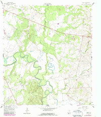
1959 Map of Hamon
USGS Topo · Published 1960About this map
The winding Guadalupe River dominates this mid-century landscape in Gonzales County, where the settlement of Hamon is captured alongside its predecessor, the Hamon (Original Townsite). This shift in the local center is anchored by the Hamon Ch and surrounded by a network of ranchlands and watercourses including Peach Creek and Turkey Bottom Creek. The map illustrates a rural Texas economy transitioning through the late 1950s, evidenced by the presence of industrial Clay Pits, a Quarry, and a major Pipeline cutting across the terrain north of Abercrombie Ranch. For genealogists and local historians, the sheet preserves the locations of family-named landmarks and small cemeteries that define the character of the river valley before modern development altered the agricultural footprint of the region.
Find a feature on this map
21 named features on this map. Tap any name to fly to it.
Don’t see what you’re looking for? This feature index may not catch every label — zoom into the map to look around manually.
Map Details
Editions of this 1959 Hamon Map
2 editions found
Other maps of this area

1901 · Flatonia
USGS Topo · 1:125,000

1953 · Seguin
USGS Topo · 1:250,000

1958 · Seguin
USGS Topo · 1:250,000

1959 · Hochheim
USGS Topo · 1:24,000

1959 · Gonzales South
USGS Topo · 1:24,000

1960 · Cheapside
USGS Topo · 1:24,000

1962 · Dilworth
USGS Topo · 1:24,000
1962 · Gonzales North
USGS Topo · 1:24,000

1963 · Yoakum
USGS Topo · 1:24,000
1965 · Moulton
USGS Topo · 1:24,000