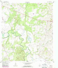
1959 Map of Hamon
USGS Topo · Published 1987About this map
The Guadalupe River snakes through the center of this landscape, its tight meanders defining the local geography as it flows past the Hamon (Original Townsite). This 1950s survey captures a distinct rural Texas community layout, showing the separate locations of Hamon and its namesake townsite near Hamon Ch. Local industry is evidenced by several Clay Pits, a Quarry, and a Gravel Pit, pointing to the extraction of river-basin resources.
Find a feature on this map
27 named features on this map. Tap any name to fly to it.
Don’t see what you’re looking for? This feature index may not catch every label — zoom into the map to look around manually.
Map Details
Editions of this 1959 Hamon Map
2 editions found
Other maps of this area

1901 · Flatonia
USGS Topo · 1:125,000

1953 · Seguin
USGS Topo · 1:250,000

1958 · Seguin
USGS Topo · 1:250,000

1959 · Hochheim
USGS Topo · 1:24,000

1959 · Gonzales South
USGS Topo · 1:24,000

1959 · Hamon
USGS Topo · 1:24,000

1960 · Cheapside
USGS Topo · 1:24,000

1962 · Dilworth
USGS Topo · 1:24,000
1962 · Gonzales North
USGS Topo · 1:24,000

1963 · Yoakum
USGS Topo · 1:24,000