
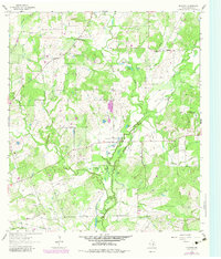
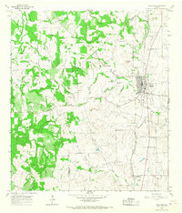
1962 Map of Dilworth
USGS Topo · Published 1965About this map
The confluence of Peach Creek and its many tributaries, such as Sandy Fork Peach Creek and Clear Fork Peach Creek, shapes this pocket of Gonzales County. Settlement patterns here are centered on small communities like Little New York and Dilworth, where rural life is anchored by local institutions including Saturn Church and St James Cemetery. The presence of an Old Railroad Grade in the south, running near Mooney Lake, reflects the changing transportation infrastructure of the mid-20th century.
Find a feature on this map
37 named features on this map. Tap any name to fly to it.
Don’t see what you’re looking for? This feature index may not catch every label — zoom into the map to look around manually.
Map Details
Editions of this 1962 Dilworth Map
2 editions found
Other maps of this area

1901 · Flatonia
USGS Topo · 1:125,000

1953 · Seguin
USGS Topo · 1:250,000

1958 · Seguin
USGS Topo · 1:250,000

1959 · Gonzales South
USGS Topo · 1:24,000

1959 · Hamon
USGS Topo · 1:24,000
1962 · Gonzales North
USGS Topo · 1:24,000
1964 · Sandy Fork
USGS Topo · 1:24,000

1964 · Waelder
USGS Topo · 1:24,000
1965 · Flatonia NW
USGS Topo · 1:24,000
1965 · Moulton
USGS Topo · 1:24,000