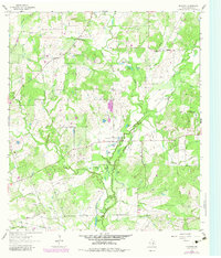
1962 Map of Dilworth
USGS Topo · Published 1983About this map
Peach Creek and its many tributaries, including the Sandy Fork and Rocky Creek, dominate this landscape in eastern Gonzales County. The small community of Little New York is central to this 1962 survey, situated near the St James Cem and several small water bodies like Pogue Lake and Parker Lake. The terrain is characterized by broad alluvial features such as Pettit Flats and the elevated Pin Oak Mound.
Find a feature on this map
35 named features on this map. Tap any name to fly to it.
Don’t see what you’re looking for? This feature index may not catch every label — zoom into the map to look around manually.
Map Details
Editions of this 1962 Dilworth Map
2 editions found
Other maps of this area

1901 · Flatonia
USGS Topo · 1:125,000

1953 · Seguin
USGS Topo · 1:250,000

1958 · Seguin
USGS Topo · 1:250,000

1959 · Gonzales South
USGS Topo · 1:24,000

1959 · Hamon
USGS Topo · 1:24,000

1962 · Dilworth
USGS Topo · 1:24,000
1962 · Gonzales North
USGS Topo · 1:24,000
1964 · Sandy Fork
USGS Topo · 1:24,000

1964 · Waelder
USGS Topo · 1:24,000
1965 · Flatonia NW
USGS Topo · 1:24,000