Old Maps of Missouri City, Texas for Academic Research
Study the evolution of Missouri City with 44 high-resolution historic maps. Whether you're teaching, researching, or modeling changes in land use, these maps provide essential visual documentation of urban, environmental, and geographic change.
- Analyze long-term change: Track patterns in development, transportation, and natural features.
- Ideal for environmental or urban studies: Support academic projects with primary historical map data.
- Use in the classroom or lab: Educators and researchers rely on these maps to bring historical context to life.
These maps are a powerful tool for teaching, research, and visualizing how Missouri City has changed over the decades.
Missouri City, TX maps
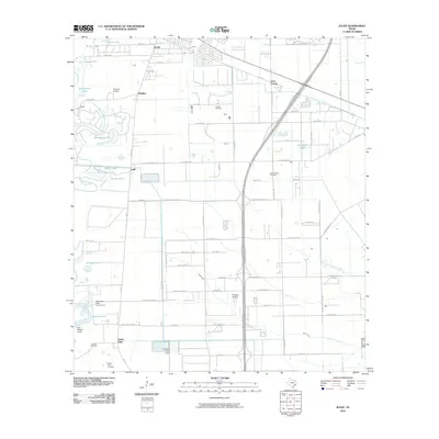
(44)- 1915 Map of Alief
 1915 Alief1915 Print · USGSIn the years before Houston's westward sprawl, this prairie landscape was a remote network of dairy farms and rail lines. You can trace the early foundations of these communities at Alief, Traceyville Church, and along the rural paths of Westheimer Road.3 unique versions available
 - 1920 Map of Almeda
 1920 Almeda1920 Print · USGSHarris County prairie land is captured here during the First World War era, showing a landscape defined by rail and water. Genealogists and researchers can trace the early footprint of Almeda and the path of the International and Great Northern railroad.2 unique versions available
 - 1943 Map of Juliff
 1943 Juliff1943 Print · USGSBrazoria County during the early 1940s shows a landscape of prison agriculture and coastal prairie drainage systems. Researchers can locate the Darrington State Farm complex, the Prison Cem, and rural schoolhouses like Mustang Sch and School No 20.2 unique versions available
 - 1950 Map of Houston, 1953 Print
 1950 Houston1953 Print · USGSCoastal Texas in the early fifties reveals a landscape of massive civil engineering and industrial transit. Genealogists and researchers can trace the growth of the Houston suburbs and the maritime infrastructure of Galveston Bay, including the Gulf Freeway and the Texas City Dike.
 - 1953 Map of Thompsons, 1955 Print
 1953 Thompsons1955 Print · USGSThe Brazos River valley in the early fifties shows a landscape transformed by petroleum at Humble Camp and Thompsons Ridge Field. Trace family roots near Thompsons and locate the Sacred Heart Church or the Darrington State Prison Farm.3 unique versions available
 - 1955 Map of Almeda, 1957 Print
 1955 Almeda1957 Print · USGSIn the mid-fifties, this portion of the Texas coastal plain was a mix of prison farms, oil fields, and rural settlements. Genealogists can locate family names and burial sites at Beth Jacob Cem or Arcola-Fresno Cem and trace the old Missouri Pacific rail corridor.3 unique versions available
 - 1955 Map of Sugar Land, 1957 Print
 1955 Sugar Land1957 Print · USGSFort Bend and Harris counties were transitioning from a plantation and prison-farm economy to a modern industrial corridor in the mid-1950s. Genealogists can trace family names at the Dewalt Cem or Riceville Ch, while researchers can map the early footprints of Sharpstown and Andrau Airpark.
 - 1956 Map of Houston, 1963 Print
 1956 Houston1963 Print · USGSSoutheast Texas in the mid-fifties is captured here as a powerhouse of oil and maritime trade. Genealogists and historians can trace the foundations of Houston and its ports, alongside landmarks like the Rice Institute and the Spindletop Oil Field.2 unique versions available
 - 1963 Map of Juliff, 1966 Print
 1963 Juliff1966 Print · USGSThe coastal prairie of Brazoria and Fort Bend Counties in the early sixties shows a landscape defined by petroleum and rail. Genealogists and historians can locate family landmarks like Woods Cem and Sandy Point Cem near the Arcola Oil Field.2 unique versions available
 - 1970 Map of Alief, 1973 Print
 1970 Alief1973 Print · USGSSouthwest Houston was undergoing rapid suburbanization in the early seventies as new developments bridged the gap between old railroad towns. Trace family history at Riceville Cemetery or locate landmarks like Andrau Airpark and Sharpstown Country Club.
 - 1970 Map of Missouri City, 1973 Print
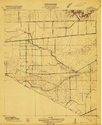
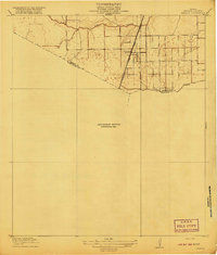
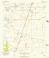
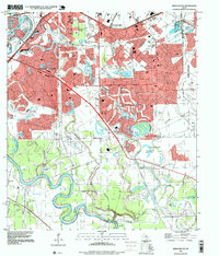
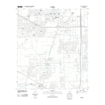
 1970 Missouri City1973 Print · USGSFort Bend County's river-bottom lands were transitioning toward suburban growth in the late sixties as the boundaries of Sugar Land and Missouri City expanded. Researchers can trace historic local sites like Dewalt Cem, Trammels, and the John Foster Dulles High Sch.3 unique versions available
 - 1975 Map of Houston, 1977 Print
 1975 Houston1977 Print · USGSThe Texas Gulf Coast in the mid-seventies shows a sprawling Houston metropolis linked to the sea by the massive Houston Ship Channel. Researchers can trace the mid-century industrial landscape from the Astrodome to the Lyndon B. Johnson Space Center.2 unique versions available
 - 1982 Map of Alief
 1982 Alief1982 Print · USGSSouthwest Houston was undergoing a massive suburban transformation in the early eighties. Genealogists and historians can trace the development of Alief and Stafford, or locate family sites near Riceville Cem and Andrau Airpark.2 unique versions available
 - 1982 Map of Almeda, 1983 Print
 1982 Almeda1983 Print · USGSThe southern reaches of the Houston area were rapidly modernizing in the early eighties as residential growth met established rural settlements. Researchers can trace the development of Almeda and Fresno alongside sites like the Blue Ridge State Prison Farm and Beth Jacob Cem.
 - 1984 Map of Angleton
 1984 Angleton1984 Print · USGSThe Texas Gulf Coast in the mid-eighties shows a landscape of salt domes and bayous at the height of its oil-and-river economy. Researchers can trace land use through the Damon Mound Oil Field and the sprawling State Department of Corrections (Retrieve Unit).2 unique versions available
 - 1992 Map of Houston
 1992 Houston1992 Print · USGSThe Houston metropolitan area reached its modern sprawl in the early nineties, centered on the Buffalo Bayou and a massive regional rail network. Genealogists and historians can trace the development of satellite cities like Sugar Land and Pasadena, or locate legacy sites like the Humble Oil Field and the NASA Lyndon B Johnson Space Center.
 - 1995 Map of Alief, 1998 Print
 1995 Alief1998 Print · USGSWestern Houston and the Alief area are seen here during the rapid suburban growth of the mid-nineties. Genealogists and historians can trace local landmarks like Andrau Airpark, the Alief Brethren Cem, and the path of the Missouri Pacific railroad.
 - 1995 Map of Missouri City, 1999 Print
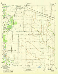
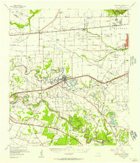
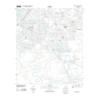
 1995 Missouri City1999 Print · USGSThe Houston suburbs were in the midst of a significant growth phase in the late nineties as residential tracts pushed into the Brazos River bottomlands. Researchers can find old family cemeteries and country churches like Dewalt Cem and St John Ch alongside the rails of the Missouri Pacific.
 - 1995 Map of Almeda, 1999 Print
 1995 Almeda1999 Print · USGSThe southern outskirts of Houston and the Fort Bend prairie are shown here during a decade of rapid suburban growth. Genealogists and historians can trace old community landmarks like the Beth Jacob Cem, Mt Corinth Ch, and the rail junction at Arcola.
 - 2010 Map of Juliff, 2010 Print
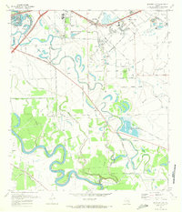
 2010 Juliff2010 Print · USGSCovers Missouri City, including Pearland, Alvin, and other nearby areas
 - 2010 Map of Missouri City, 2010 Print
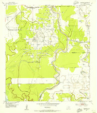
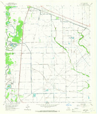
 2010 Missouri City2010 Print · USGSCovers Missouri City, including Houston, Sugar Land, and other nearby areas
 - 2010 Map of Thompsons, 2010 Print
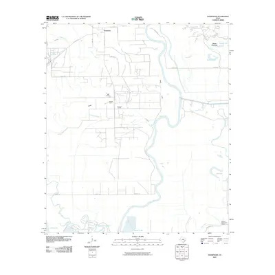 2010 Thompsons2010 Print · USGSCovers Missouri City, including Alvin, Thompsons, and other nearby areas
 - 2010 Map of Alief, 2010 Print
 2010 Alief2010 Print · USGSCovers Missouri City, including Houston, Sugar Land, and other nearby areas
 - 2010 Map of Almeda, 2010 Print
 2010 Almeda2010 Print · USGSCovers Missouri City, including Houston, Pearland, and other nearby areas
 - 2013 Map of Juliff, 2013 Print
 2013 Juliff2013 Print · USGSCovers Missouri City, including Pearland, Alvin, and other nearby areas
Showing maps 1-25 of 44
Top cities near Missouri City
- Houston historical maps
- Pearland historical maps
- Sugar Land historical maps
- Rosenberg historical maps
- Alvin historical maps
- Fresno historical maps
See more
Top neighborhoods of Missouri City
Frequently asked questions
- What are the different types of historical maps available for Missouri City?
- What is the oldest map of Missouri City?
- Where can I purchase historical maps of Missouri City for my home or office?
- Where can I download high-res historical maps of Missouri City?
- Are there historical topographic maps available for Missouri City?
- Is there historical aerial imagery available for Missouri City?
- Where are historical maps of Missouri City sourced from?