2020s Maps of Kyle, Texas
Explore 4 historic maps of Kyle from the 2020s. These maps offer a rare glimpse into what life looked like during the 2020s — showing old roads, neighborhoods, homes, and landmarks that have changed or disappeared over time.
Whether you're researching your family's past, planning a metal detecting trip, or studying how Kyle's landscape evolved across the 2020s, these high-resolution maps are a powerful tool for exploring the history of this region.
- Focus on a specific era: All maps on this page are from the 2020s, giving you a focused view of this time period.
- See what’s changed: Compare century-old streets, trails, and buildings to today's modern landscape using overlays and satellite layers.
- Research with precision: Use these maps for genealogy, historical research, land use analysis, or educational projects.
- View, download, or print: Maps are fully viewable online in high resolution, and can be downloaded or printed for your own records.
Start exploring Kyle's history through authentic maps from the 2020s. This is your window into the past.
Kyle, TX maps
(4)- 2022 Map of San Marcos North, 2022 Print
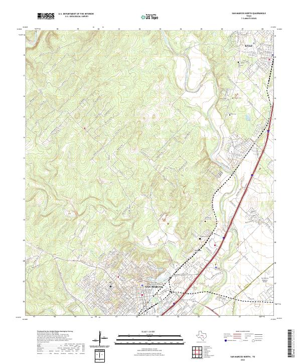 2022 San Marcos North2022 Print · USGSTexas Hill Country development and the San Marcos River headwaters are captured in this 2020s study. Researchers can trace the layout of Texas State University or locate several local burial grounds like Skyview Cem and Guadalupe Cem.
 - 2022 Map of Uhland, 2022 Print
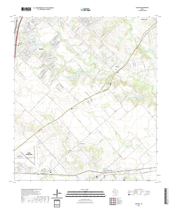 2022 Uhland2022 Print · USGSThe Hays and Caldwell county borderlands are captured here in the early 2020s, showing a mix of residential growth and rural heritage. Genealogists can locate several historic burial sites, including Saint Michaels Cem, Ebenezer Cem, and the Maxwell Hispanic Cem.
 - 2022 Map of Mountain City, 2022 Print
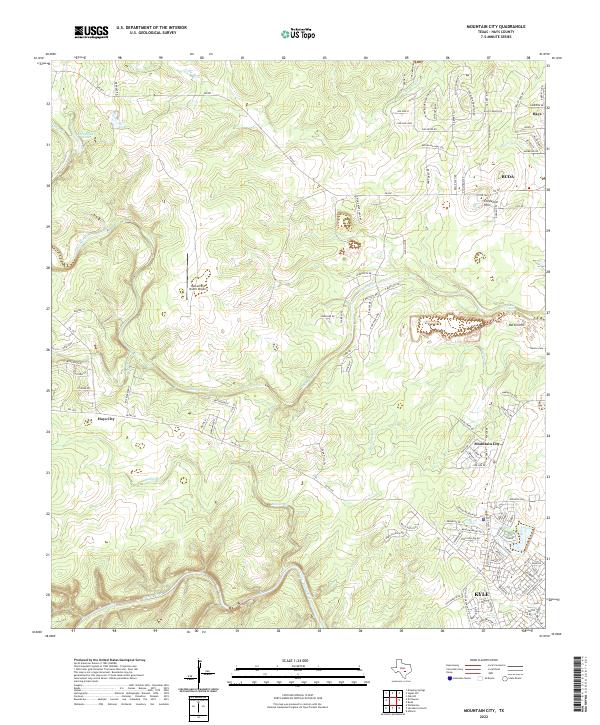 2022 Mountain City2022 Print · USGSHays County undergoes significant transformation in this modern era as suburban growth reaches toward the Blanco River. Genealogists and local researchers can trace legacy sites like Barton Cem alongside newer landmarks such as Rutherford Ranch Airport and Hays City.
 - 2022 Map of Buda, 2022 Print
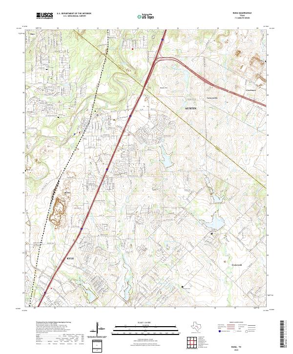 2022 Buda2022 Print · USGSThe corridor between Buda and Kyle comes into sharp focus during this era of Central Texas growth. Genealogists can trace early settler history at Winters Cem and Antioch Cem or follow the historic route of the Old San Antonio Rd.
End of results
Showing maps 1-4 of 4
Top cities near Kyle
- Austin historical maps
- New Braunfels historical maps
- San Marcos historical maps
- Buda historical maps
- Lockhart historical maps
- Dripping Springs historical maps
See more
Frequently asked questions
- What are the different types of historical maps available for Kyle?
- What is the oldest map of Kyle?
- Where can I purchase historical maps of Kyle for my home or office?
- Where can I download high-res historical maps of Kyle?
- Are there historical topographic maps available for Kyle?
- Is there historical aerial imagery available for Kyle?
- Where are historical maps of Kyle sourced from?