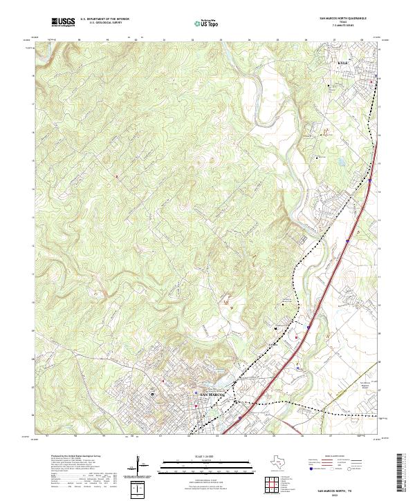
2022 Map of San Marcos North
USGS Topo · Published 2022About this map
The Blanco River and San Marcos River corridor in Hays County is defined by the significant hydrological features of the Balcones Escarpment, most notably the San Marcos Springs and Spring Lake. The landscape transition is evident between the elevated terrain of Oak Meadows and Boulder Bluff to the west and the developing urban footprints of Kyle and San Marcos to the east. For genealogists and local historians, the sheet is particularly dense with burial sites including San Vincente Cem, Kyle Cem, and the centrally located San Marcos Cem. The presence of Texas State University San Marcos anchors the southern portion of the map, while the San Marcos Regional Airport marks the southeastern boundary near the Hays and Caldwell County line.
Find a feature on this map
184 named features on this map. Tap any name to fly to it.
Don’t see what you’re looking for? This feature index may not catch every label — zoom into the map to look around manually.
Map Details
Editions of this 2022 San Marcos North Map
This is the sole edition of this map. No revisions or reprints were ever made.
Other maps of this area

1887 · Blanco
USGS Topo · 1:125,000

1894 · Blanco
USGS Topo · 1:125,000

1896 · Austin
USGS Topo · 1:125,000

1897 · Austin
USGS Topo · 1:125,000

1910 · Austin
USGS Topo · 1:125,000

1911 · San Marcos
USGS Topo · 1:125,000

1919 · San Marcos
USGS Topo · 1:125,000

1929 · Hunter
USGS Topo · 1:62,500

1953 · Seguin
USGS Topo · 1:250,000

1954 · Llano
USGS Topo · 1:250,000